A new adventure has begun: the Southern Waterline Trail. This long-distance footpath runs from Bergen op Zoom to Grave (or vice versa) in the Netherlands and follows the Brabant water line, called the Zuiderwaterlinie (Southern Waterline). This line is the oldest and most widely used waterline defense structure in the Netherlands, the predecessor of the Old and New Dutch Waterline.
The trail is 290 km long and developed on the basis of the hiking trail network. The trail does not belong to the well-known LAWs (Long Distance trails) of Wandelnet. The Alliantie Zuiderwaterlinie, an alliance between 25 partners, including municipalities and nature organisations was created to raise awareness of the Southern waterline, this trail being part of it.
Moved to North Brabant province
Yet another adventure has begun for me. Those who follow my Instagram know it all along. I have moved to a new town, a new municipality, and even a new region and province. I now live in Zevenbergen, municipality of Moerdijk. That’s in the west of the province of North Brabant. If you go by train: in between Dordrecht and Roosendaal.
When I knew I was moving, I immediately went to see what hiking trails are around the area I now live in. I had never hiked in North Brabant before. In fact, I haven’t even been there often in general, with the exception of a few cities, such as Breda and Den Bosch. So a world opened up for me. My eye fell on the Southern Waterline trail. The trail goes through my own small town. This seems like a nice introduction to the province and especially region West Brabant (and later central and eastern Brabant).
I immediately made it a long-term project, because after this trail I want to hike other (water) line trails too. There are many trails along lines: the Old Dutch waterline trail and the most famous the Waterliniepad (LAW17) along the Defense Line of Amsterdam and the New Dutch waterline. There is also a Grebbelinie trail. Further north, there is an IJssel Line and a Frisian Waterline, no idea if there is a trail for those too as well. That will be a 20-year project 😂.
Detour through Bergen op Zoom
But first things first, in Bergen op Zoom I start with the Southern Waterline trail. However, I am not feeling very well on D-day. I have to adjust my plans. In the booklet (or rather folder), there are some sights located in the city of Bergen op Zoom that are not necessarily part of the trail. I will check those out before starting the trail If I don’t feel better, I can quickly take the train back home.
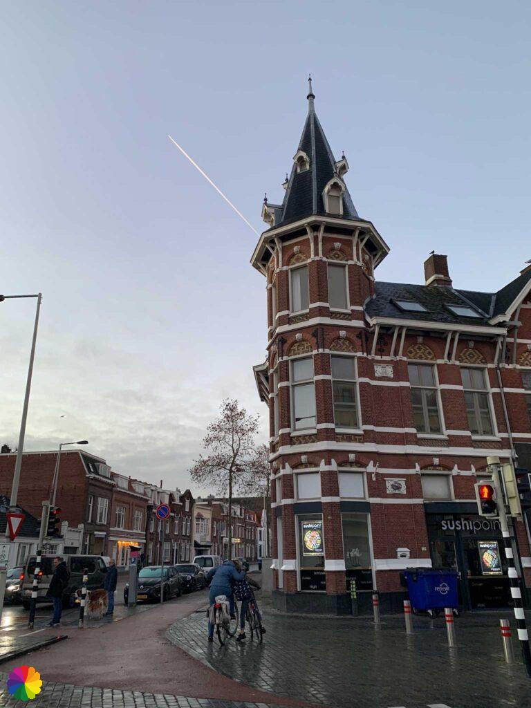
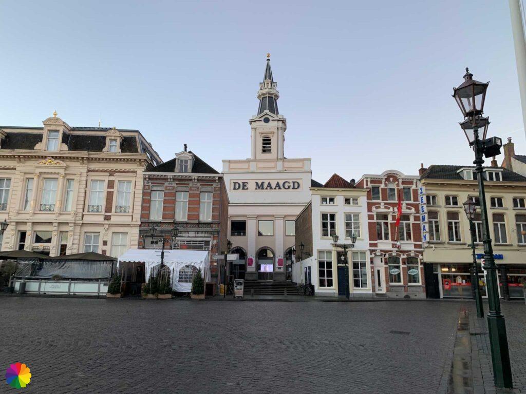
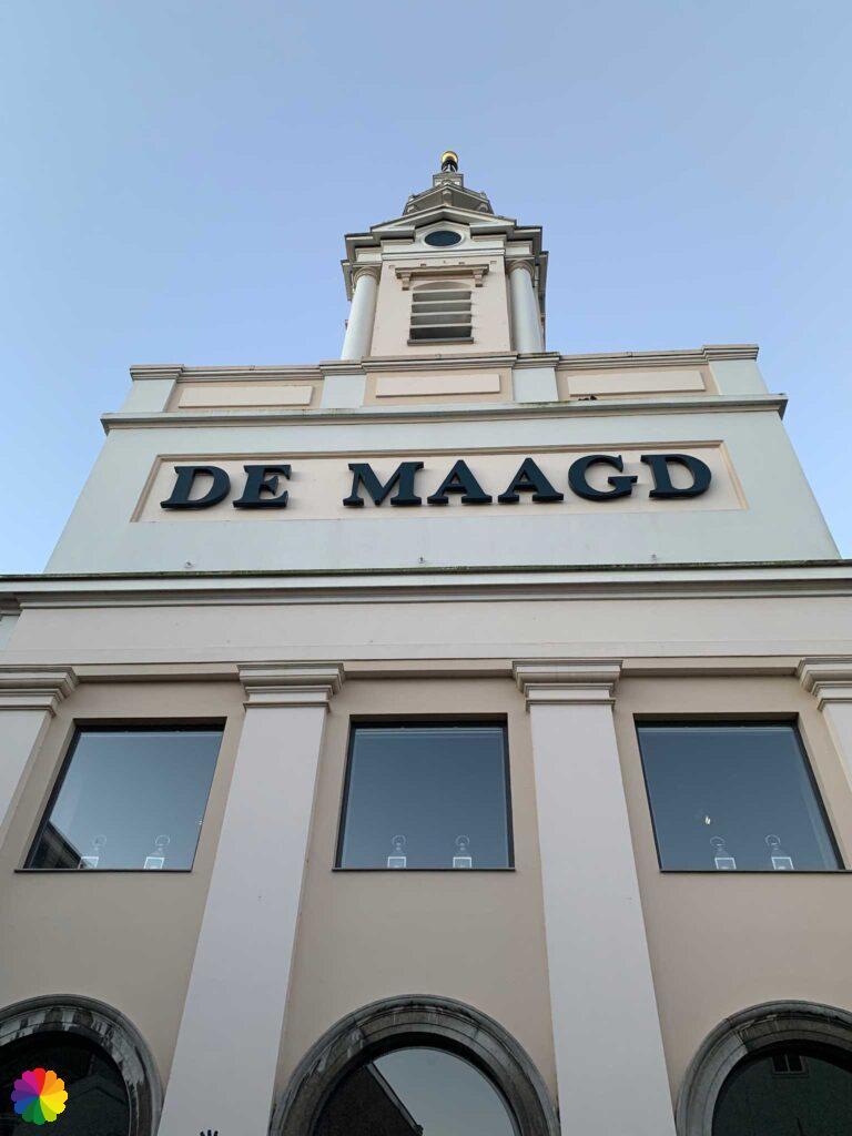
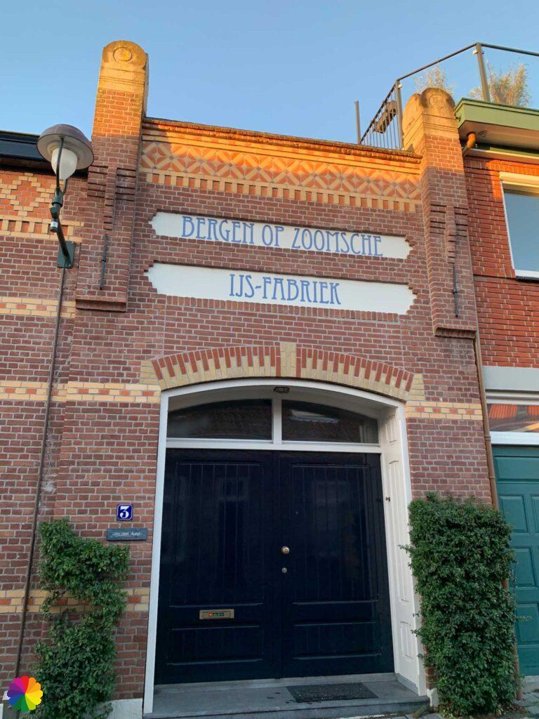
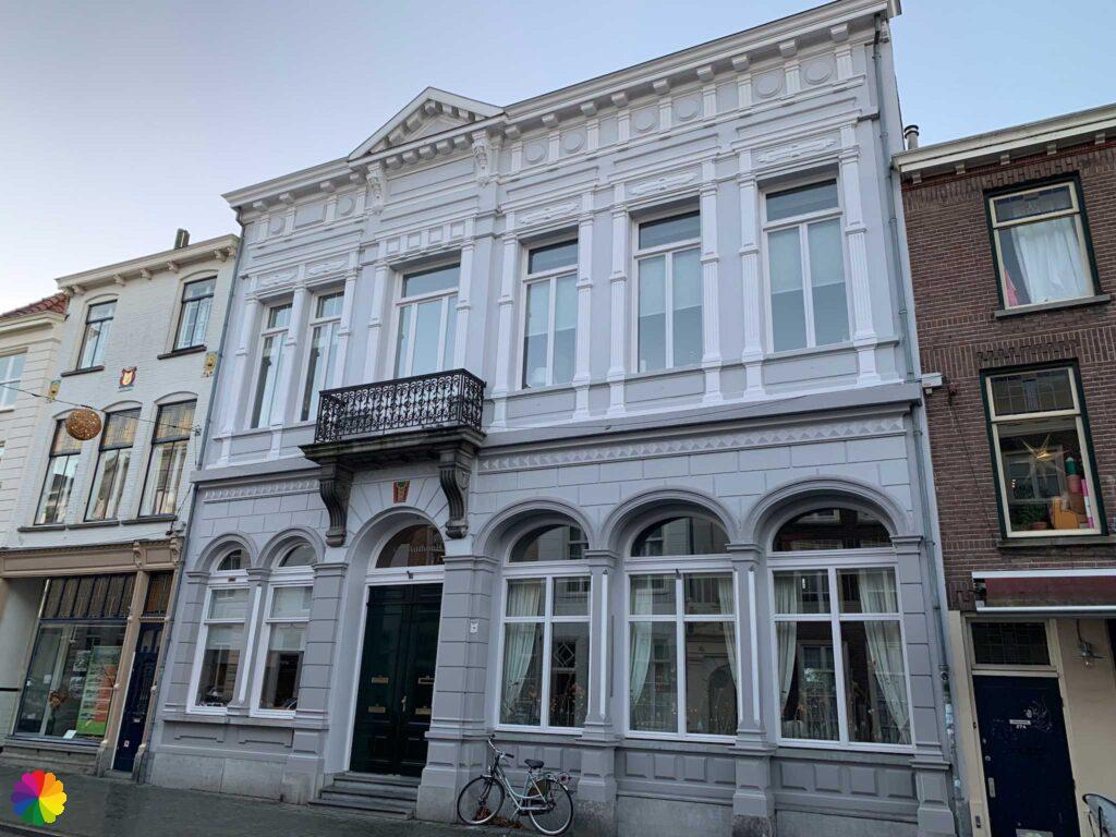
I walk from the station through a shopping street. It is very early, so the shops are still closed. Although it is busy with cyclists and vans. I walk past a church that is wrapped up in scaffolding. I reach the Market Square and the white building De Maagd (Virgin) immediately catches my eye!
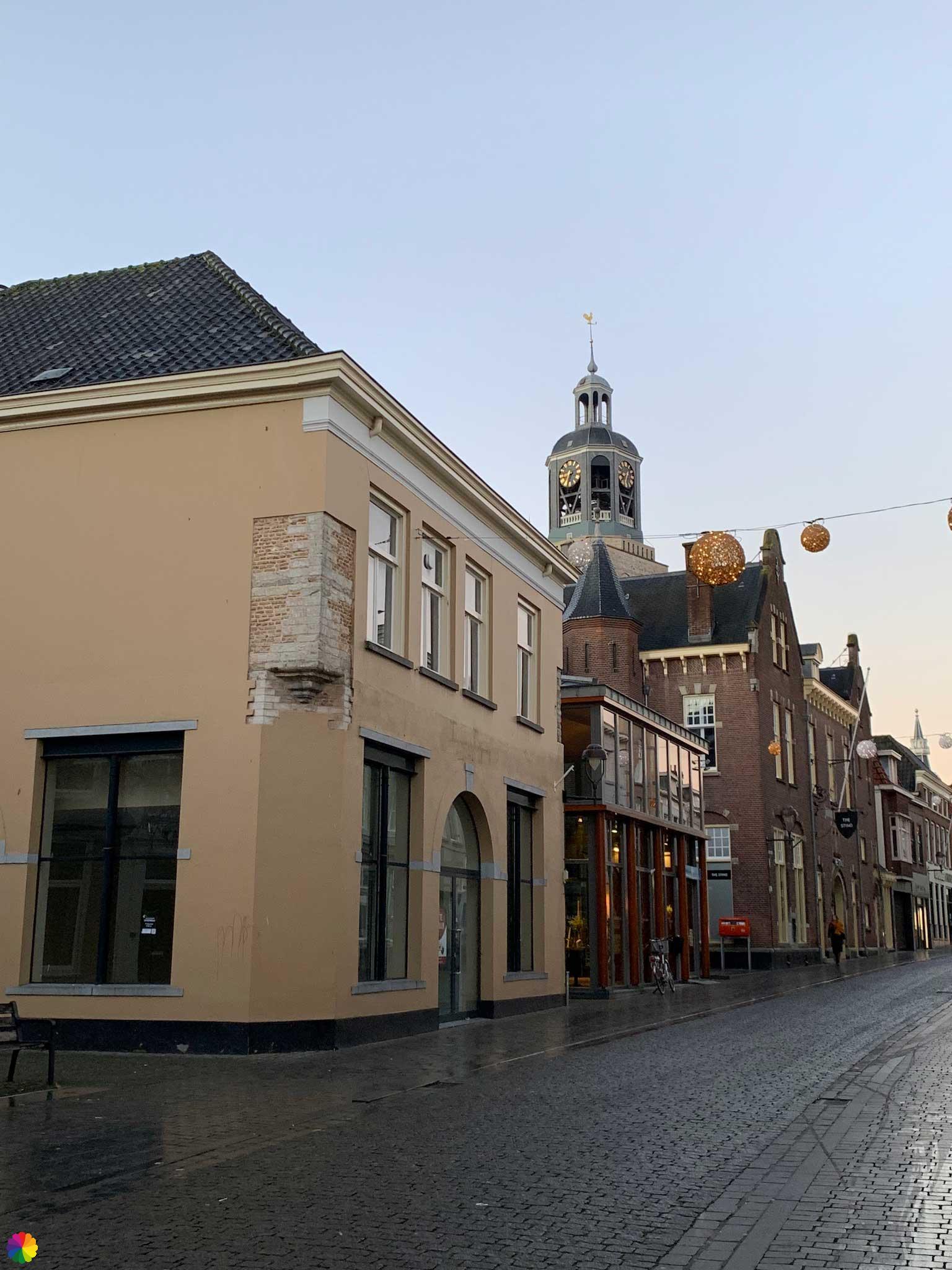


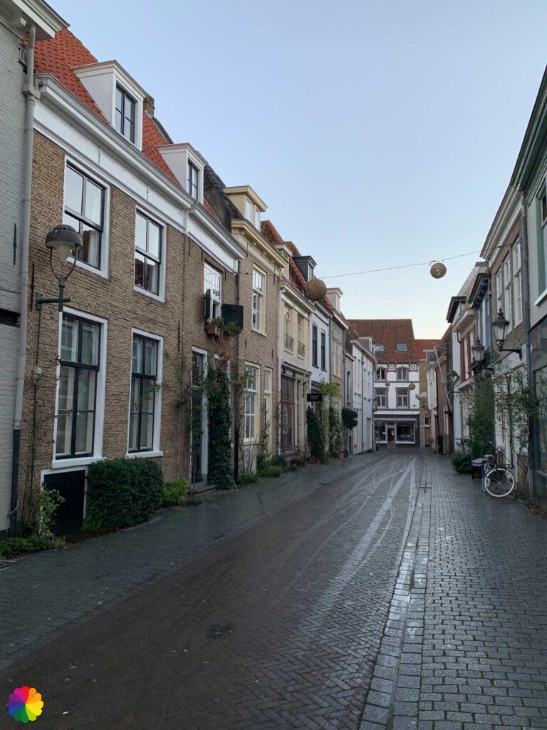
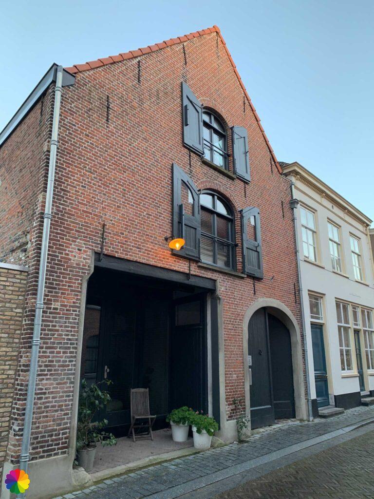
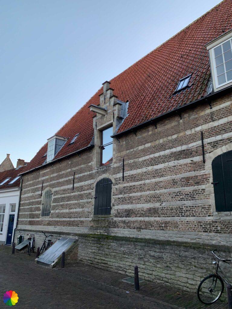
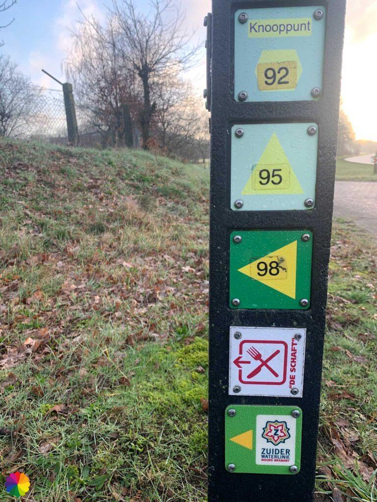
Using a self-created trail following numbers and markings of the trail network, I walk through the city centre. I walk past pretty houses with graceful facades.
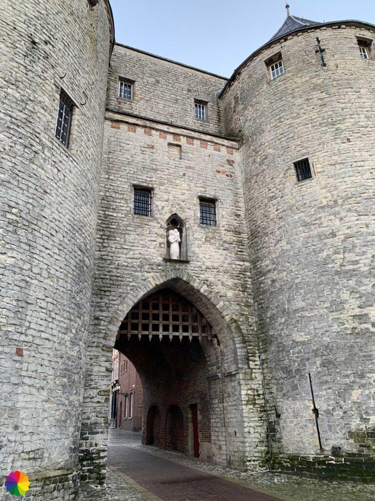
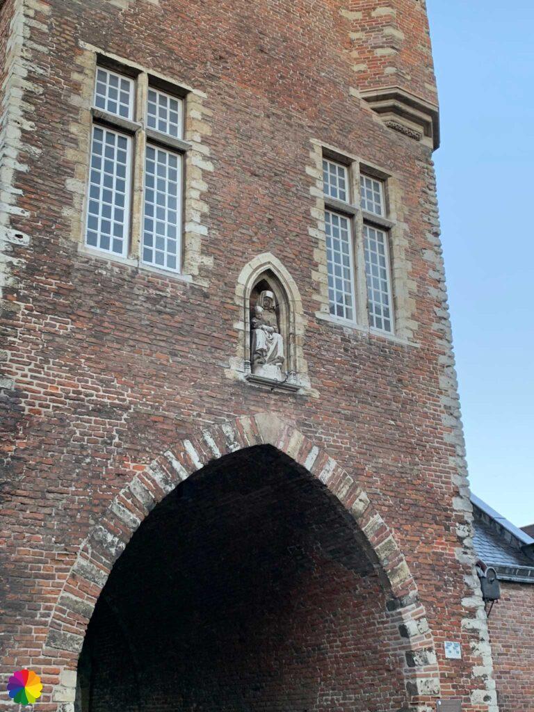
I make my way to the Prison Gate. When I want to take a photo of the gate, a blue Albert Heijn delivery van just arrives. He just doesn’t go around the corner, which puts him exactly in the photo. OK, then I’ll take a photo from the other side. When I get to the other side, the driver decides to park the van in front of the gate opening 😡. I give up! Then just a photo of the details on the gate itself. I’ll get back here on a Sunday morning.

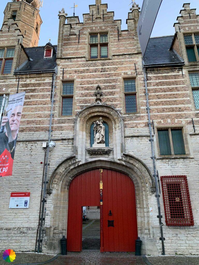
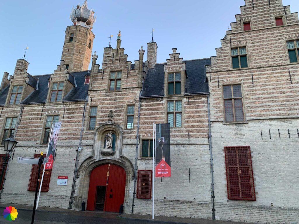
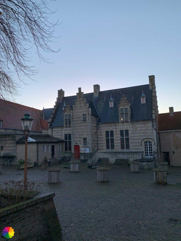
Now on to the Markiezenhof, but I’ve already lost the trail numbers. That’s going well, I haven’t even started the actual trail yet, I’m already lost!
I walk all the way around the beautiful Markiezenhof. What an immense building! At a gate, a sign shows that the Markiezenhof is not open for public because of corona restrictions. Nevertheless, the gate is open and I take a peek inside the walls. I take a quick photo and continue the hike.

Through back streets and along the side of the Ravelijn op den Zoom, which does belong to the trail, I return to the station. I don’t feel any better and won’t bother with the trail today anymore.
Starting the actual trail
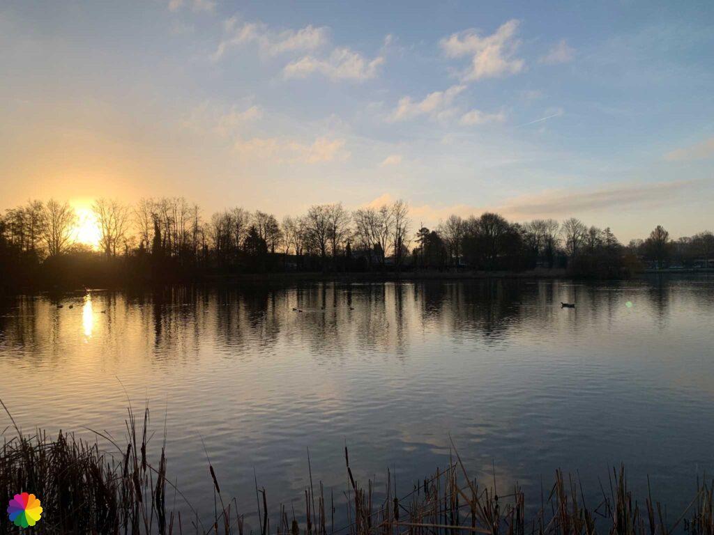
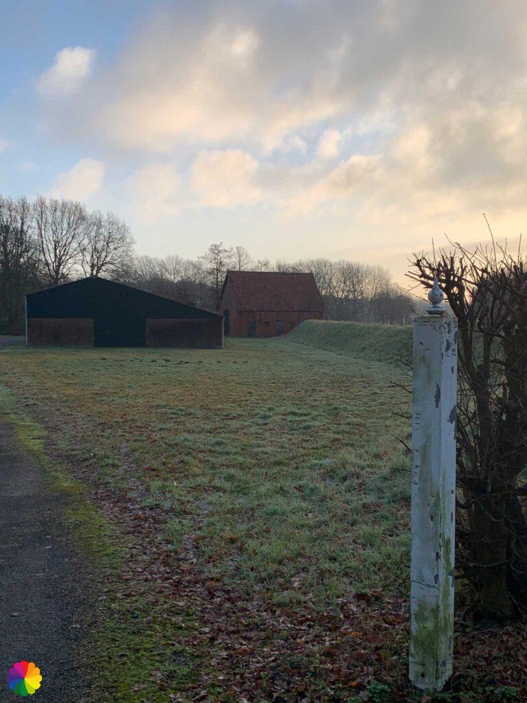
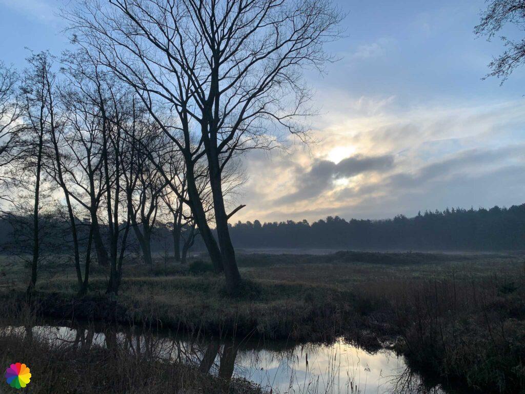
Within a week, I am back at the Bergen op Zoom station. Now I will really start the trail. At Anton van Duinkerken Park, I encounter a road break and diversion signs. I walk across the road and this time pass the front of Ravelijn op den Zoom. It looks beautiful under the pink sky.
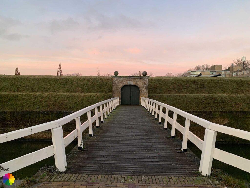
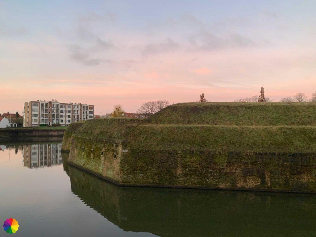
A ravelin is a pentagonal defensive structure in the moat of a (former) fortress. Sometimes it is attached to the fortress as a peninsula. Ravelijn op den Zoom is equipped with underground corridors, called casemates. There is also a powder cellar and several viewing and firing slits.
Every Sunday afternoon, it is possible to visit Ravelijn op den Zoom with a guide. You do need to make reservations for this.
Source (in Dutch): Zuiderwaterlinie
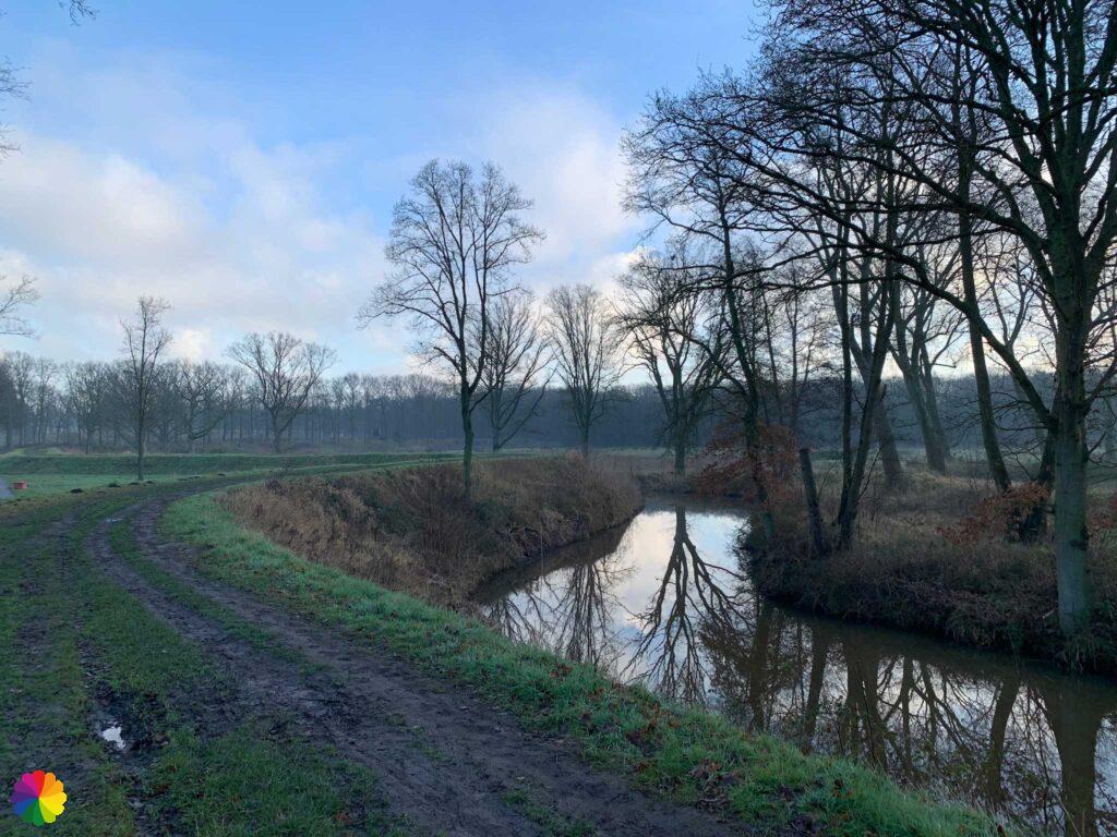
After the Ravelin, I have to search where to go. I eventually manage to get on the right path and also see the markings again. By the way, here are the most beautiful villas. I walk along a raised path along a sort of moat, a remnant of old ramparts of the city I think.
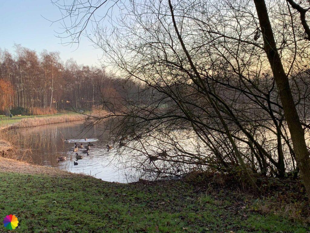
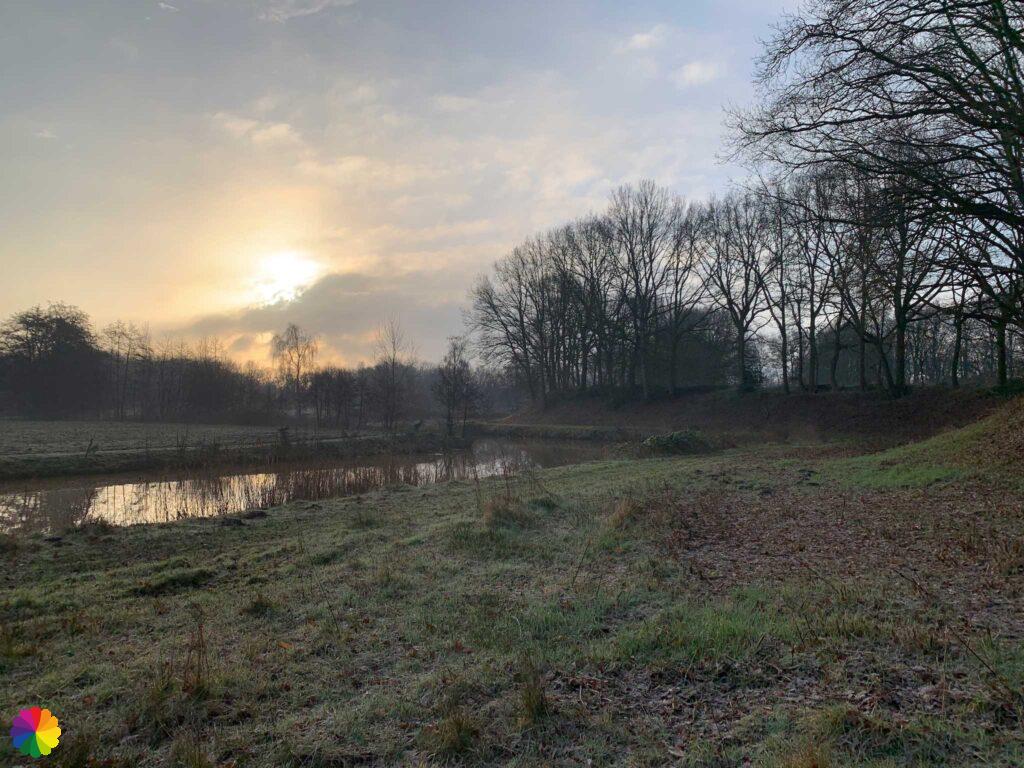
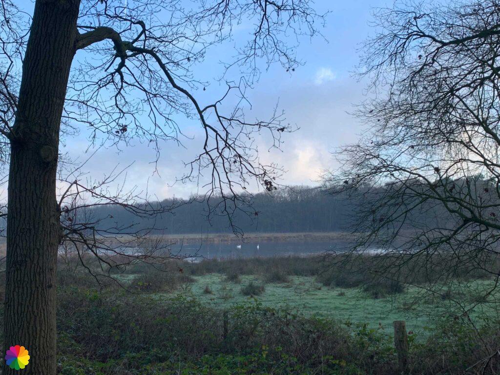
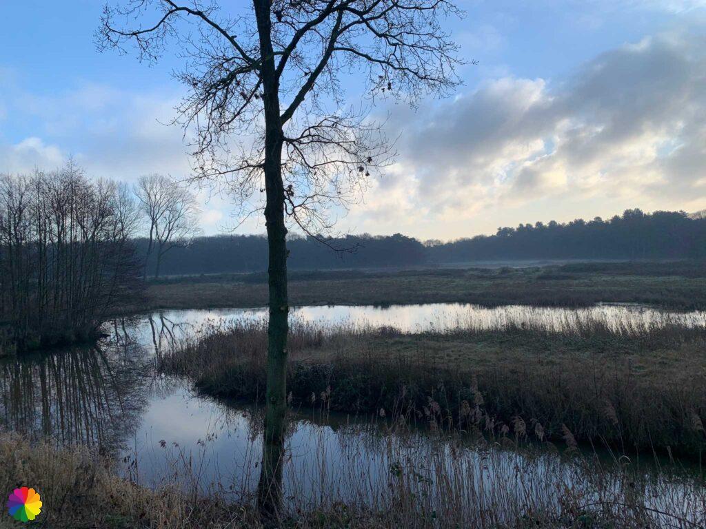
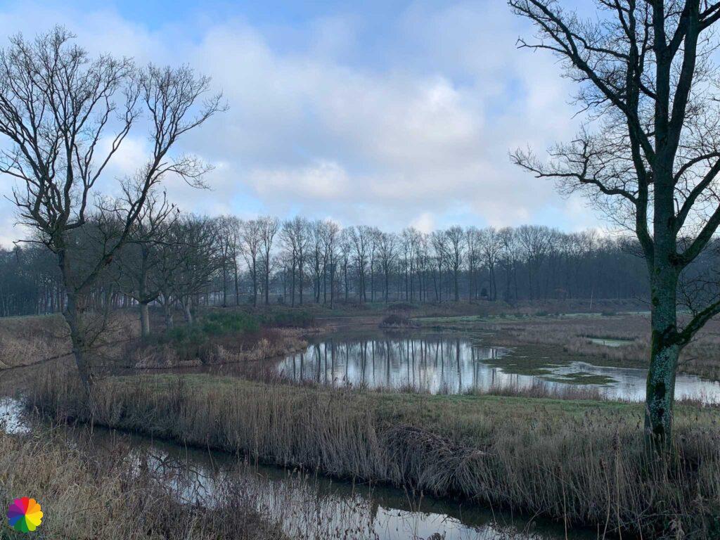
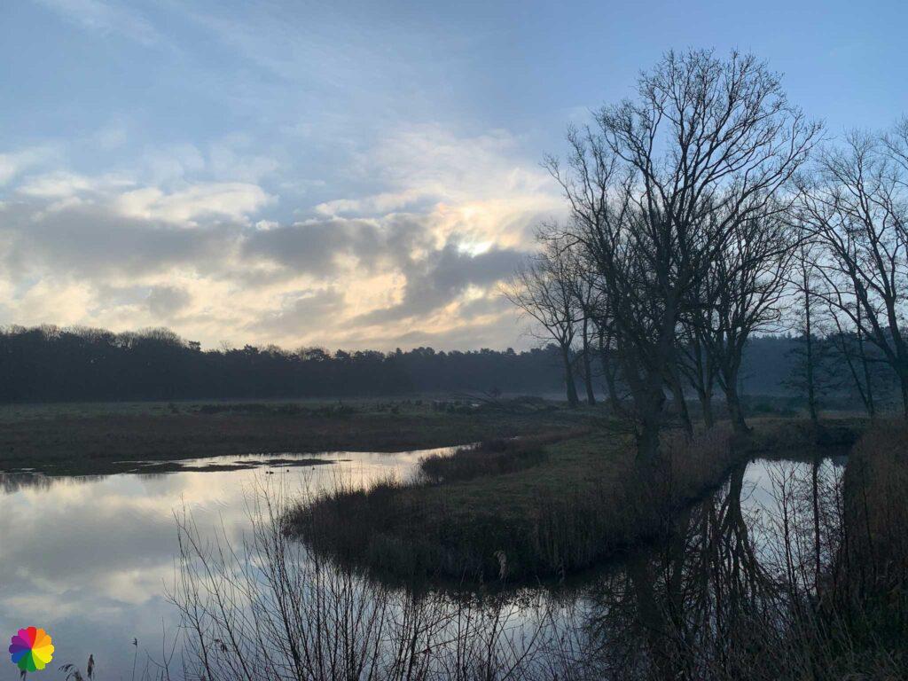
While zigzagging, I walk through Bergen op Zoom. I walk past a park and there the marker points to the right. I take the small street just after the park, but soon I lost the markings. I probably should have gone through the park after all. What a hassle with the markings again. Luckily I have the trail booklet with me and not much later I have found the markings. I am at the next park with a large pond in the middle. The water glistens at me with the rising sun. It is crowded with geese and coots.


Fort Pinssen and the Brabantse Wal
I then take a u-turn to the left along the highway. I cross the highway and go back along the highway on the right. I am now close to the Brabantse Wal forest and nearby there must be the first fort called Pinssen. It is not entirely clear to me where the fort is. It is hidden in the forest I think, or I am already walking on the outline of the fort, as the path seems to be on some kind of dike.
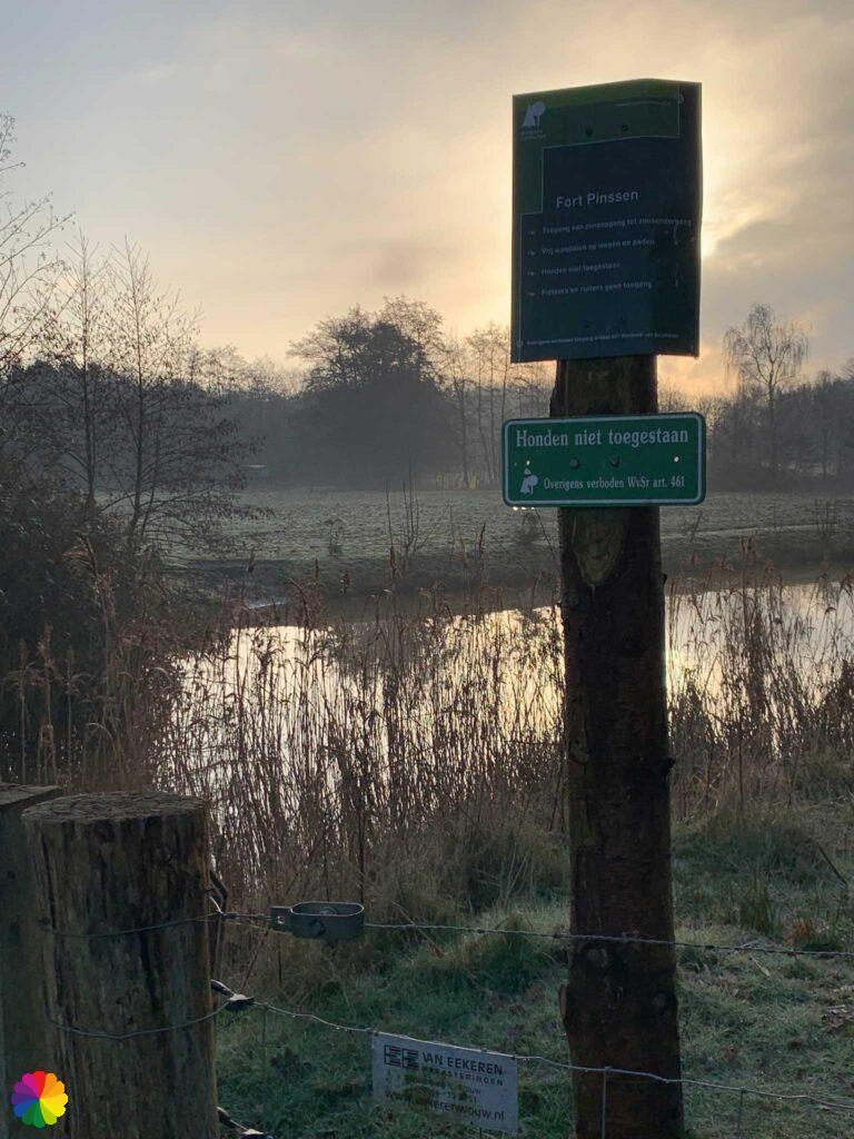
Fort Pinssen is named after Colonel Willem Pijnssen (Pinssen) van der Aa of the Dutch State Army in the 17th century. Fort Pinssen was an important link in the West Brabant Waterline around Bergen op Zoom. The fort protected the inundation areas around Halsteren.
Source (in Dutch): Zuiderwaterlinie
Other trail guide about the same region
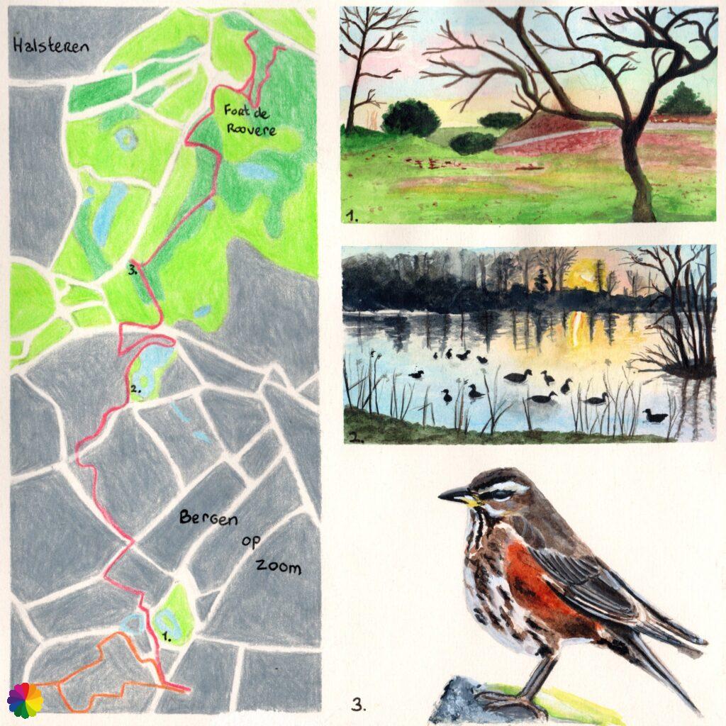
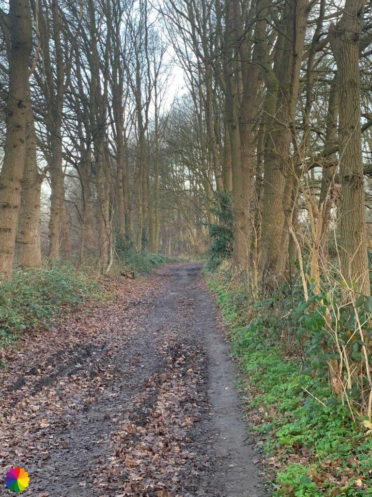
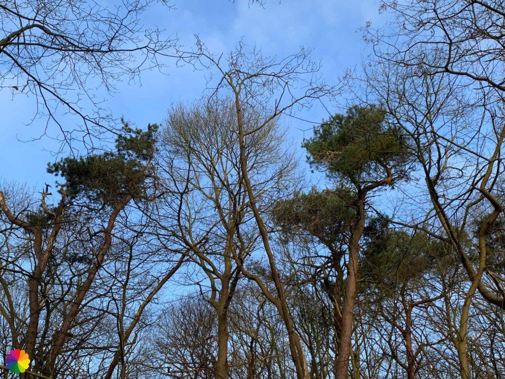
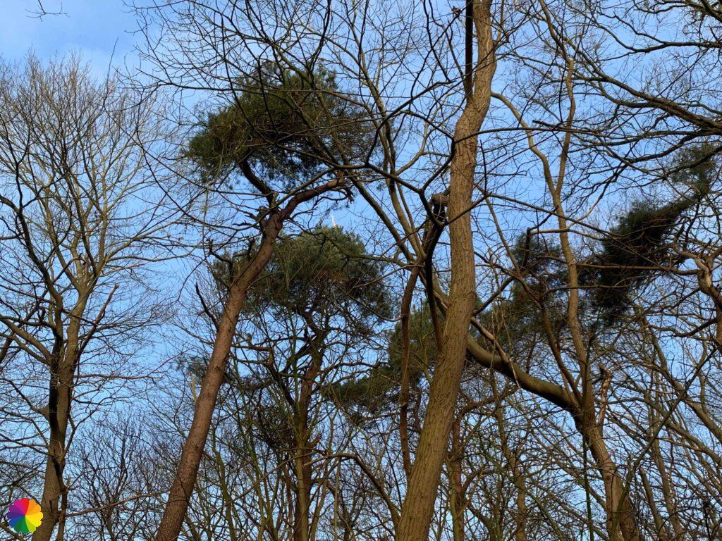
I walk along a muddy path between the trees. In the bushes I see a beautiful bird and recognise it as a redwing. What a beautiful rust-brown colour he has.
A redwing is related to the thrush and can be recognised by its copper-red flanks under the wings. Redwings are mainly found in the winter months in the Netherlands. During the breeding season, they can be found in Scandinavia. These birds are mainly seen in forests, parks, meadows, orchards and gardens. The birds love berries, such as rowanberry and spindleberry.

Source (in Dutch): Vogelbescherming
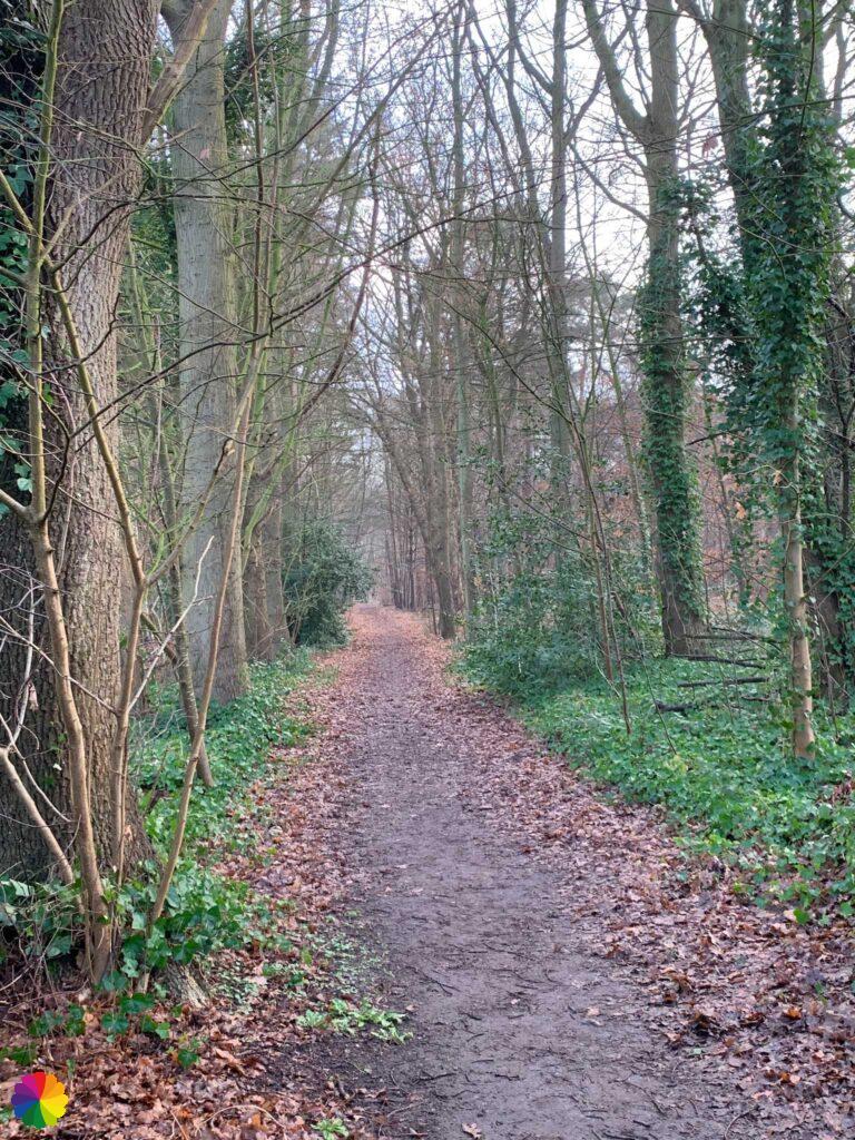
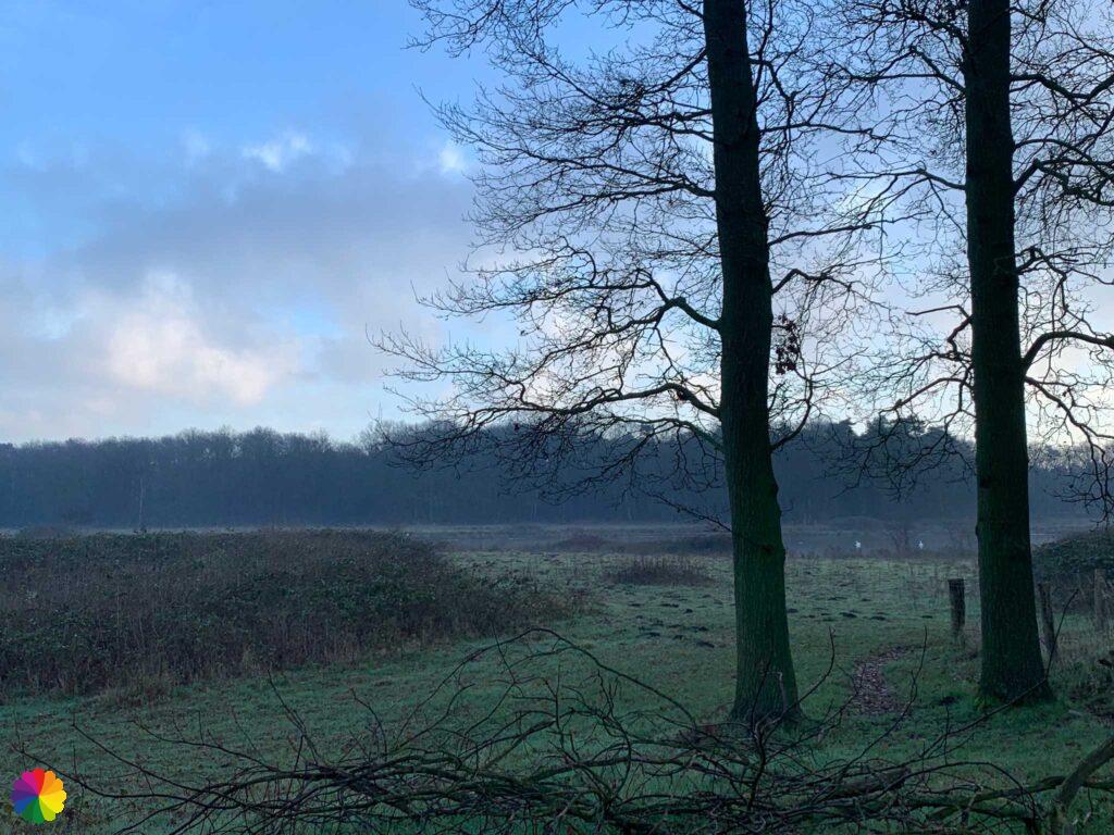
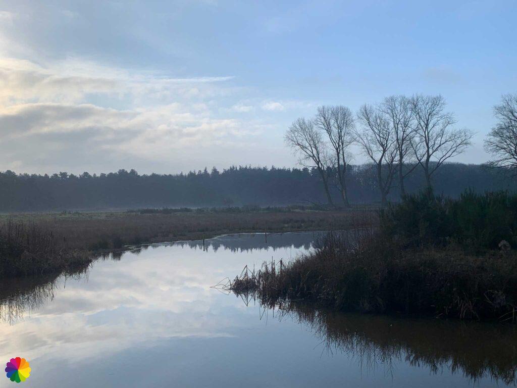
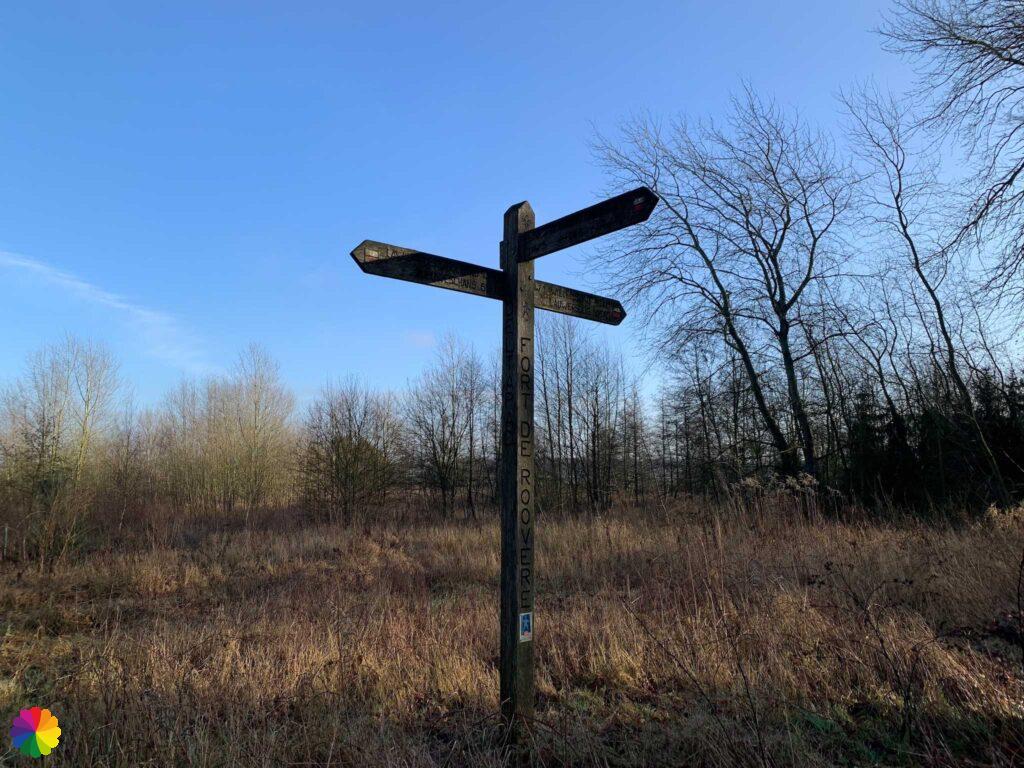
Distracted by the bird, I have already lost the markings; I have walked too far straight ahead. I don’t know if it’s just me or if the markings on the trees have been painted over. There are black dots on the trees everywhere. The map doesn’t make me much wiser either, so I just take a path. I’ll make my own trail. I know where to go: towards Fort de Roovere.
Fort de Roovere, Pompejus tower and Moses bridge
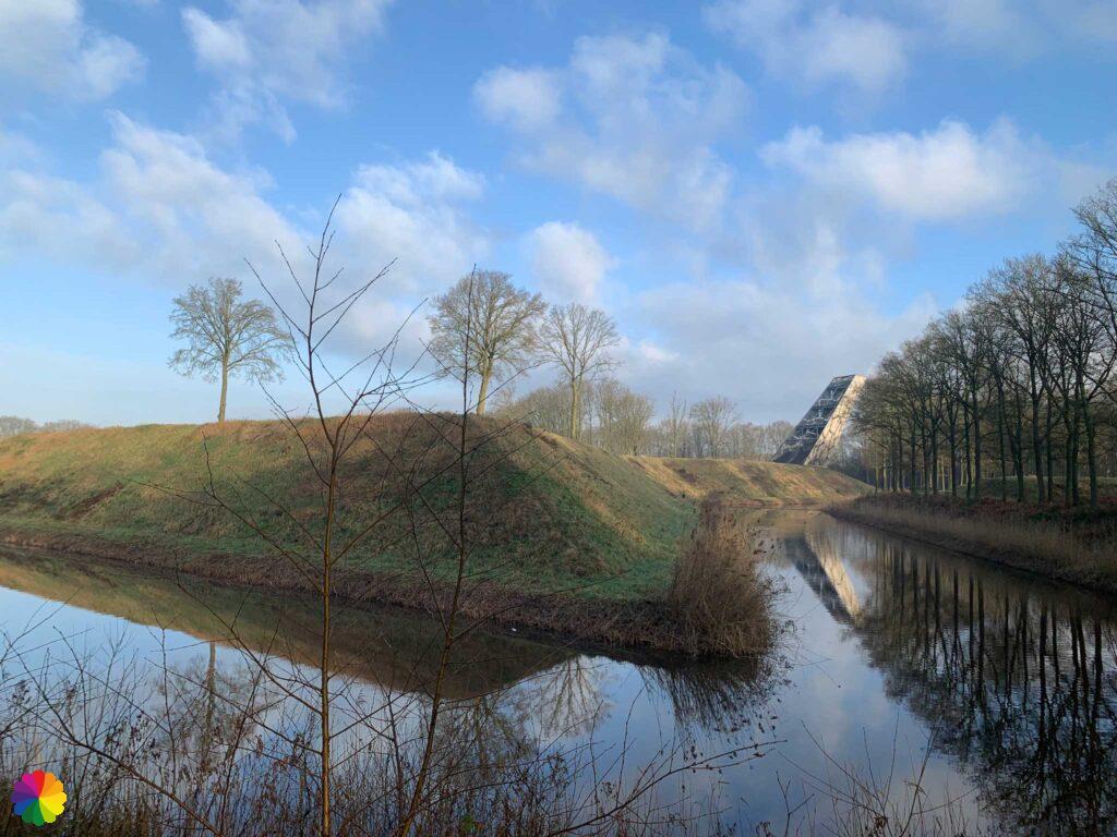
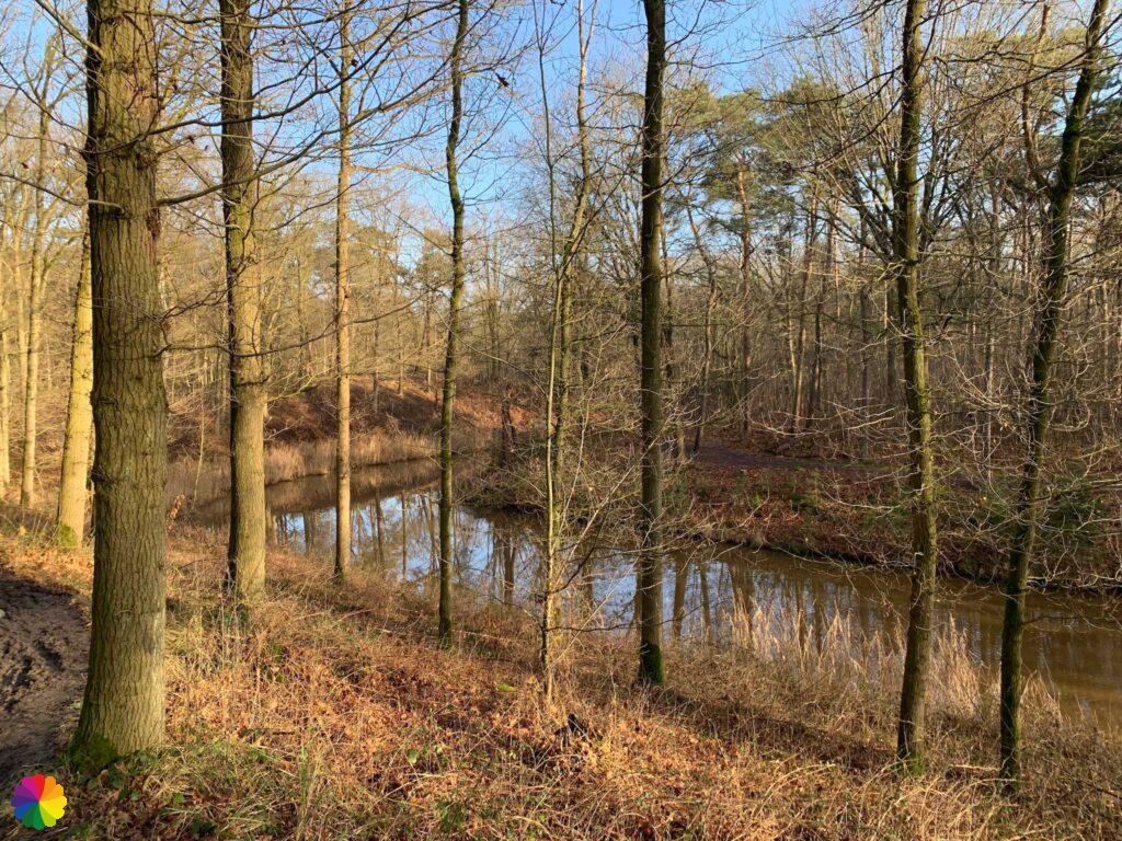
After a while through the forest, I come to a clearing with a great view over the Wasven (Wash lake). Fort de Roovere is in the distance.
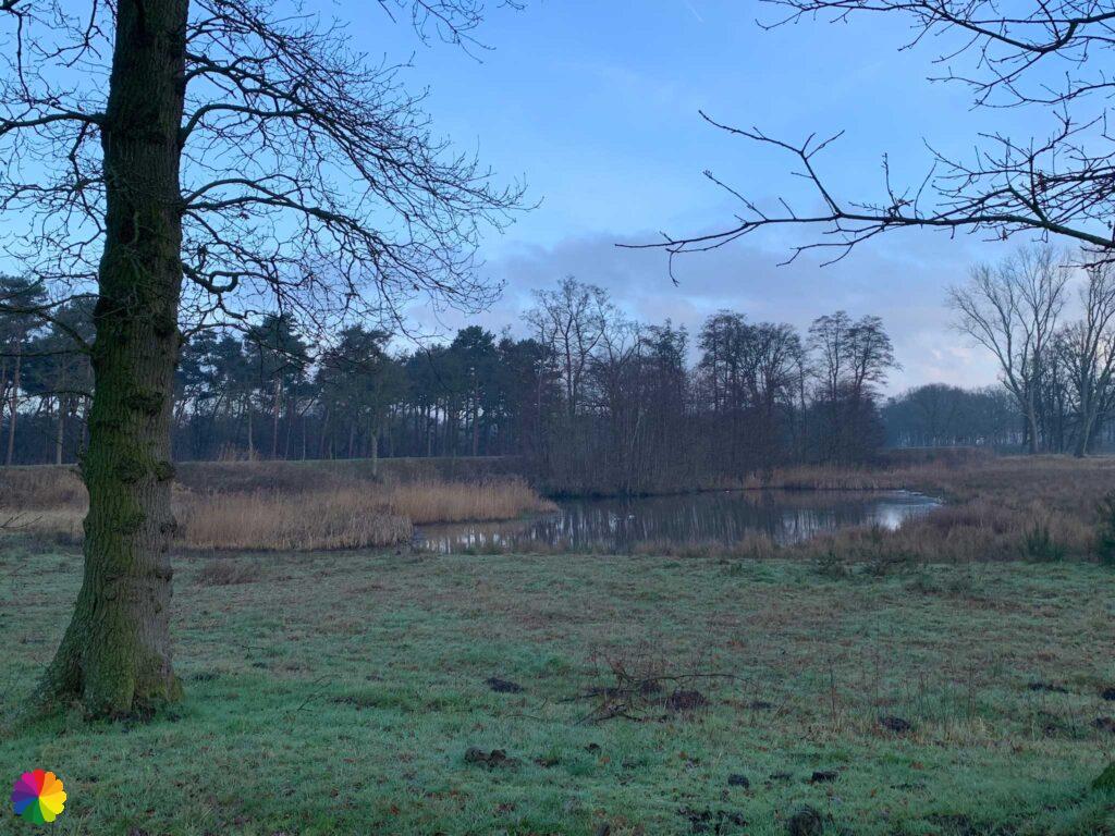
I walk towards the Ligneweg and here I can go towards Fort de Roovere via an earthen wall. From the earthen wall, I have nice views over water and wetlands.
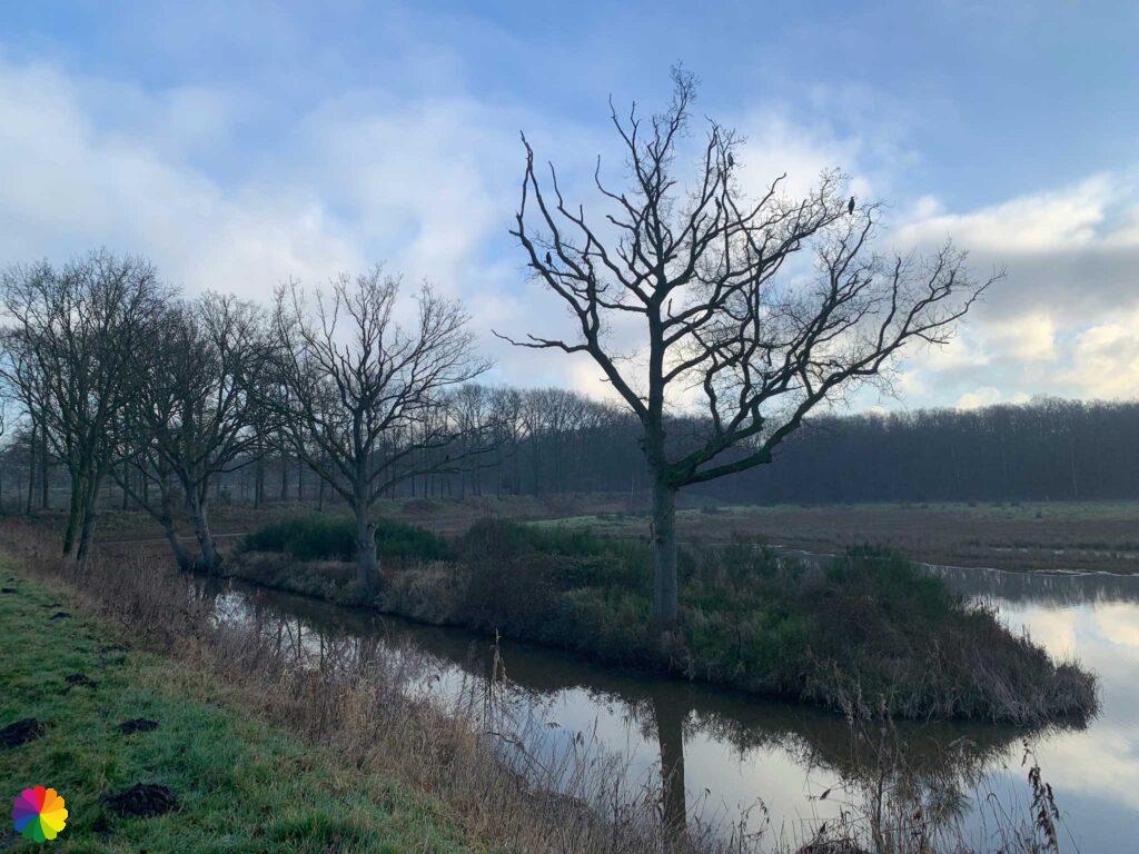
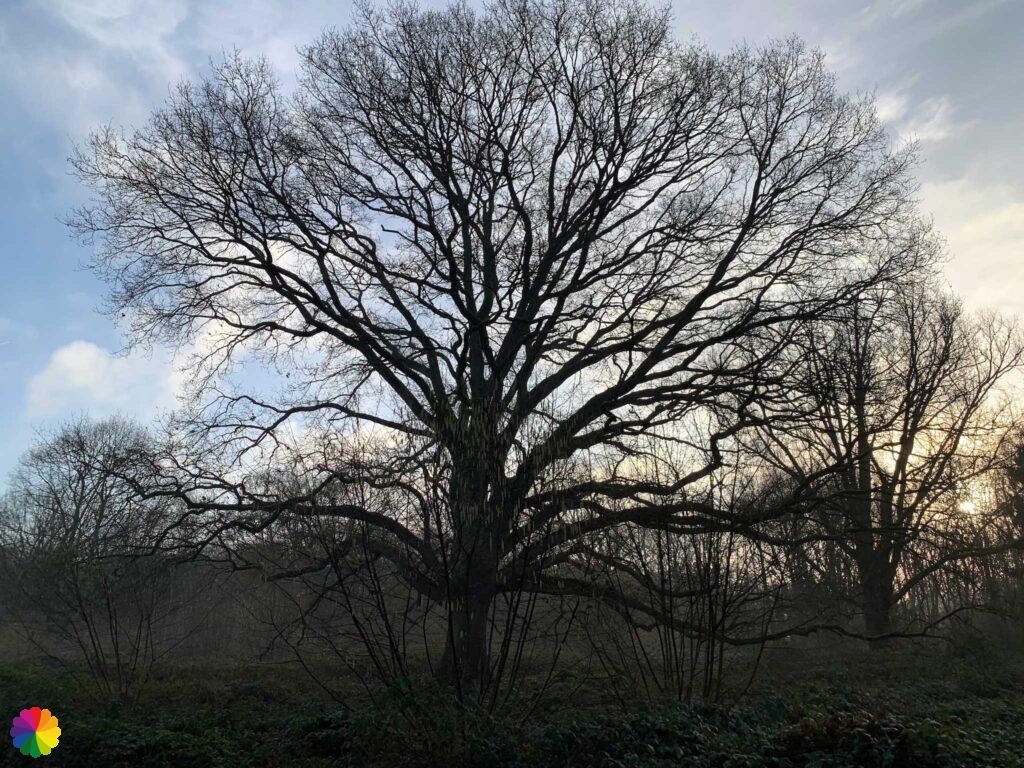
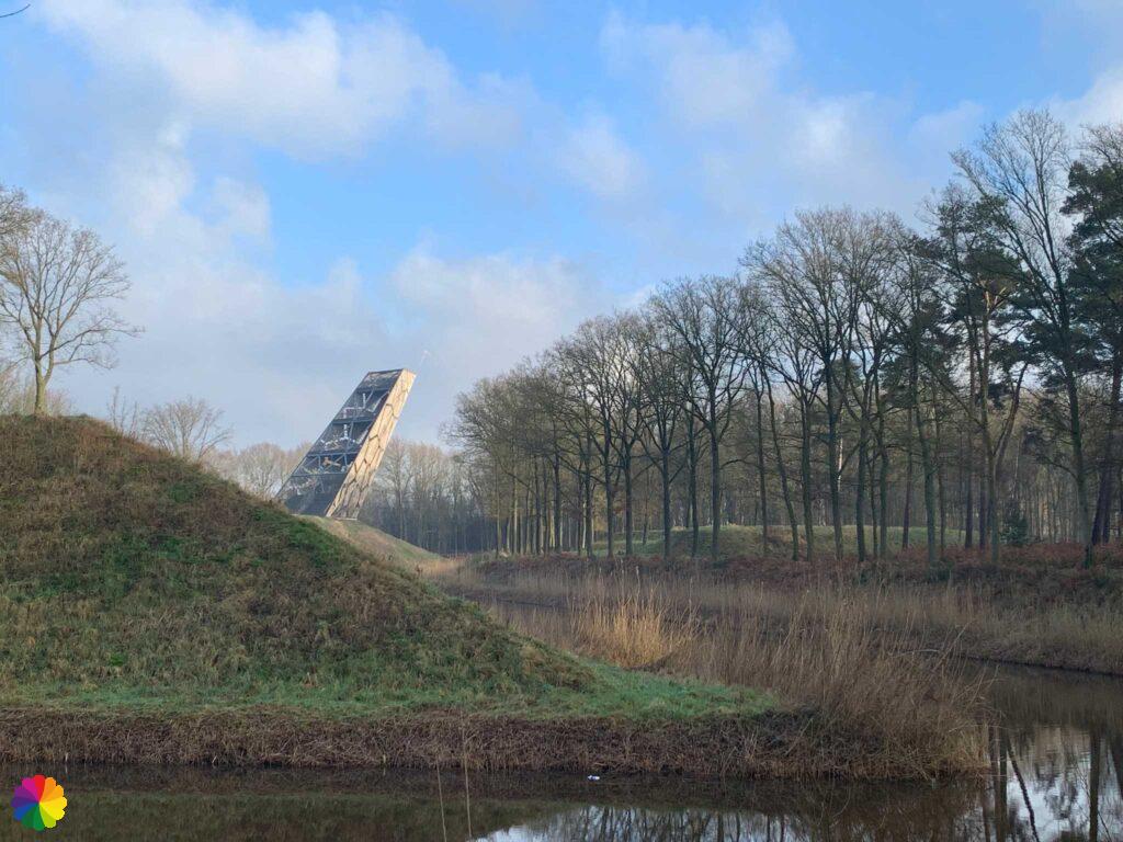
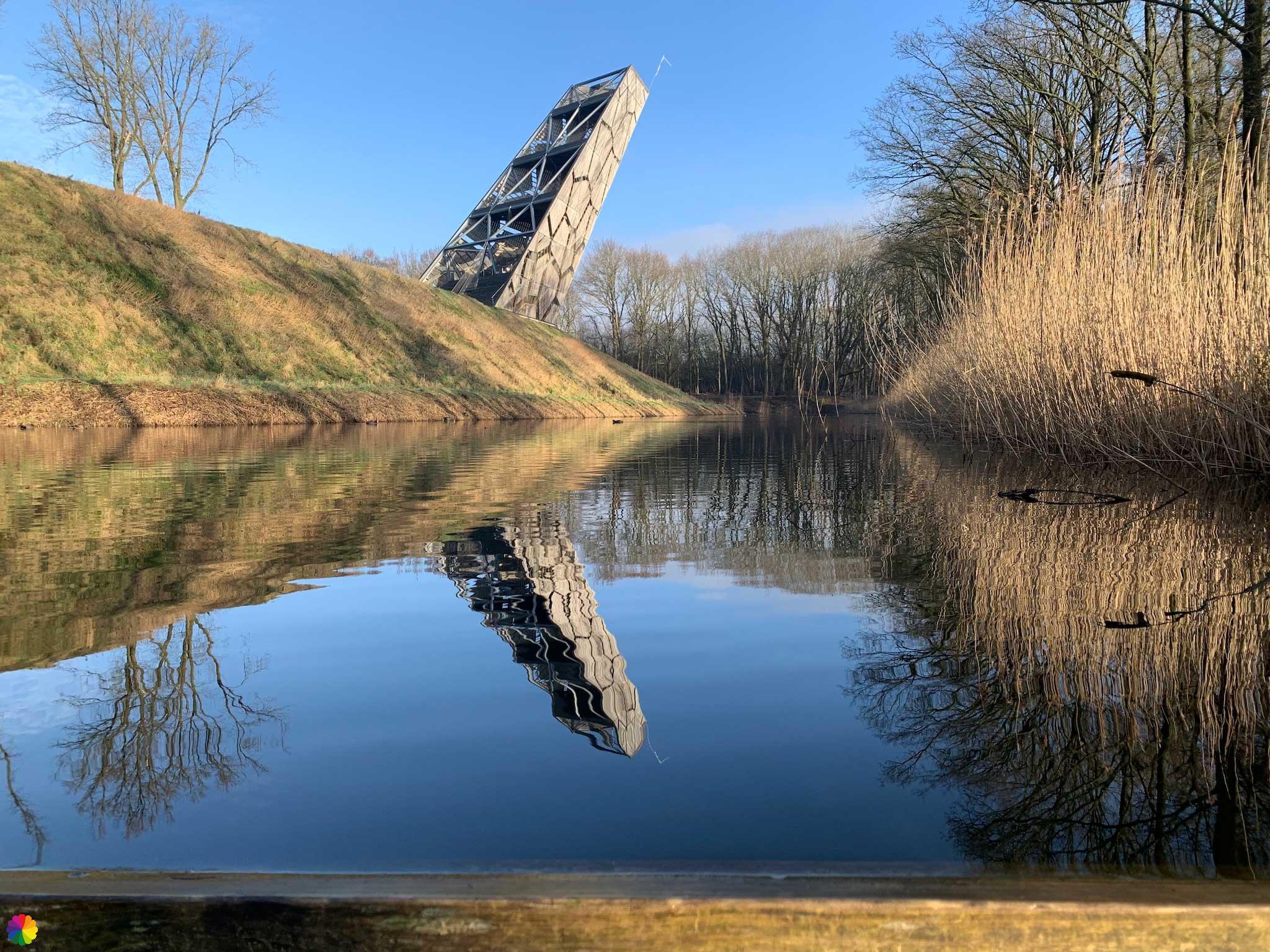
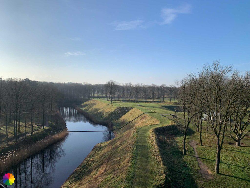
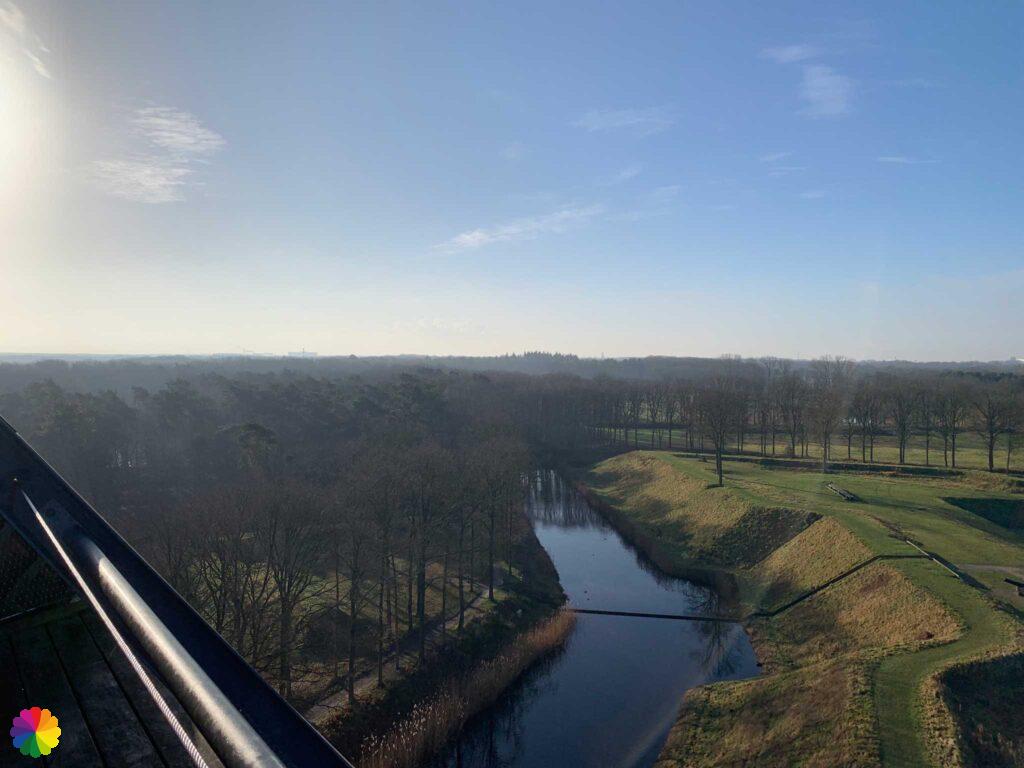
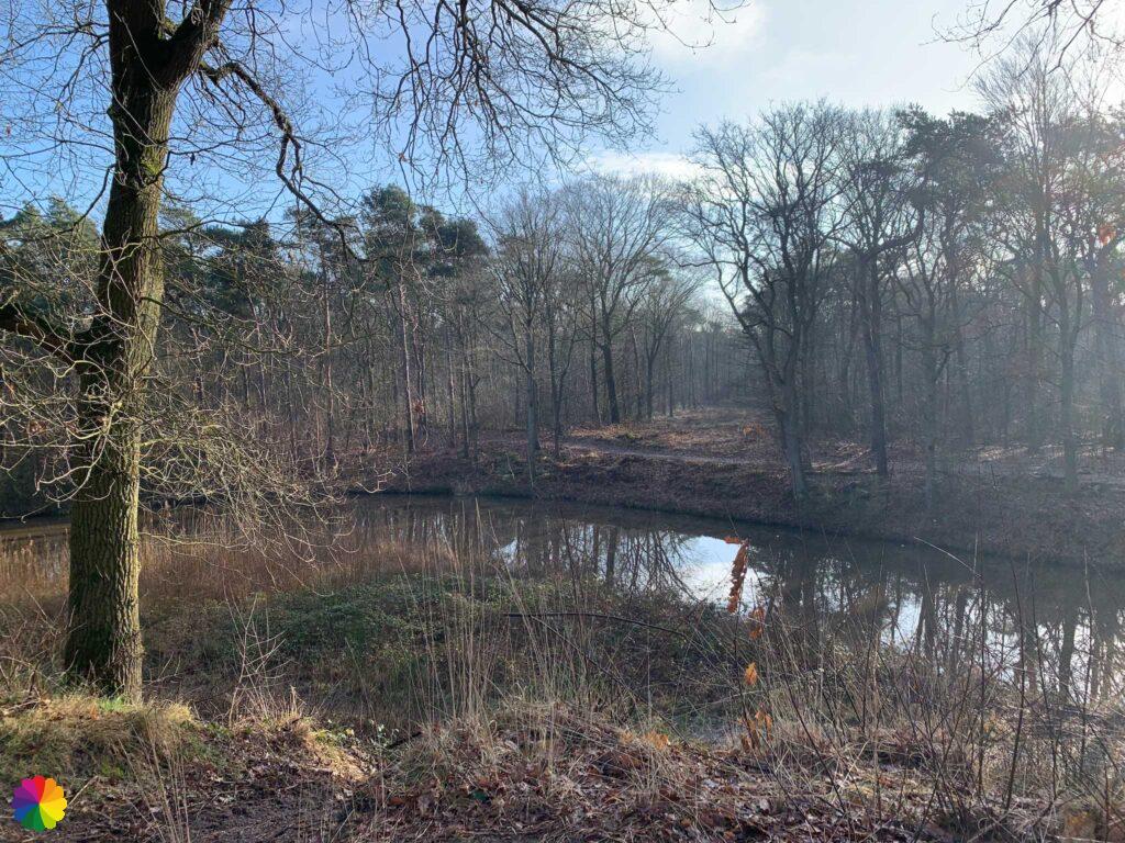
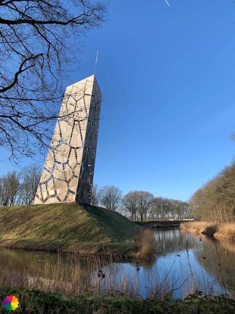
Then I reach Fort de Roovere. I walk around the fort along the outside of the rampart. A path through a ditch takes me into the forest behind the fort. Suddenly I have found the markings again. The Pompejus tower in the distance slopes dangerously over the edge of the fort. The water in the moat gives a beautiful reflection of the tower.
Fort de Roovere is one of the largest forts in the West Brabant Waterline defense system. The fort stopped Spaniards, French and Belgians alike in many wars and battles in the past. The fort was completely renovated in 2010. Earthen ramparts and French trenches can also be discovered near the fort. At information centre De Schaft, you can learn all about Fort de Roovere.
Source (in Dutch): Zuiderwaterlinie

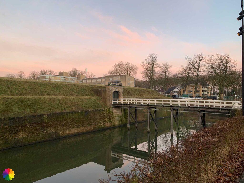
The markings lead me to the Moses Bridge. The Moses Bridge is a very unusual bridge that hangs in the water, so you appear to be walking through the water. Another photogenic structure at the fort.
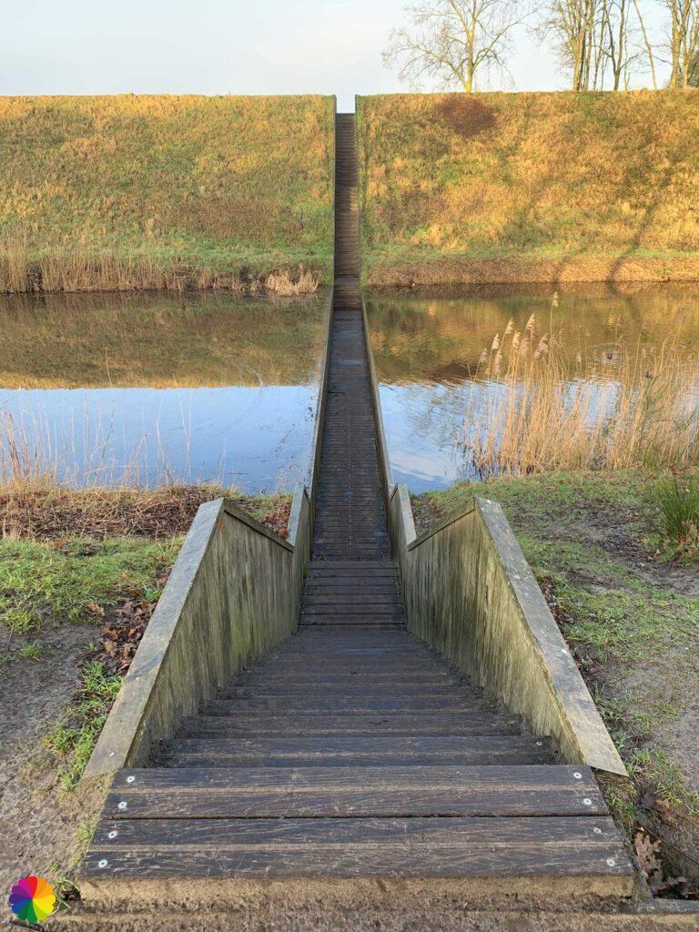
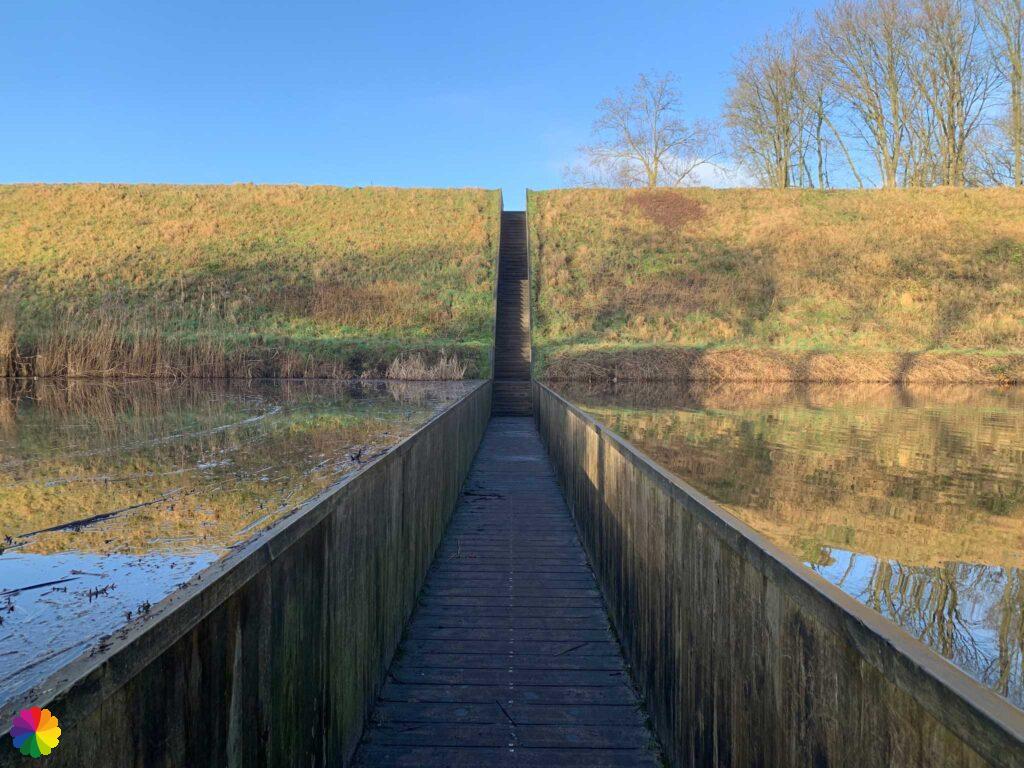
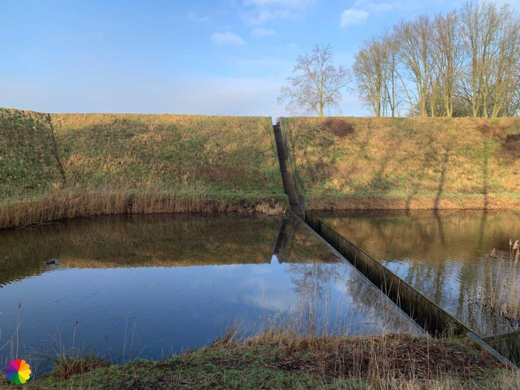
According to the trail, I have to cross the bridge, but from the other side. Apparently I ended up in the opposite direction of the trail, no idea how 🤷🏻♀️.
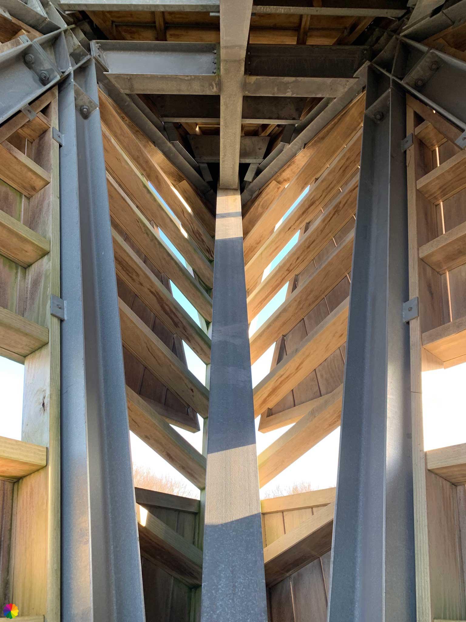
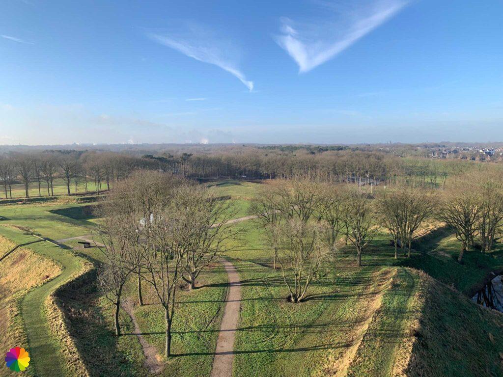
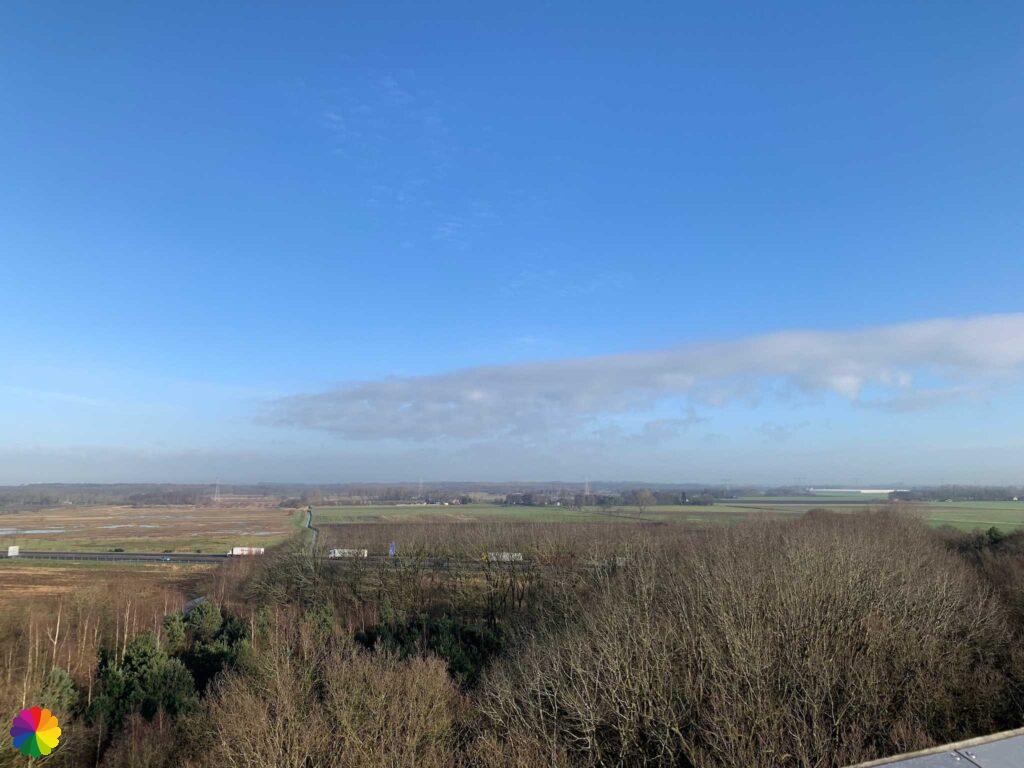
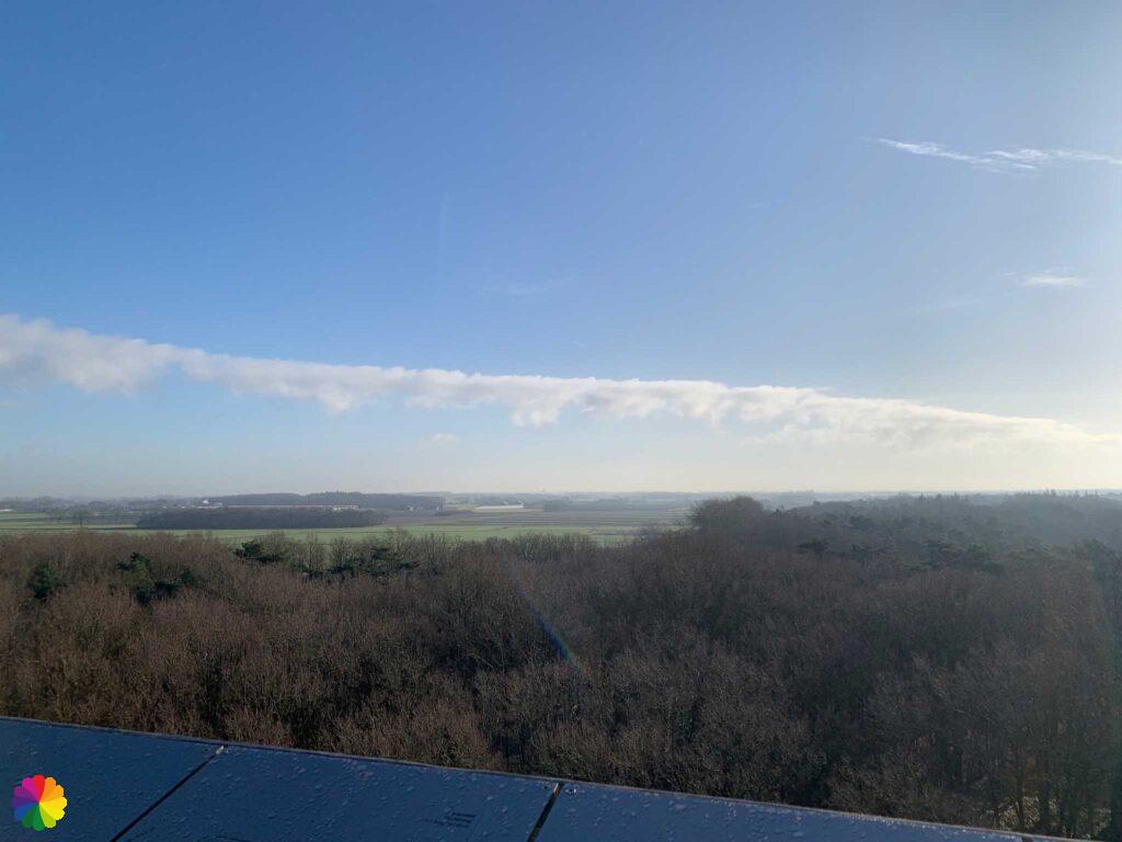
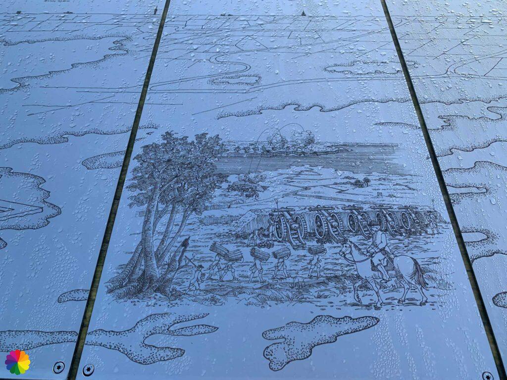
Via the bridge, I walk into the fort. I head straight for the watchtower. I climb up the wooden stairs. The tower has several platforms and I go all the way to the top one.
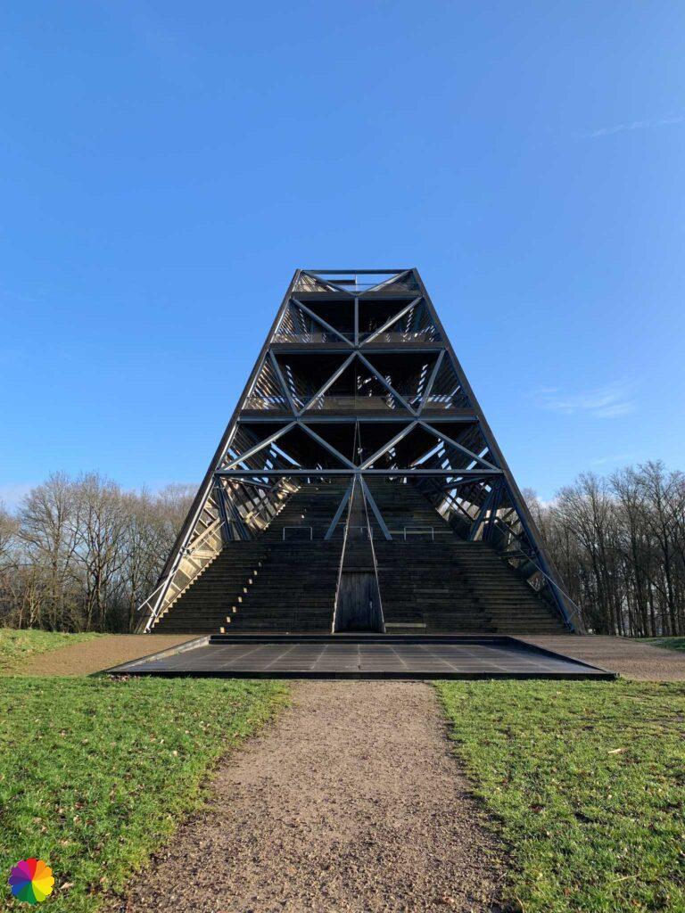
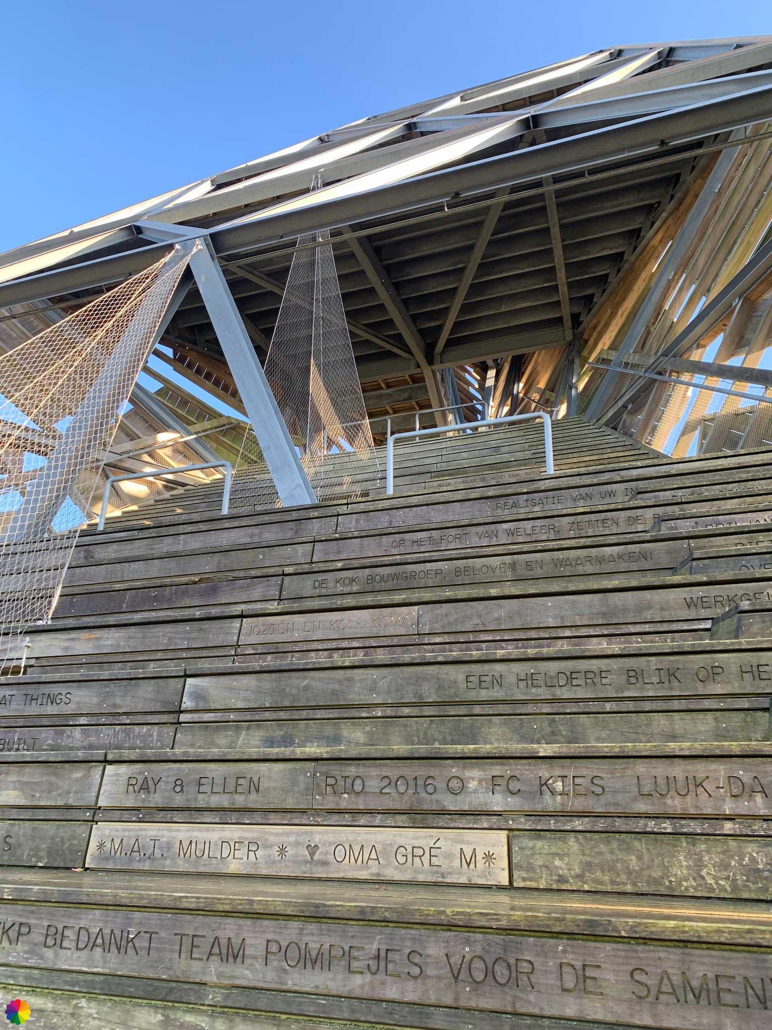
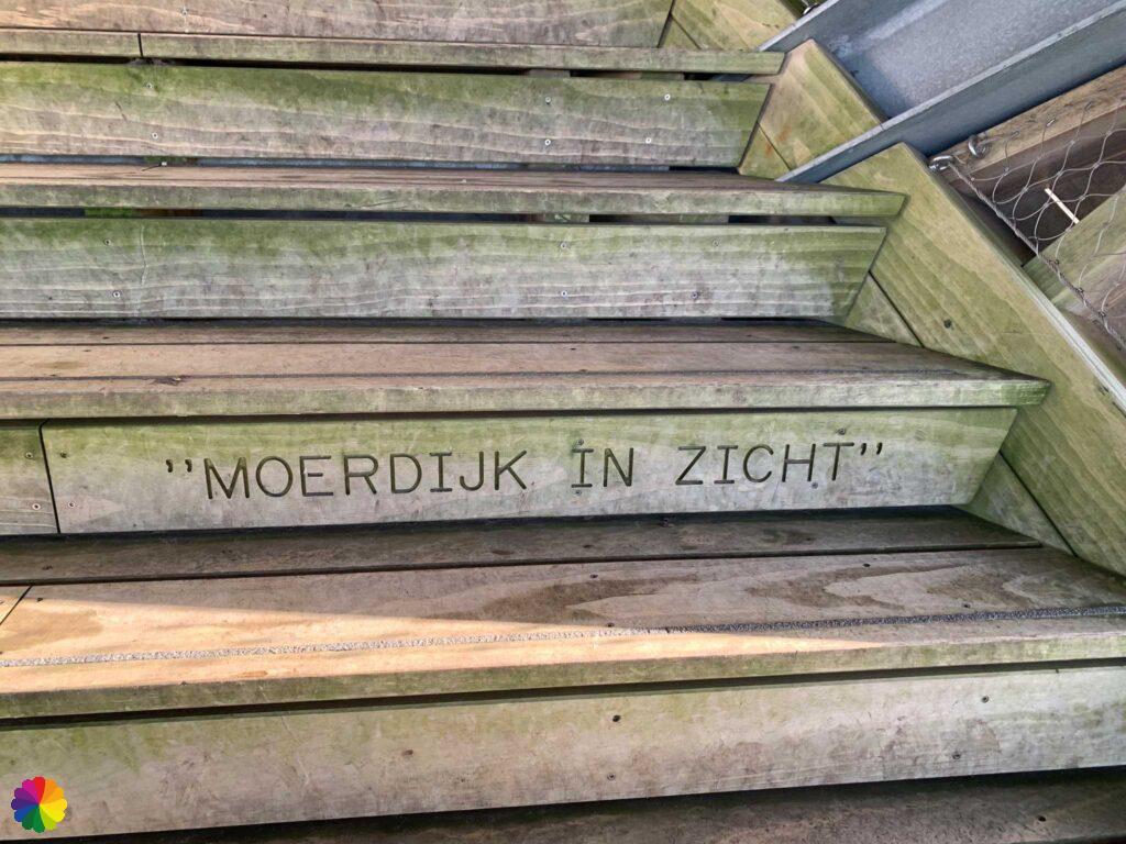

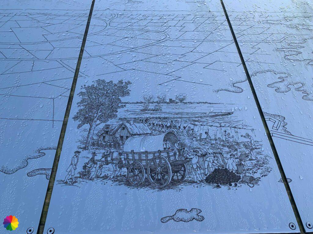
The info panels on the top floor have beautiful illustrations about the history of Fort de Roovere. It also shows in which direction which place can be seen, and Moerdijk is listed – that’s where I live! I can see the industrial towers in the distance.

I go down the tower and via the Moses Bridge I pick up the trail again. This time I go in the right direction. From now on, the markings are much clearer. I walk through the forest with considerable height differences. This makes it a very enjoyable path.

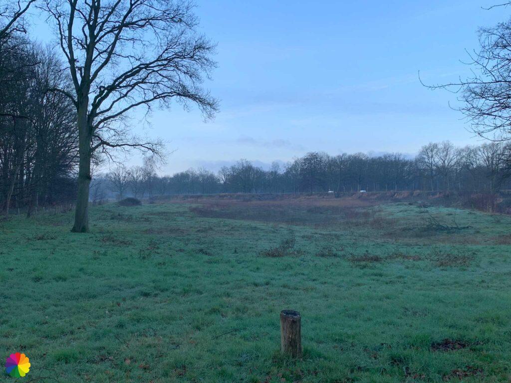
A round trip through the forest takes me to the ring road. Here is a signpost from Wandelnet showing long-distance footpaths and the Streekpad Brabantse Wal. At this signpost I stop my hike. From here I go to Halsteren where I can catch a bus. I cast one last glance at the Pompejus tower.
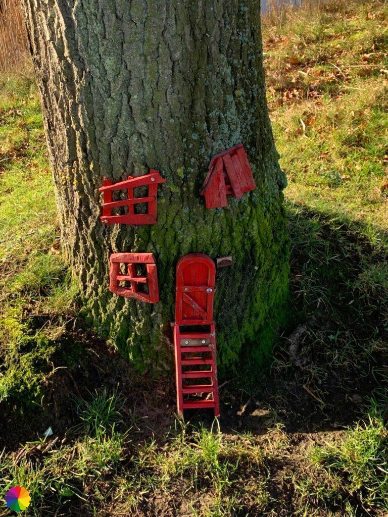
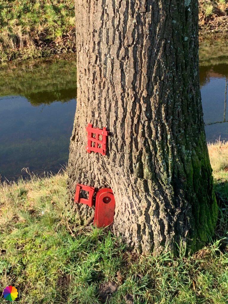
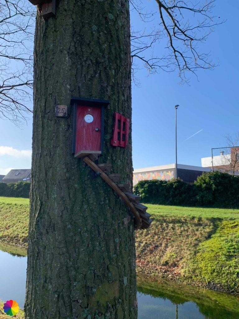
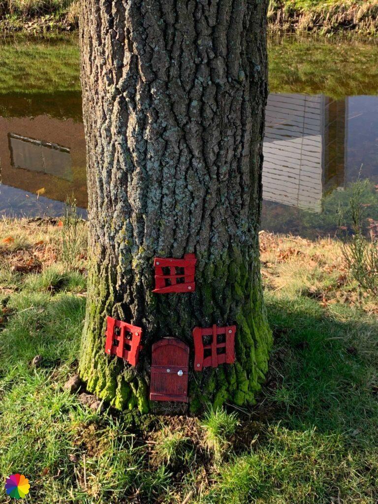
On my way to Halsteren, I come across cute little gnome houses on a row of trees along the road. Some houses are at ground level, others have stairs leading up and even have a balcony. What a funny sight. It makes this boring road a lot more fun.

Final thoughts
A great start of the Southern Waterline trail. The trail between Bergen op Zoom and Halsteren is very diverse, with first a bit through the city and then through beautiful nature. Also nice that the Southern Waterline theme is well highlighted in this part of the trail.
Also worthwhile is the extra detour through Bergen op Zoom with beautiful historical sights.
Bergen op Zoom has a certain appeal to me that makes me sure to return more often for hike, both in and around the city.
More info:
Trail: Section 1 Southern Waterline trailWhere: from Bergen op Zoom to Halsteren, Noord-Brabant, the Netherlands.
No. of km: +/- 8 km
Hiking date: 24 en 28 januari 2022
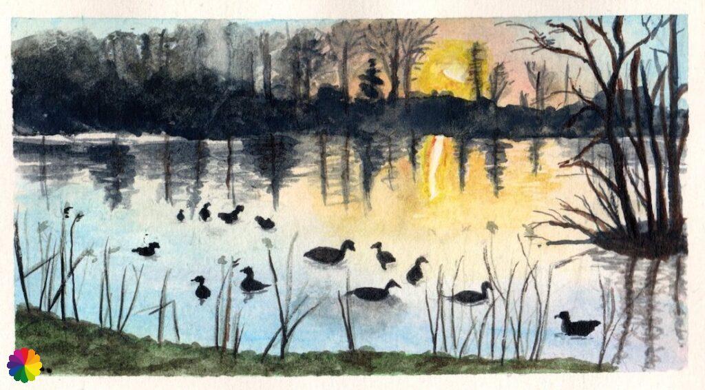
Materials used in illustrations: Coloured pencils for the map and watercolour paints for the illustrations
Rating: ⭐⭐⭐⭐⭐
Pin this hike
Would you like to do this wonderful hike as well? Pin this hike on Pinterest to save for later!

More hiking along waterlines
ColourFlux Studio makes use of so-called affiliate links. If you buy a product through the link in an advertisement, ColourFlux Studio receives a small amount. There are no additional costs for the buyer.
Back to Blog.