In this blog, I have combined two sections of the Southern waterline trail. I classify the two hikes together as a Fine hike.
In part 1, I hike from Maren-Kessel to Lithoijen in the Netherlands. This part is a little too short to devote a separate blog to.
In part 2, I start in Oss and hike to Teeffelen (neighbouring Lithoijen) via a self-made trail. From this town, I pick up the Southern waterline trail towards Megen. This part is a bit boring to make a separate blog about.

Part 1: no trespassing
Nature reserve Lithse Ham
In December 2023, I finally find a slot in my diary and a rain-free day to go hiking. I travel to Maren-Kessel along the Maas river to continue on the Southern waterline trail. The last hike on this beautiful trail (from ‘s-Hertogenbosch to Maren-Kessel) was months ago. A few more sections and I will have completed the trail. In 2024, I will reach the finish line, won’t I?
In Maren-Kessel, I walk along a church path towards the dike. I pass a walibi enclosure with some walibis hopping around.


On the dike, I look out over the water. This is not the Maas river, which is a little further on, but rather an inlet of the Maas river called Lithse Ham.
A ‘ham’ is a type of lake in the floodplain, formed by sand extraction, which is still connected to the river. Unlike the ‘wielen’ that form separate lakes or ponds. The nature around the ham is in the form of a kind of peninsula. In any case, it is a beautiful view to look at.


The trail first goes along the dike and a little further on I am allowed into the floodplain to have a closer look at the ham.


In the distance, I see something scurrying in the bushes. They turn out to be highland cattle. As I approach, the animals move pontifically onto the path and look at me, chewing. Fortunately, it is not too densely overgrown here and I can go around them in a wide circle.

This does make me deviate slightly from the trail. I come to a recreational beach with a holiday park next to it. I continue walking along the water until I reach a barrier. I can’t get out at all! It turns out that the beach is only accessible from 1st of April and it is only December. So I am not allowed here at all. Oh what am I going to do now. I don’t want to walk all the way back. I follow the fence for a bit and reach the main entrance which is closed with a gate. Fortunately, I can climb over it. Along a path past mobile homes, I quickly walk down the holiday park. Pfff, I don’t think anyone noticed me and I managed to avoid a fine 😅.
Lith and Lithoijen
After my debacle at the holiday park, I am back on the trail, once again along the Maas river. I think I can go back into the floodplains, but I stay on the dike for now.


On my right I pass the town of Lith. I pass two church towers. A sluice complex appears on the horizon, aptly named, you’ll never guess: Lith. Always special to see such a sluice complex.


Still walking along the Maas river, I have now passed Lith. The next town already presents itself: Lithoijen. Here the trail does go down the dike and into the town. I pass a pretty, picturesque little square with a church and the Old Town Hall (now a restaurant).


I am taking a break and wondering what is convenient to do in terms of travelling back by public transport. I have three options:
- Stop early and walk to the nearest bus stop, which I can still catch within half an hour.
- Walk to Oijen, about 5 km, at the risk of just missing the bus and having to wait an hour for the next one.
- Or walk on to Megen, another 10 km or so, when I’ve already covered 10 km.
I opt for the former, actually I think 12 km is a bit short for such a long way away and with over 2 hours travel time (and 2 hours back), but I don’t like the other two options either. So it happens, I walk to the bus stop between Lithoijen and Teeffelen and decide to make the hike to Megen a bit longer next time by starting from Oss.
Part 2: shitty hike
Starting in Oss
A few months later, I once again travel to the province of Brabant. Today I start in Oss. Last time I had ended near Teeffelen. I will walk there first. From there it is about 10 km to the finishing point in Megen. I add about an 11 km stretch to it. So that’s a big hike for me.
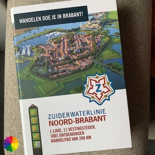
Other trail guide about the same region
In Oss, I walk northwards through parks and green strips to the outskirts of the city. It is a beautiful clear morning. At the edge of Oss, I also walk through a green strip with pretty ponds. I look out over the fields.


I then walk on cycle paths along the provincial road to the town of Teeffelen. This is a busy and boring stretch, but in Teeffelen it is quiet in the picturesque streets. I pass a statue of Virgin Mary and a church. Then I head towards the Maasdijk where I pick up the Southern waterline trail.
An impressive artwork on the dike depicts the battle with the water and the river.


Natuurmonumenten has a sense of humor
I walk past a nature reserve of Natuurmonumenten under construction called Hemelrijkse waarden (Heavenly plains). You can already see the contours of the future footpaths emerging. Probably great fun to walk through later, for now I’ll stay on the dike.
Not much later, I walk past a sewer purification plant. Oh dear, what a smell 🤢! Occasionally while hiking, farmers are fertilising their land. That is already not a pleasant experience, but this is even a bit worse! I do find it humourous that the nature reserve in the floodplain is called Heavenly. It is definitely not heavenly here. I have already thought up a nickname in English for the hike: shitty hike. Almost half an hour later, the foul sewer smell finally subsides.
At the bend of the dike, the nature reserve is passable. There is a watchtower to get a better view of the area. I climb the tower and enjoy the view and fresh air 😂.


Oijen, Macharen and Megen
I like it that the names of the towns in this area blend together. In the previous hike I already passed by and through Lith and Lithoijen, now it is Oijen’s turn. This town also has a statue of Virgin Mary and a tiny church.


I go down the dike a bit and pass the white castle of Oijen. Unfortunately, construction work is in progress on half of the castle, so I only take a photo from the side.


I pass the next town: Macharen. I deviate from the river again, but keep walking along a canal. I only skim the village. Via a drawbridge, I reach the other side of the canal before returning to the river.


Once again I walk for kilometres along the dike next to the Maas river. It’s a monotonous walk today. It hasn’t improved much and even a bit of the trail through the floodplain I find boring.
Finally I reach the end point in Megen. It must be a beautiful town, the smallest fortified town in the Southern waterline, but after 20 km of walking I don’t have the energy to go and see it in detail. I’ll do that next time. All I see at this point is a windmill and a historic building near the bus stop.


Final thoughts
These two sections of the Southern waterline trail go almost entirely along the Maas river, making it a fairly monotonous walk. The views are beautiful, but at some point it gets boring. The towns of Lith, Lithoijen, Oijen and Macharen don’t provide much variety either. Overall, it is a Fine hike.
Tip: I recommend skipping the section between Teeffelen and Oijen if you also want to do this hike in two parts. So: stop at Teeffelen and pick up the trail again at Oijen. Walking for kilometres past a sewage purification plant is really no fun.
More info:
Trail: Section 10 and Section 11 Southern Waterline trailWhere: from Maren-Kessel via Lithoijen to Megen, Noord-Brabant, the Netherlands.
No. of km part 1: +/- 12 km
No. of km part 2: +/- 10 km (from Oss: 21 km)
Hiking date part 1: 18 December 2023
Hiking date part 2: 8 March 2024
Materials used in illustrations: Coloured pencils for the map and watercolour paints for the illustrations
Rating: ⭐⭐⭐
- OV starting point part 1: bus stop Kerkplein, Maren-Kessel – school line 662 between Oss and Maren-Kessel
- OV ending point part 1: bus stop Pastoor van Weerdtstraat, Teeffelen – school line 662 between Maren-Kessel and Oss
- OV starting point part 2: Train Station Oss, or in Oijen: bus stop Kloosterstraat, Oijen – neighbourhood bus 296 between Oss and Megen
- OV ending point part 2: bus stop W. Kippstraat – neighbourhood bus 296 between Megen and Oss
More hikes in two parts
Here are some more blogs with merged hikes on the Southern waterline trail:
ColourFlux Studio makes use of so-called affiliate links. If you buy a product through the link in an advertisement, ColourFlux Studio receives a small amount. There are no additional costs for the buyer.
Back to Blog.


