This time again two sections of the Southern waterline trail in one blog, due to two early discontinued hikes.
During the first part from Waspik to Waalwijk, it became a water ballet. During the second part from Waalwijk to Oudheusden, I got a headache on the way and unfortunately did not have asprin with me. Partly because of these events, the hikes also turned out less enjoyable than I had hoped. Who knows, maybe I will return for a second chance.

Part 1: Waspik – Waalwijk
In the previous hike on the Southern waterline trail, I ended in Waspik (in the Netherlands), which was in October 2022. That was quite a while ago. In fact, I am jumping quite a bit further in time. For those who want to know: I was ill for pretty much all of November because of a sinus infection. By now, it is the end of December and I am fully back on my feet. So I pick up the trail in Waspik.
I get off the bus in the centre of Waspik and immediately see a beautiful church with tall columns in front. Soon I walk out of the centre of Waspik. I then walk through nature park de Veste (the Stronghold), where I get to watch a beautiful sunrise. I stroll along winding gravel paths through the park.


Unfortunately, the nice weather is short-lived. I can already see dark clouds in the distance.
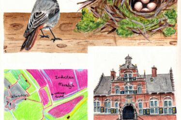
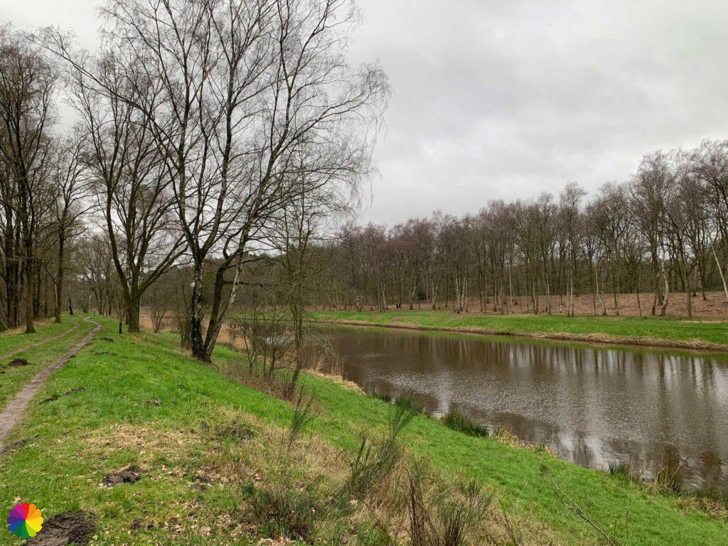
After the park, I turn right once more over the former Halvezolen line (see the previous blog for more explanation). Then I turn left between the grasslands. Many grasslands have now become wetlands. I see mostly geese using it. These wetlands belong to the De Langstraat (Long Street) nature reserve. This is a longish area between Waspik and Waalwijk with lots of marsh forests and pastures.


Nature reserve de Langstraat is a so-called ‘stroke landscape’: long, narrow plots bordered by alder hedges. The area lies on a transition from sand to clay and is also called the ‘Seam of Brabant’.
The website (listed as a source) has a nice hiking trail through this area. As you can see from the photos, you do need waterproof shoes or boots to enter this area.
Source (in Dutch): Natuurgebied Langstraat
The trail turns right on a grassy path that leads me right through De Langstraat nature reserve. A little further on, the trail directs via a loop through a marshy forest and past a duck decoy, but the path is flooded by the rain. I decide to skip this loop.
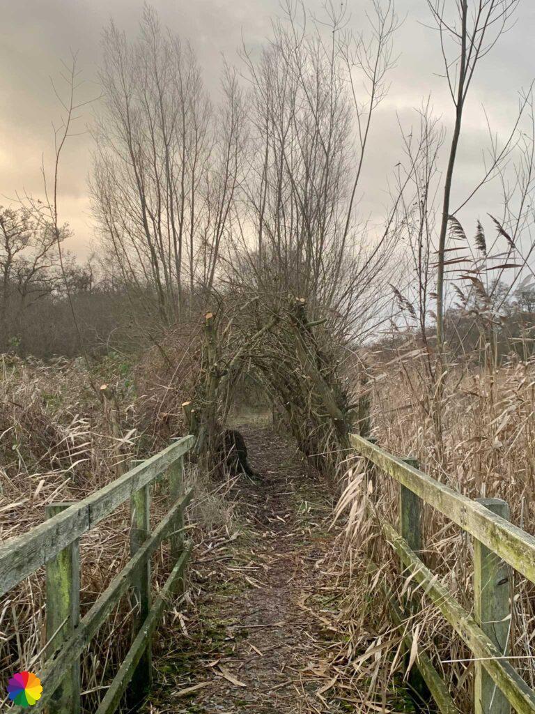
It also suddenly starts raining hard and I take shelter for a while under an arch made of reeds.


The rain eases a little and I continue along the grassy path, climbing over the occasional fence. At the end of the path I reach the town of Sprang-Capelle. I walk through the town for a while before continuing along the grassy path again, still through De Langstraat nature reserve.


It starts raining hard again and this time, unfortunately, it does not stop at a shower. As the wind comes from the right, in no time my entire right side is soaked. There is no possibility of shelter. I see an arrow pointing towards a bird watching hut where I might be able to take shelter, but this path is also flooded with water and therefore impassable.
Other trail guide in the same region
I just go on steadily. With this weather, De Langstraat (Long Street) is an excellent name for this area. In fact, the hike is taking way too long for me. My mood has dropped to zero by now.


Just before Waalwijk, I have to turn right on a grassy path which is also flooded. I decide to go to Waalwijk as soon as possible to catch a bus. Unfortunately, my self-chosen track is not anything to write home about. Every time, I stand on the verge because of passing cars. With the rain, this is no fun at all.
On the outskirts of Waalwijk, I can finally take shelter under a viaduct, but the rain has stopped 🤷🏻♀️. Quickly I walk towards the bus station and I think I’ve taken a little piece of the trail unnoticed…

Part 2: Waalwijk – Oudheusden
Again, I jump a long way through time, it is now early February and I continue with the Southern waterline trail. I start in Waalwijk at the bus station and soon I am on the trail. I pass the remarkable St. John the Baptist church. Perhaps a bit disrespectful, but the church reminds me of the Efteling hotel (amusement part hotel not far from Waalwijk). The oval tower looks somewhat like it.


After the church, I turn right through a shopping street. Then I have to turn left and right again. I pass through a park. Then I turn right and left. In this way I zigzag through the residential areas of Waalwijk. A little later I turn left and right again and go through a park once more, now right next to the highway. After the park, the trail turns right and left again, and I’m getting sick of the zigzagging. Further on, I should have gone to the left another time, but fortunately I overlooked a marking and walk straight on for a while.
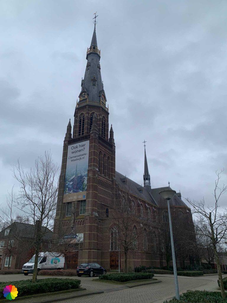
Walking straight ahead can be quite fun! In fact, I pass the beautiful St. Clemens Church. The church is being turned into an apartment building. Unfortunately, the housing corporation has put a gigantic banner on the church tower. Very convenient to advertise this way, but quite a waste of the church. Are you able to live in a beautiful church, and then there is a huge banner hanging over your door!

There are many churches in Waalwijk, not all of them in use anymore apparently. In fact, I pass another small church before leaving Waalwijk behind me.

Finally some nature! I walk along a cycle path along the Drainage Canal ‘s Hertogenbosch-Drongelen also called Baardwijkse Overlaat Canal. I also see a path right along the canal. At a bridge I take a break and in the next section along the canal I do walk through the floodplains. That’s a lot quieter than on the cycle path.


I am at the edge of the Loonse and Drunense Dunes National Park. An information panel shows many other walking trails. I cross the canal via a bridge and then immediately turn right. I walk into the Baardwijkse Overlaat nature reserve. I still go along the canal for a bit and then turn left into the forest.


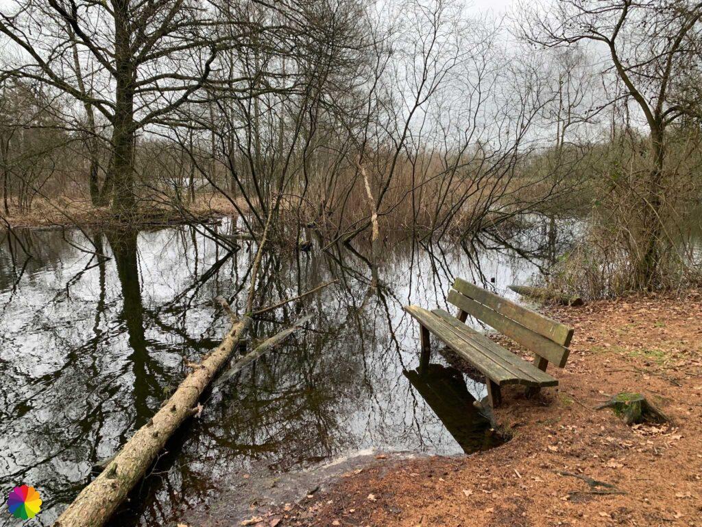
Nice winding paths lead me through the forest towards the Lange Wiel (Long Lake). I have beautiful views over the water. I could enjoy the view on a bench for a while, but then my feet would get wet. Too bad it is cloudy today, but fortunately I don’t have rain like last time.


I go through a fence and I am now in a wetland forest. In the distance I see Galloway cows, but eventually I don’t get close to them.


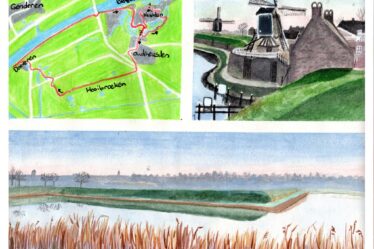
I reach a recreational lake on the outskirts of Drunen. I take a few photos of the lake and quickly continue the trail via a set of stairs to the top. I do not enter Drunen itself, but keep walking along the edge of the town until I reach the windmill There I go to the other side of the highway.


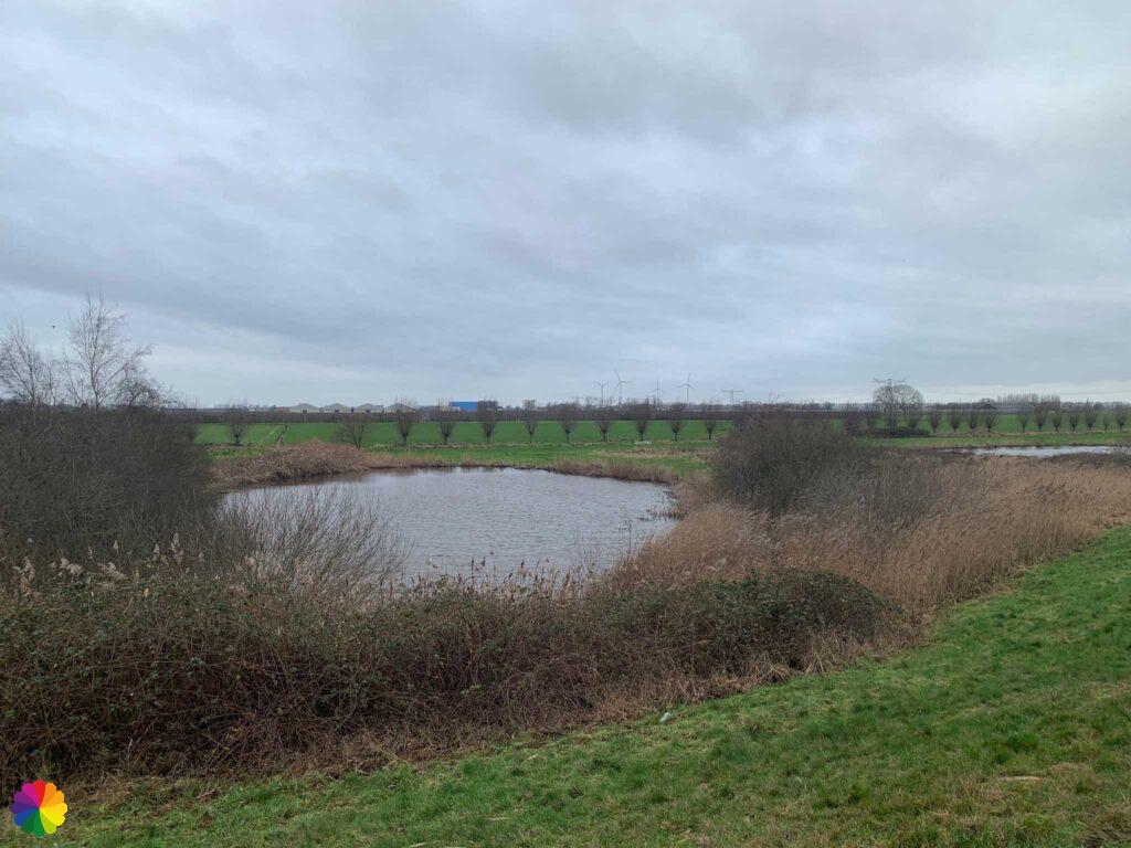
On the other side of the highway, I walk over the winding Zeedijk along the Elshoutse Wielen (Elshout Lakes). As in other places along a river, these little lakes were created by a breach in the dike. The lakes have amusing names such as Kamperswiel, Gonnegatwiel and Ace of hearts.


At the Koppelwiel there is a path down and a small platform. I take a break there. I was planning to walk to Heusden, but I’ve had a headache all morning and it’s not getting any better. I decide to look for the nearest bus stop. That turns out to be in Oudheusden. Although that is still a 5 km walk. On the way to Oudheusden, I pass the Hooibroeken nature reserve and a duck decoy with the cute name Ter Kwak (The Quack).


Next time, I will visit Heusden and dedicate a blog entirely to this beautiful, historic fortified town.
Final thoughts
The sections of the Southern waterline trail between Waspik, Waalwijk and Oudheusden were a bit disappointing. This is not due to the trail, but more due to weather and personal circumstances. The Langstraat nature reserve seems very nice to visit again without rain showers and flooded paths.
The Baardwijkse Overlaat nature reserve overlooking the beautiful Lange Wiel (Long Lake) is the highlight of this part of the trail, but the Zeedijk and Elshoutse Wielen are also worth a visit. In short, two Fine hikes on the Southern waterline trail!
Tip: Regional path 18 The Biesbosch trail follows the same section along the Elshoutse Wielen.
More info:
Trail: Section 8 en Section 9 Southern Waterline trailWhere: from Waspik via Waalwijk to Oudheusden, Noord-Brabant, the Netherlands.
No. of km: +/- 12.5 and 16 km
Hiking date: 29 December 2022 and 3 February 2023
Materials used in illustrations: Coloured pencils for the map and watercolour paints for the illustrations
Rating: ⭐⭐⭐
- Starting point: bus stop Kerkstraat, Waspik – bus 134 between Raamsdonksveer and Waalwijk
- In between point: bus stop Vredesplein, Waalwijk – multiple bus lines to Den Bosch and Tilburg
- Ending point: bus stop Laagstraat, Oudheusden – bus 135 between Wijk en Aalburg and Den Bosch
Pin this hike
Would you like to do this Fine hike as well? Pin this hike on Pinterest to save for later!

More hiking along winding dikes
Personally, I am not a fan of straight dikes to walk on, but a dike winding through the landscape is a lot more fun. Here are three more hikes along winding dikes:
ColourFlux Studio makes use of so-called affiliate links. If you buy a product through the link in an advertisement, ColourFlux Studio receives a small amount. There are no additional costs for the buyer.
Back to Blog.