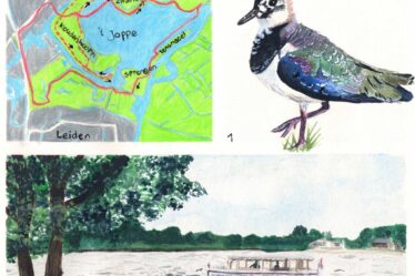
A great round trip around and through fortified town of Heusden in the Netherlands, with as many as three beautiful windmills and picturesque streets. I then walk back to the Zeedijk from the previous hike via Oudheusden. This part follows the Southern waterline trail through the village of Doeveren and along the Bergsche Maas river back to Heusden.

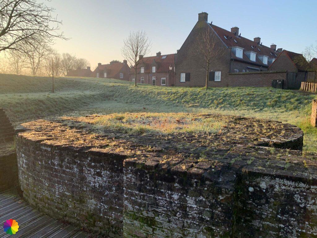
Gorgeous sunrise in Heusden
The bus drops me off at the entrance to Heusden where a gate once stood. There are still two old-fashioned guardhouses that now serve as bus stops. First, I walk a bit outside the canal of the fortification. The fog and sunrise make it look like a fairy tale.


At a picnic spot, I enjoy the gorgeous sky for a while.


History in Heusden
At the Heusdenseweg, I re-enter Heusden and head up the inner wall, still following the trail from the guide. A beautiful, black windmill becomes visible on the wall. What a beautiful mill! I also walk past a ruin.


A fortified town cannot do without a historic gate. So that is the next landmark in Heusden: the Veerpoort. At the gate, I go up the wall again and suddenly see two more windmills. No less than three mills on the walls! Unfortunately, I can’t get all three mills in the photo at the same time.


On the outside of the wall, I see docked boats in various little marinas. On the inside, I look out on picturesque old houses. I not only take photos of the windmills from afar, but also up close. I almost walk under the sails. It gets even more like Holland (or should I say Brabant 🤔) with a steep little drawbridge.


I am not entirely wrong that Heusden looks like a Holland-esque picture: in fact, in 1357, the Land of Heusden was sold to County Holland. Around 1810, Heusden was annexed to province of North Brabant.
In the 16th century, the city got its first medieval walled enclosure with four city gates: Wijkse Poort, Bossche Poort, Oudheusdense Poort and Veerpoort. Later, the gates were demolished, replaced or moved until only two gates remained.
Modernisation of the fortifications began in 1581 and was improved and expanded several times. In 1821, the town lost its fortified status as it no longer had a function due to the foundation of the Kingdom of the Netherlands. The defensive works were neglected.
Fortunately, a decision was made to restore the fortified town in 1968. This project took about 20 years.
Source (in Dutch): Wikipedia
I continue walking along the wall and reach another entrance gate: the Wijkse Poort.


It is time to leave the fortified wall. I enter the city centre via the Vismarkt (Fish Market Square). I walk through pretty cobbled streets with beautiful facades and I pass two churches.


I pass a beautiful castle tower with battlements. And even the fire station looks picturesque in Heusden. I walk back to the entrance road where I started the hike earlier this morning. I didn’t quite follow the trail anymore, but I had a great time in and around the fortified town for at least two hours.


The rest of the Zeedijk
Now I want to continue with the trail. That means walking back via Oudheusden and Hooibroeken nature reserve to the Zeedijk from the previous hike. So far, the trail is very nice, but there is one drawback: the narrow cycle lane along a provincial road between Oudheusden and Hooibroeken. I am not looking forward to this, as it was very busy last time. This time, fortunately, it is not so bad. With firm strides, I cross this non-pleasant part of my hike.
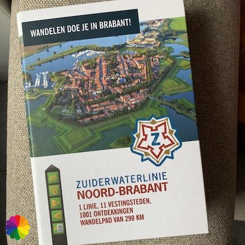
By the way, if you follow the Southern waterline trail from the trail guide (or via the website), you won’t encounter the pesky provincial road at all.
Other trail guide about the same region
Once at Hooibroeken nature reserve, I slow my pace and take my time to take photos of the surroundings. You can’t actually enter the Hooibroeken, there is only a straight cycle path between the woodlands and fields. Duck decoy Ter Kwak (The Quack) is hidden somewhere among the woods. A foreboding sign of spring has arrived in the form of snowdrops and crocuses on the roadside.


Finally, I am back on the winding Zeedijk. Last time I already walked past many wielen (lakes), but I still have several to go. At one of the lakes, I can get closer to the water via some steps down.


There is supposed to be a beaver burrow in one of the lakes, but I cannot detect one. At the end of the Zeedijk is the town of Doeveren. It is a small town and I pass through in no time. I pass a nice little church and a beautiful farm.


Along the (Bergsche) Maas river
Just after Doeveren, I walk up the dike and end up at the Maas river. Later it turns out that this is not yet the Maas river, but the Bergsche Maas. Only after Heusden does this river bear the name ‘Maas’. I go over the dike towards Heusden again.


The Heusden bridge is getting closer and closer. I don’t have to cross this bridge, but I do have to go under it to get to the other side of the road. There I can see another bit of the Bergsche Maas.


Via a different entrance road than this morning, I once again reach the beautiful fortified town of Heusden. The sun is now higher in the sky and I can now see the fortifications in the canal better.


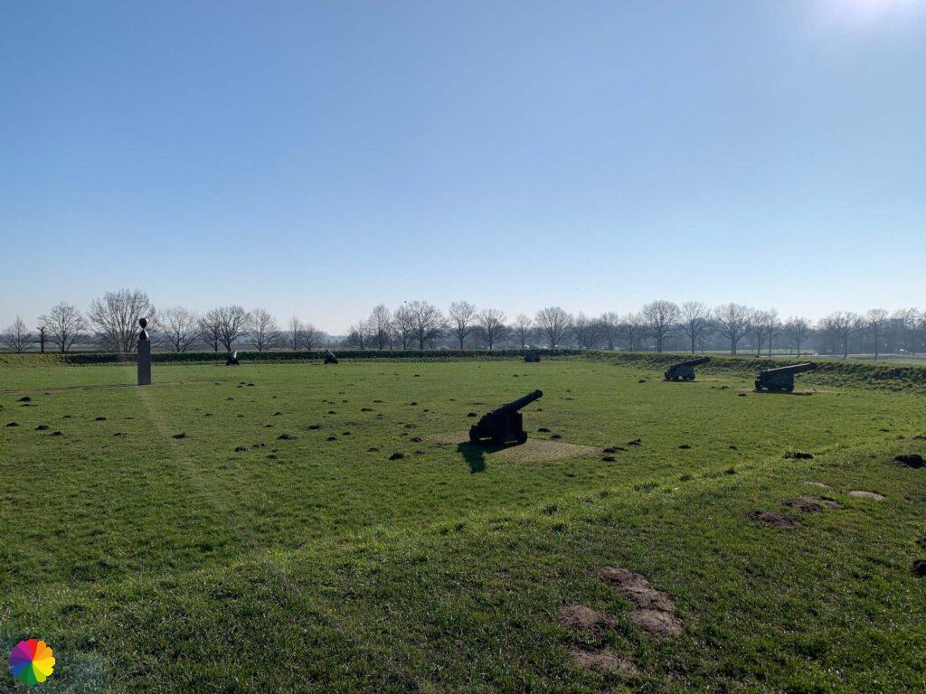
At the Wijkse Poort, I finish the last stretch on the fortified walls. On the inside of the wall, I see a castle ruin. I go down the wall for a moment to have a closer look. After a short break on a bench, I go up the wall again. This time I walk across a bastion where a lot of cannons are arranged.


At the entrance gate from earlier this morning, I wait for the bus to return home.
Final thoughts
There is only one thing I can say about this hike: it is a wonderful one! My morning couldn’t be better with the beautiful sunrise in the fog, and the fortified town of Heusden was great to visit with so many beautifully preserved sights.
But…there is a downside: the road from Oudheusden to Hooibroeken nature reserve is simply annoying to walk along. A narrow cycle lane along a provincial road is no fun for a hiker. However, if you follow the trail from the guide, you won’t get there at all! So for trail followers a 5 star rating and for non-trail followers like me 4.5 stars.
Tip: The Pilgrim Trail Part 1 (long distance trail 7-1) also passes through fortified town Heusden.
More info:
Trail: Section 9 Southern Waterline trailWhere: Heusden, Noord-Brabant, the Netherlands.
No. of km: +/- 16.5 km
Hiking date: 14 February 2023
Materials used in illustrations: Coloured pencils for the map and watercolour paints for the illustrations
Rating: ⭐⭐⭐⭐✨
- Starting and ending point: bus stop Steenweg, Heusden – bus 135 between ‘s Hertogenbosch and Wijk en Aalburg
Pin this hike
Would you like to do this Wonderful hike as well? Pin this hike on Pinterest to save for later!

More hiking by pink skies
Of course, the weather is out of your control. So an overwhelming pink morning is not always in the cards. Which is good, otherwise it wouldn’t be as special. In the hikes below, the sky also turned pink:
ColourFlux Studio makes use of so-called affiliate links. If you buy a product through the link in an advertisement, ColourFlux Studio receives a small amount. There are no additional costs for the buyer.
Back to Blog.