This time a different blog post than usual. In September 2021, I completed the last trail from the booklet Groene Hart trails of the ANWB. This booklet contains 43 round trails in the Green Heart region in the Netherlands. The booklet is no longer for sale and the hexagonal ANWB trail markings are outdated or no longer present everywhere, but the trails can still be followed and found on the internet. Therefore, I thought it would be useful to make an overview of where you can find these trails online.
Some trails are unfortunately not available online, but you can still more or less hike them using the trail network. For each trail, I have indicated which numbers of the network you should follow from the starting point. In addition, I have made a top 5 of the most favourite trails of this booklet and a description of the least favourite one (I have to get it off my chest).
Introduction to the Green Heart
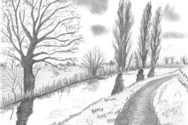
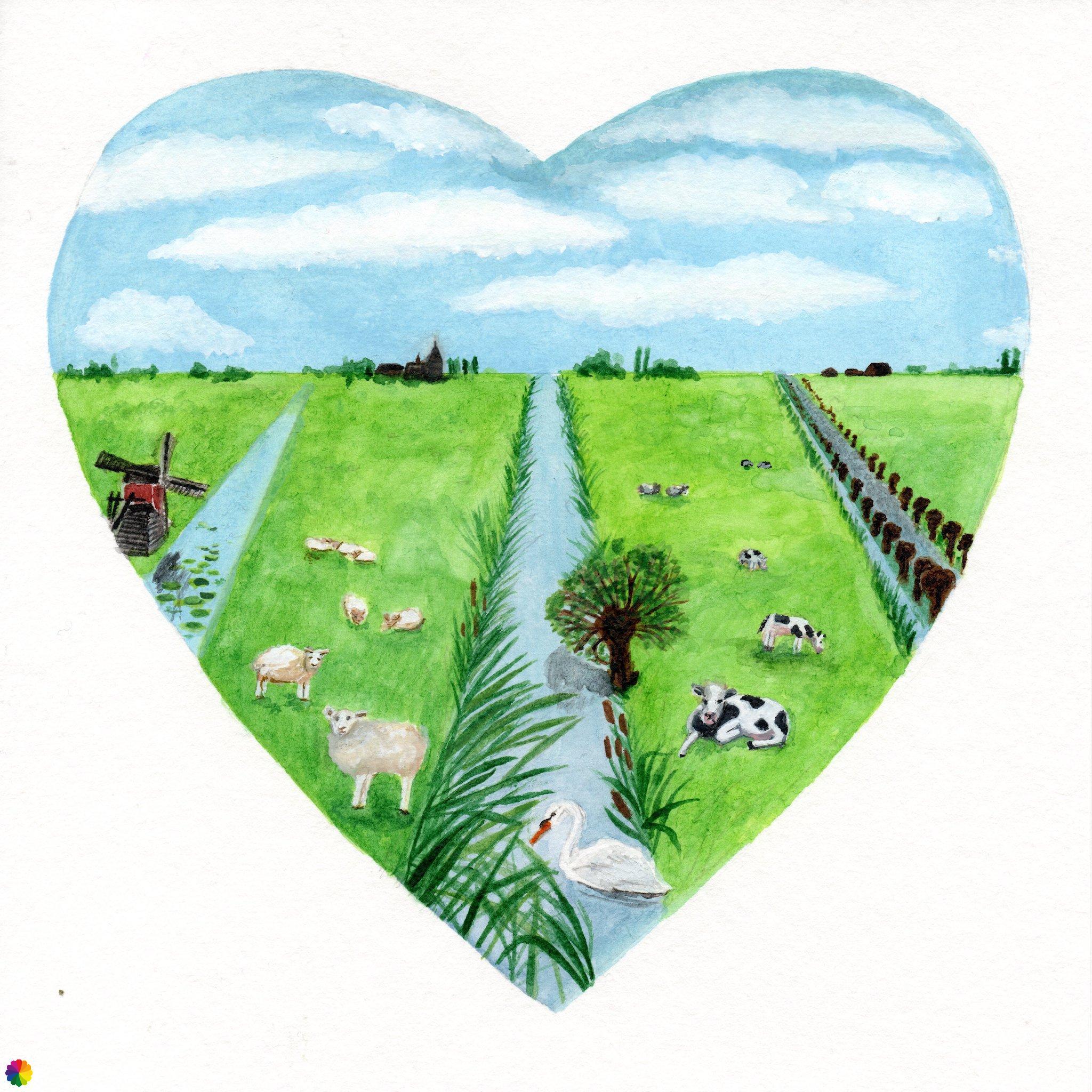
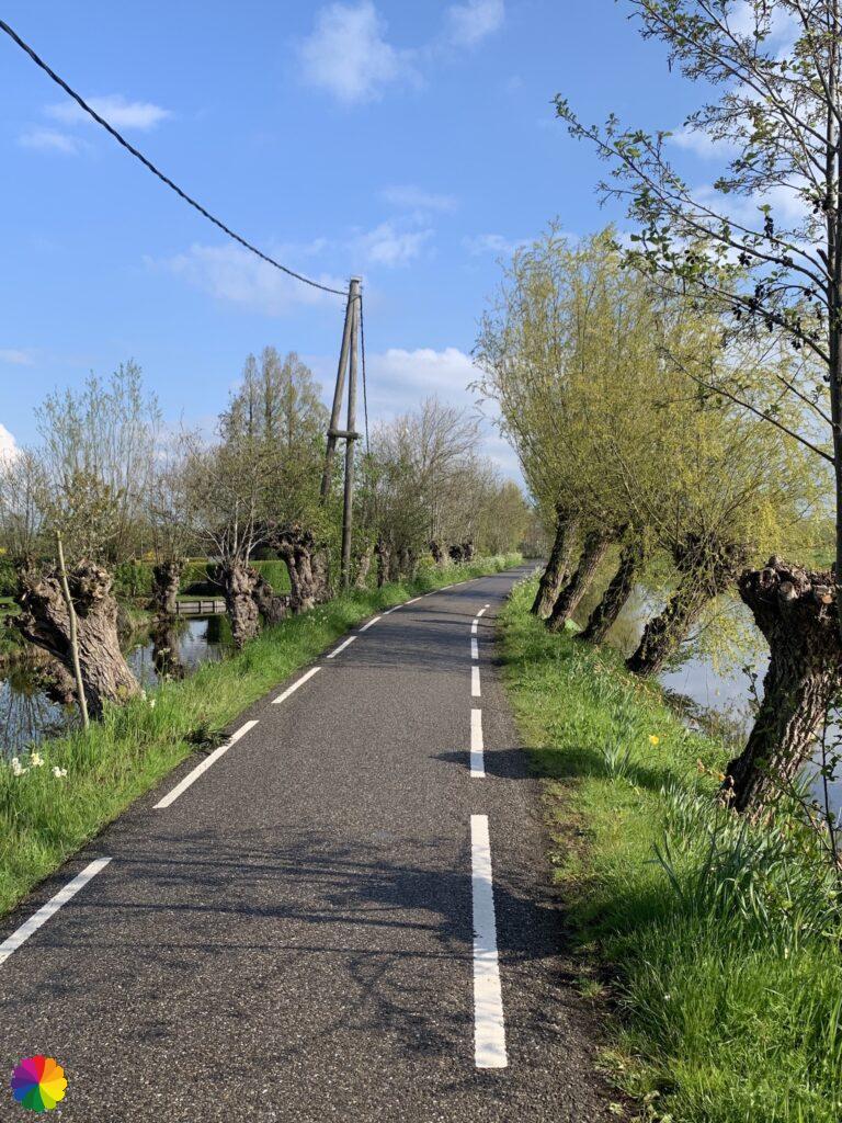
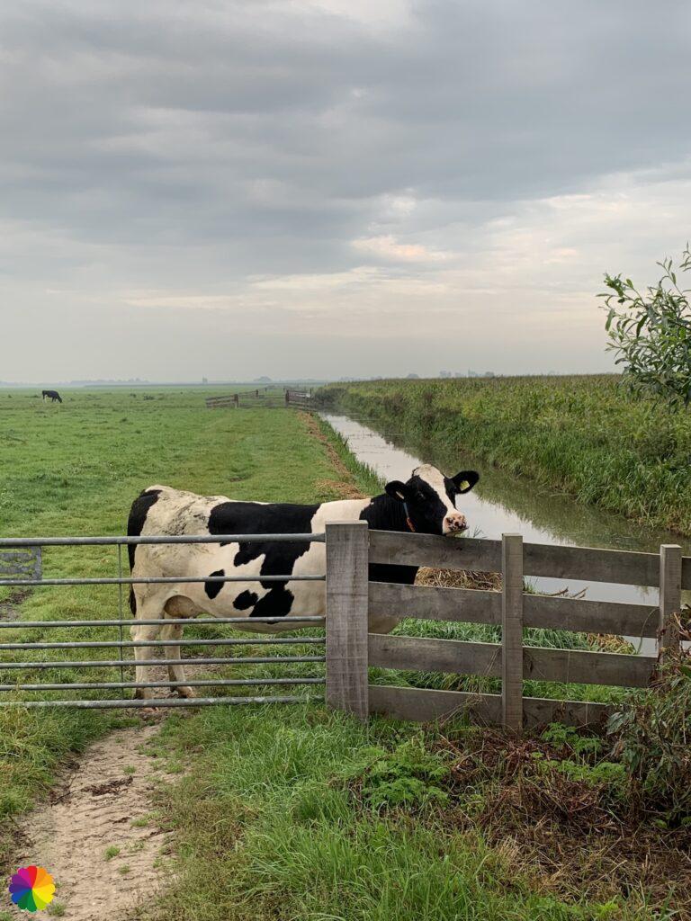
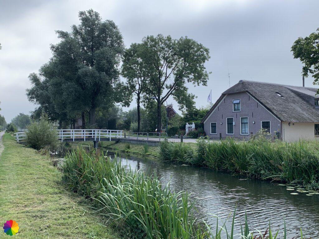
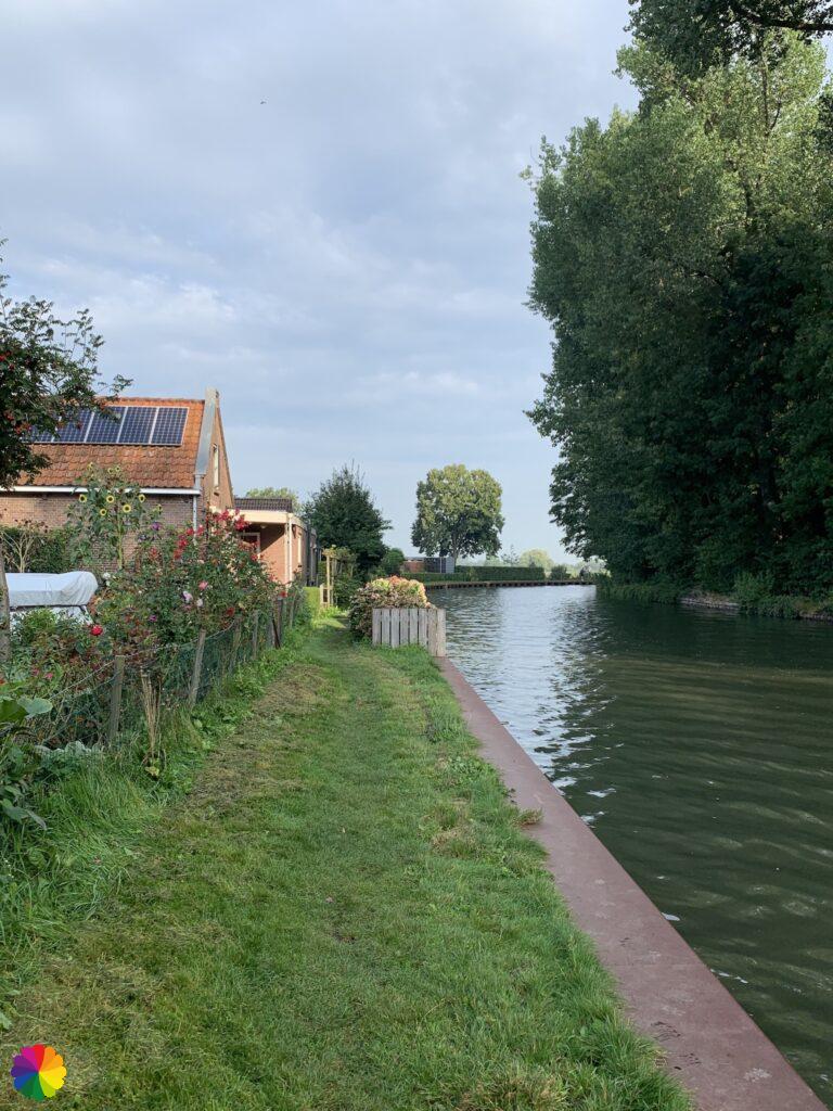
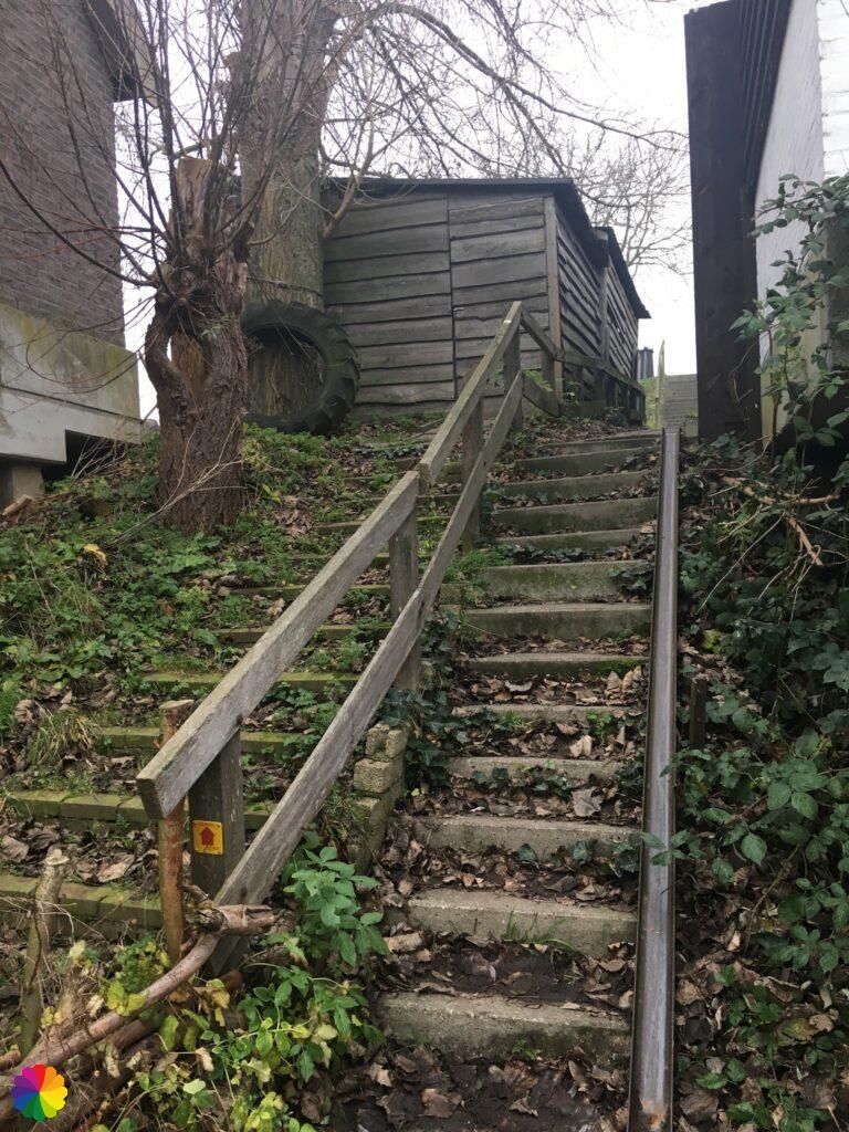
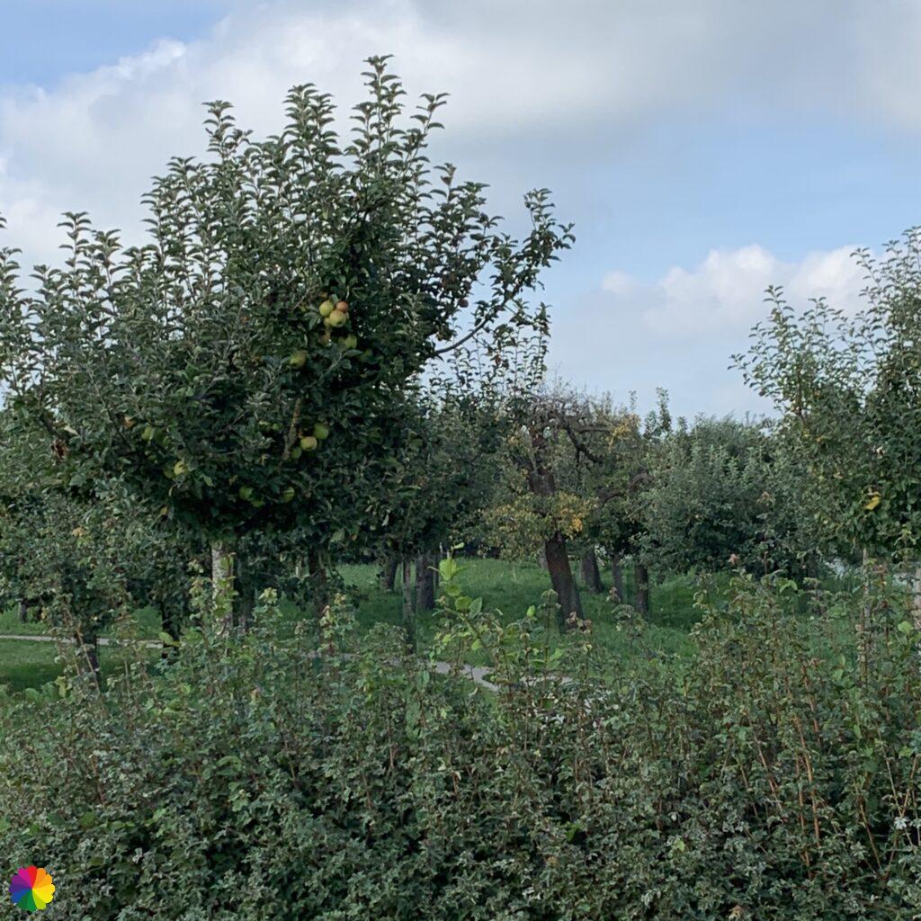
First, a brief introduction to the Green Heart. The Green Heart is located in the west of the Netherlands between the major cities of the Randstad. The area stretches across the provinces of Noord-Holland, Utrecht and Zuid-Holland. The landscape consists mostly of polders, meadows, fields and farms, in short, an agricultural area. But you will also find lakes, marshes, (recreational) forests, (small) rivers and ancient towns and villages. There are an enormous number of hiking paths, on polder roads and cycle paths, but also on tiend roads, towpaths, legakkers (laying fields), wood embankments, farmland paths and off-road paths.
The largest city (and also the centre) of the Green Heart is Gouda, known for its cheese and syrup waffles. Strangely enough, none of the trails from this booklet passes through Gouda. The Goudse Hout trail only passes just outside this city.
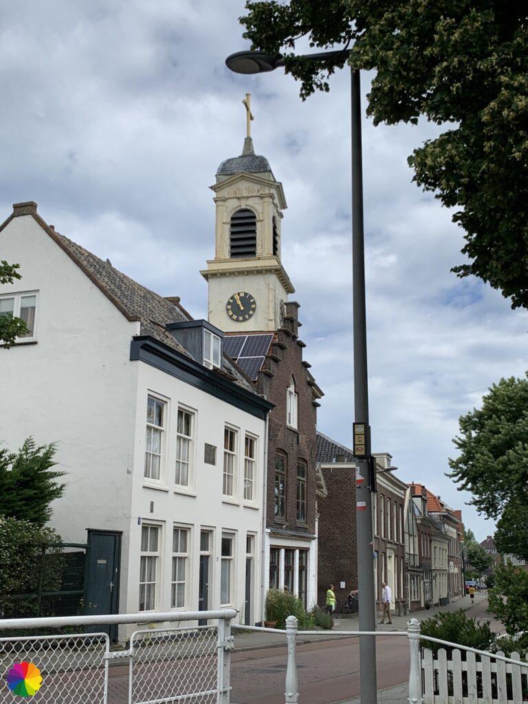
Another common sight in the Green Heart are the fortified towns, forts and defensive structures of the Old and New Dutch Waterline. Several forts are open to the public and definitely worth a visit. It is also fun to walk around an old fortified town, such as in Woerden, Muiden or Schoonhoven. Since 2021, the Nieuwe Hollandse Waterlinie has been added to the UNESCO World Heritage List.
What do all the different terminology mean?
- Legakker – Laying Field: A laying field is a rectangular piece of land in the moorlands on which peat cutters used to lay the peat to dry. The dried peat was pressed into blocks and used as fuel.
- Tiendweg: a tiendweg is a road built on a peat bank, this can be a paved road, but there are also unpaved tiendwegen. These roads are often surrounded by willows.
- Jaagpad – towpath: a jaagpad is a path along a river where ships were pulled forward by horses or people. Such a towpath runs along the Hollandsche IJssel river and the Oude Rijn river.
- Wood embankment: a wood embankment is a peat bank covered with trees such as willow, ash, alder and sometimes oak. The timber from the trees was used by the local residents. The wood embankments often form the boundary of a piece of polder.
- Farmland path: a farmland trail is a path across a farmer’s yard and land. The farmer has opened part of his land for hikers. Not my favourite kind of path, you often just walk through a field, which means you have to plough through the mud and high grass. There is often no constructed path. Sometimes the grass is mowed where you are allowed to walk.
- Off-road path: these trails are unpaved paths through the floodplains of a river, for example along the Lek river. At low tide, you can often walk freely on these paths. At high tide, these paths are not accessible because the area is flooded with water.
Source (in Dutch): Wikipedia
Numbers, arrows and posts
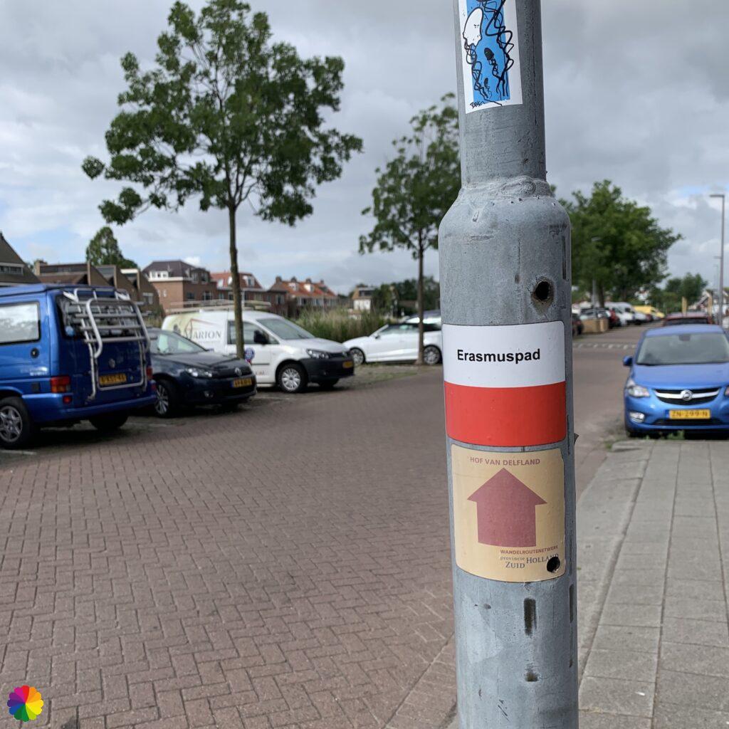
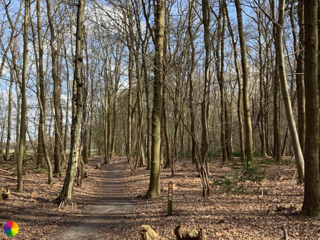
All throughout the Green Heart the trail networks can be found. These networks have long been available to cyclists in the form of rectangular signs with numbers and arrows pointing to the next intersection, but there is also a similar network for hikers. Almost everywhere in the Netherlands, you will find posts with numbers and arrows (sometimes these markings are on lampposts). The numbers indicate the intersection and the arrows show you the way to the next intersection. With the help of a trail planner, you can put together your own trail by linking the numbers together. In this way, you can explore almost all of the Netherlands with the help of the intersections. At wandelnet.nl, you will find the entire hiking trail network (with the exception of recently launched regions, such as Amstelland region of the Noord-Holland network or the Arnhem Nijmegen region).
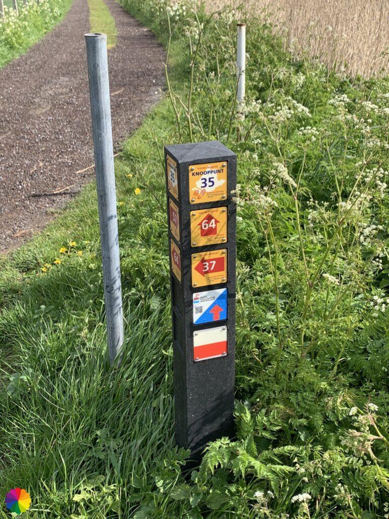
Each province has its own trail network and is divided into regions within the province. For example, the intersection signs in Zuid-Holland have a yellow background and a red number or arrow. In Utrecht, the colours are blue (background) and orange (number or arrow). In the province of Noord-Holland, you can even hike a pre-set trail by following coloured arrows or still plan your own trail using the trail numbers. Each region has its own trail numbers, so if you are hiking on the border of two regions, you may end up with two identical numbers in your trail.
In the overview further on in this post, I have more or less mapped out the trails from the booklet with the help of a trail planner. The trail from the planner and the trail from the booklet are not always the same, simply because there is no trail number or the arrow points in a different direction. That is why some trails via the trail network are slightly longer.
Would you rather map out a trail in the Green Heart yourself? Then go to wandelnet.nl, routemaker.nl or route.nl for the trail planners. Wandelnetwerk Noord-Holland also has its own website and app with its own planner.
Tourist Transfer Point
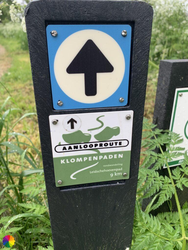
I have often mentioned Tourist Transfer Points (TTPs, Toeristisch Overstap Punt or TOP in Dutch) in my blog posts and I want to mention them again because several trails from the ANWB booklet have been ‘taken over’ by such a TOP. TOPs are locations where several hiking, cycling and sometimes boat trails are mapped out, usually with the help of the trail network. TOPs can be found almost everywhere in the country and each province or region has its own variation on a TOP. In Noord-Brabant, for example, these points are called Natuurpoorten (Nature Gates) and can be recognised by a large metal key. In traffic, the location of a TOP is indicated by a brown traffic sign.
There are two types of TOPs in the Green Heart:
- In Noord-Holland province there are TOPs in the form of an information column, for example at the Diemerbos car park. Each region of Noord-Holland has its own design of information columns.
- In Zuid-Holland and West Utrecht provinces, the TOPs can be recognised by the large green blade of grass (which I have mentioned before). Near the blade of grass is a kind of square with information panels about the area and the trails.
Top 5 favourite trails
1. Groenekan trail
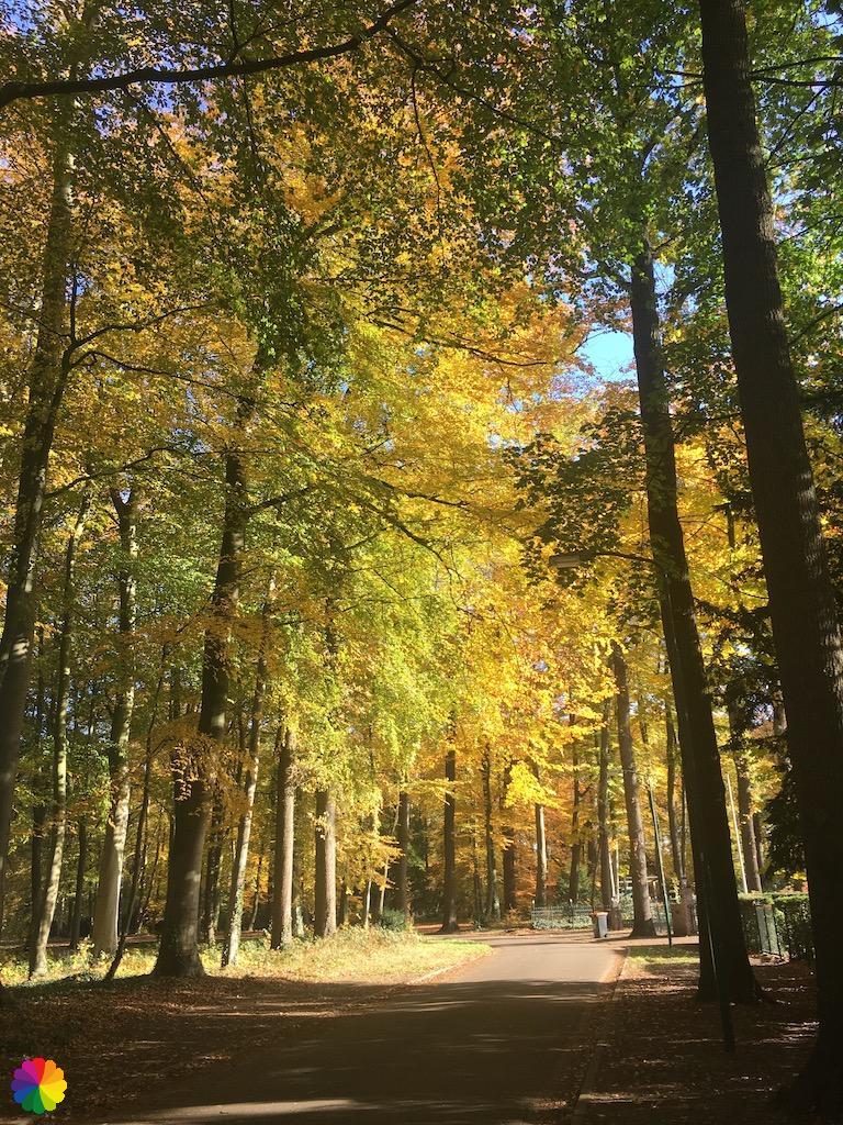
Forest! In the Green Heart there is not much forest to be found and yet that is my most favourite place to hike. Actually, there are only recreational forests to be found, like the Loetbos (although the trail with this name does not go through the nicest part of that forest), but for ancient forests you have to look carefully. There is one exception to the rule and that is the Groenekan trail. The town of Groenekan just above Utrecht is located on the edge of the Utrechtse Heuvelrug and het Gooi. From Groenekan the trail goes to Maartensdijk and back and you walk a large part through the Beukenburg estate. This trail has been replaced by a Klompenpad (wooden shoes trail) and is now called the Beukenburgerpad. I myself hiked there in the autumn and really enjoyed the golden yellow leaves falling from the trees.
By the way, I did not complete the whole trail; I skipped the part around Fort Blauwkapel (of the Nieuwe Hollandse Waterlinie), but this is a nice variation if you are going to hike this trail.
2. Demmerik trail
Maybe it is because it was the first trail I hiked from the booklet or because it is near my home town, I find the Demmerik trail in Vinkeveen a very nice trail. For me the trail has many recognisable, but also new spots in the area where I grew up in. Part of this trail goes along with the Bello trail: a hiking trail over the old railway track of the Haarlemmermeer train between Haarlem and Nieuwersluis, named Bello. In the summer and autumn, a Bellosafari is organised in the Demmerikse Polder, see the website hetspoorhuis.nl for more information.
Also nice to know is that there is a memorial bench along the old railway track overlooking the Catholic Church of Vinkeveen. This is in memory of my uncle and aunt Leen and Annie. Leen once used the train to visit Annie.
3. Zwanburger trail
The Zwanburger trail itself may be a bit boring, but the trip with the boat De Heere Schouten as a ferryboat makes this a unique hike! The volunteers on the ferry explain all sorts of things about the area and the nature around the trail. They even gave me a pair of binoculars to admire the nature in the Zwanburgerpolder. Really a great experience! I made an extensive story about this trail on this website.

4. Blokland trail
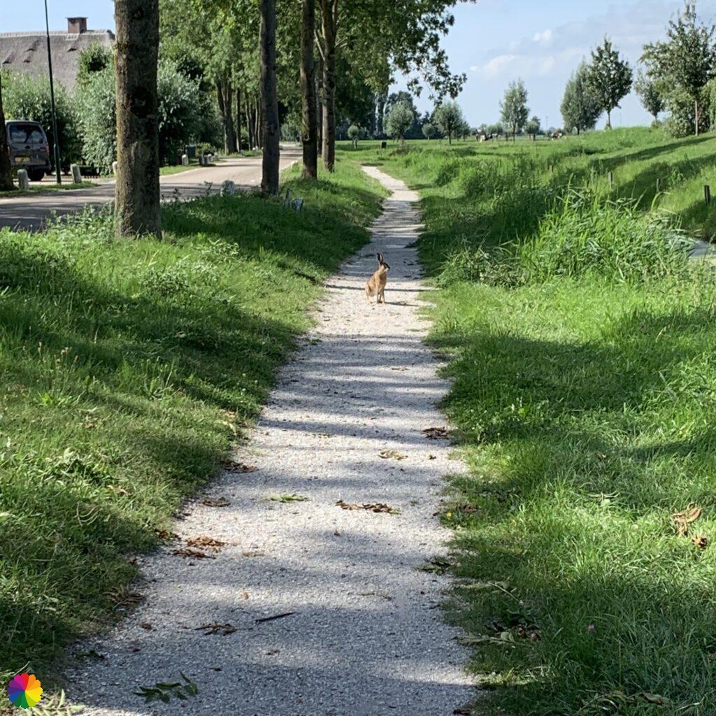
I loved the Blokland trail so much. I enjoyed the barn swallows that flew around me on the Tiendweg and the other animals I saw, such as a toad, a hare and many bird species. Also fun are the roadside produce stalls in the town of Blokland. I bought a bag of hazelnuts myself. Towards the end of the trail, you walk through a park with fruit trees that you can pick yourself, and past windmill de Valk.
5. Westbroek trail
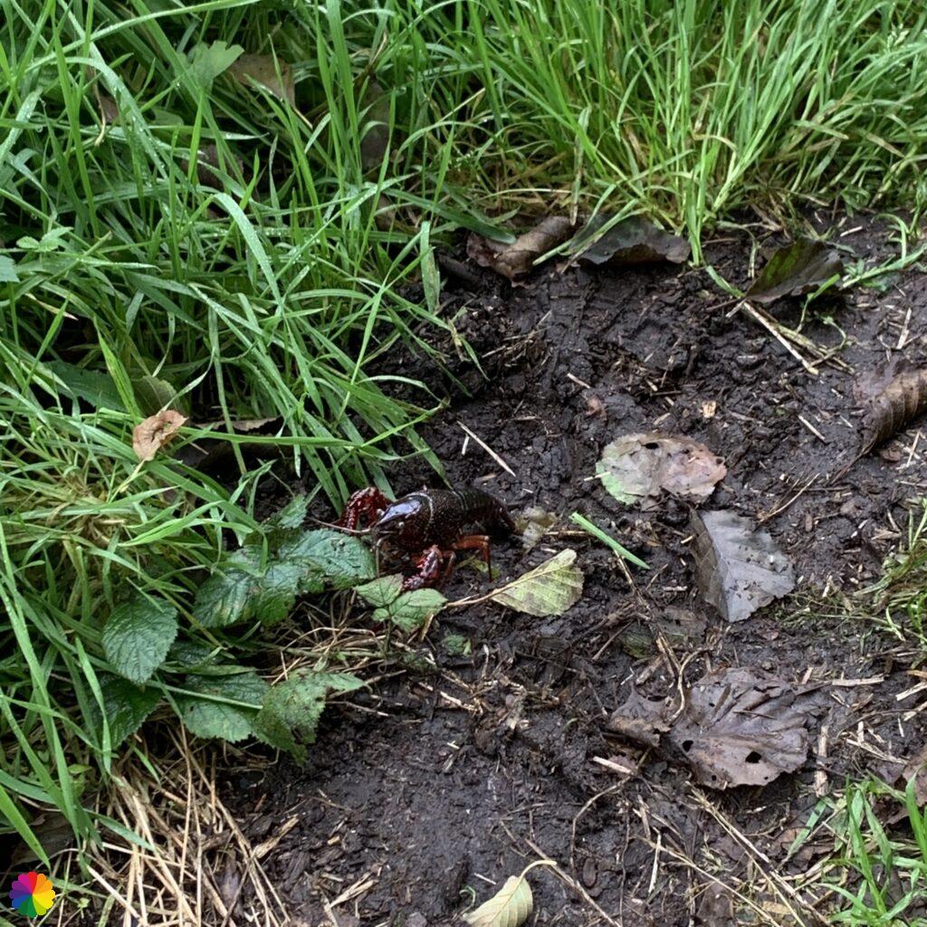
It is funny that from the same town of Tienhoven, you can hike one of the nicest, but also one of the least nice trails (see next chapter). The Westbroek trail is the fun trail and has been renamed the Klompenpad (wooden shoes trail) Zoddenpad. I walked through the town of Tienhoven and got a free apple from a roadside stall. I walked over grass dykes and over the Bert Bospad through a swampy area. I also walked through the low peatland area the Zodden and along the Loosdrechtse Plassen. But watch out for the crayfish, which threateningly raise their claws. These animals are looking for a new territory and you may come across them in the polder areas. So don’t step on them!
The least favourite trail: Bethune trail
In my opinion, the Betune trail is the least interesting trail from the booklet. And it is even near one of the nicest trails! I must admit I was not having a good day.
I had to get off the bus two stops earlier in Maarssen because of maintenance work and of course I only found this out on the way. I then got hopelessly lost in a residential area in Maarssen (why are pedestrians not allowed to cross the ring road!). Once on the trail and an hour later than planned, it was all quite boring: straight polder roads, you walk in a kind of square (always turning right) instead of a circle and along a not very interesting part of the Loosdrechtse Plassen. I also went the wrong way, I actually made a square of it myself I should have gone to the right earlier, but the trail would not have been much better. To make matters worse, I had a migraine attack while hiking and spent the rest of the afternoon in bed at home.
Nevertheless, I would like to give this Betune polder another chance, because both the LAW (long distance trail) the Waterlinie trail and a trail from the Roots magazine booklet ‘Best trails along water’ run through the same area. That is worth a second chance!
All trails in a row
Below are all the trails from the trail booklet in alphabetical order. For each trail you will find a link to the online location (only Dutch websites). I have also indicated the trail with the trail network intersections and sometimes there is a nice tip or special interest. There is also information about public transport, parking and restaurants in the area. Click on the link to jump straight to the trail description.
- Aetsveld trail, Weesp – 11 km
- Angstel trail, Nieuwersluis – 11 km
- Arkel trail, Gorinchem – 13 km
- Avelingen trail, Boven-Hardinxveld – 9 km
- Bethlehem trail, Wilnis – 10 km
- Bethune trail, Tienhoven – 9.5 km
- Bijleveld trail, Wilnis – 6 km
- Blokland trail, Montfoort – 8 km
- Blokweer trail, Alblasserdam – 8 km
- Bommelstein trail, Nederhorst Den Berg – 10 km
- Braassem trail, Roelofarendsveen/ Rijnsaterwoude – 11.5 km
- Cabauwse Jacobs trail, Schoonhoven – 14 km
- Demmerik trail, Vinkeveen – 12 km
- Diemerbos trail, Diemen – 9 km
- Engherkade trail, Montfoort – 12 km
- Gaasperzoom trail, Amsterdam Zuid-Oost – 14 km
- Gagel trail, Utrecht – 7 km
- Goudse Hout trail, Gouda – 8 km
- Gouwebos trail, Waddinxveen – 7 km
- Grecht trail, Woerden – 10 km
- Groenekan trail, Groenekan – 12 km
- Hitland trail, Nieuwerkerk aan den IJssel – 10 km
- Kleine Balij trail, Zoetermeer – 7 km
- Krimpen trail, Krimpen aan den IJssel – 7 km
- Kromme IJssel trail, IJsselstein – 10 km
- Loetbos trail, Ouderkerk aan den IJssel – 11 km
- Middelpolder trail, Amstelveen – 10.5 km
- Molenvliet trail, Haastrecht – 13 km
- Muiderberg trail, Muiderberg – 10 km
- Noord Aa trail, Zoetermeer – 10 km
- Olmenhorst trail, Lisserbroek – 10 km
- Oostgeer trail, Hazerswoude-Dorp – 7.5 km
- Oukoop trail, Hekendorp – 9 km
- Potterskade trail, Harmelen – 9 km
- Reeuwijkse Hout trail, Reeuwijk – 11 km
- Spoordijk trail, Wilnis – 13 km
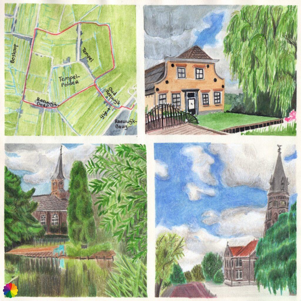
- Tempel trail, Reeuwijk – 8 km
- Tiendweg trail, Giessendam – 8 km
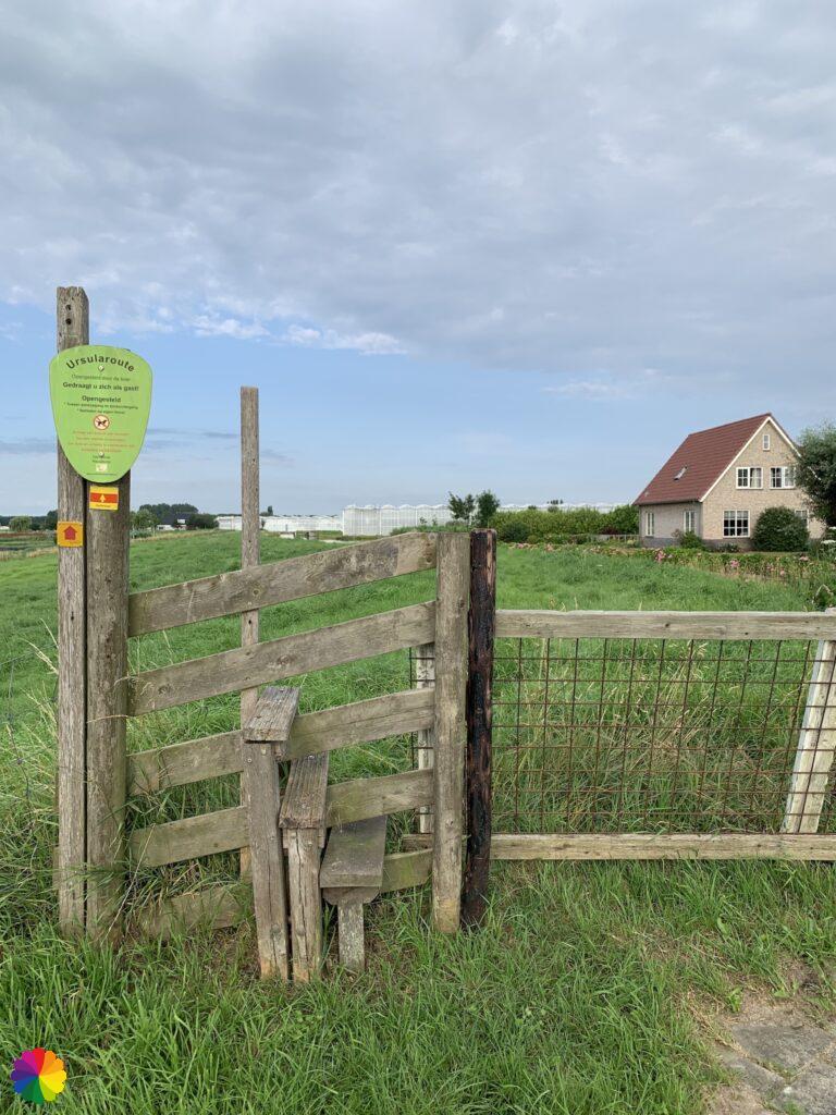
- Ursula trail, Nieuwveen – 5 km
- Weegje trail, Waddinxveen – 11 km
- Westbroek trail, Tienhoven – 12 km
- Willige Langerak trail, Lopik – 12 km
- Zwanburger trail, Warmond – 7 km
Aetsveld trail, Weesp – 11 km
- Link to trail:
- Where: Weesp, Noord-Holland
- Starting point: train station Weesp
- Intersection numbers to follow from starting point (trail network Noord-Holland): 83 – 82 – 81 – 65 – 66 – 63 – 64 – 76 – 75 – 73 – 72 – 71 – 56 – 67 – 68 – 69 – 65 – back to the station – 82 – 83
- Characteristics: fields, polders, rivers, waterline, forts, fortified town
- Tip: at Wandelnetwerk Noord-Holland you can find more hiking trails from this starting point.
- Public transport: train station Weesp
- Parking: at train station Weesp
- Restaurants:
- Eeterij de Schalkse (eatery) at Ossenmarkt in Weesp
- Theetuin (tea garden) at Ossenmarkt in Weesp
Angstel trail, Nieuwersluis – 11 km
- Link to trail: unfortunately, this trail cannot be found online. However, you can still hike this trail by following the intersection numbers of the trail network.
- Where: Nieuwersluis/Breukelen, Utrecht
- Starting point: Nieuwersluis
- Intersection numbers to follow from starting point (trail network Utrecht): 13 – 19 – 18 – 17 – 98 – 72 – 73 – 87 – 85 – 84 – 86 – 14 – 15 – 18 – back to starting point – 19 – 13
- Characteristics: fields, polders, rivers, waterline, forts, ferry, windmill
- Tip: I myself started at Loenersloot (intersection 87) and did the most boring part along the Amsterdam-Rijnkanaal first.
- Public transport:
- Bus 120 (Utrecht – Amsterdam Bijlmer Arena), bus stop Nieuwersluis Dorp
- Bus 121 (Mijdrecht – Hilversum), bus stop Loenersloot Amsterdam-Rijnkanaal, pick up the trail at intersection 87
- Parking: at the Vechtbrug in Nieuwersluis or in Loenen with access trail via the towpath along the Vecht river.
- Restaurants: Nieuwersluis Fort (open at Thursday, Friday and Sunday)
Arkel trail, Gorinchem – 13 km
- Link to trail: TOP Gorinchem
- Where: Gorinchem, Zuid-Holland
- Starting point: train station Gorinchem
- Intersection numbers to follow from starting point (trail network Zuid-Holland): 40 – 38 – 33 – 30 – 39 – 32 – 35 – 47 – 48 – 64 – 58 – 42 – 44 – 41 – 40
- Characteristics: fields, polders, rivers, waterline, fortified town, windmill
- Public transport: train station Gorinchem
- Parking: at train station Gorinchem
- Restaurants: in Gorinchem and Arkel there are various restaurants and cafés
Avelingen trail, Boven-Hardinxveld – 9 km
- Link to trail: unfortunately, this trail cannot be found online. However, you can still hike this trail by following the intersection numbers of the trail network. At TOP Gorinchem is a Avelingen trail to be found, but this is a completely different trail than from the booklet.
- Where: Boven-Hardinxveld, Zuid-Holland
- Starting point: train station Boven-Hardinxveld
- Intersection numbers to follow from starting point (trail network Zuid-Holland): 86 – 87 – 17 – 18 – 19 – 16 – 86
- Characteristics: fields, polders, recreational forest, rivers, dikes
- Public transport: train station Boven-Hardinxveld
- Parking: at train station Boven-Hardinxveld
- Restaurants: Restaria Liba at Rivierdijk in Boven-Hardinxveld
Bethlehem trail, Wilnis – 10 km
- Link to trail: TOP Heinoomsvaart (with access trail)
- Where: Wilnis/Mijdrecht, Utrecht
- Starting point: Zorgboerderij (social care farm) and camping Amstelkade (Zorgboerderij Bethlehem before)
- Intersection numbers to follow from TOP Heinoomsvaart (trail network Utrecht): access trail – 13 – 85 – 91 – official starting point at social care farm – 63 – 62 – 73 – 38 – 85 – back to TOP Heinoomsvaart – 13
- Alternative trail: at intersections 91 and 62 you can choose to go straight through the farmland. To do this, turn right instead of going straight ahead. At intersection 62 you skip No. 73 and you do lose a piece along the small river Kromme Mijdrecht.
- Characteristics: fields, polders, rivers
- Special interest:
- part of the trail (between intersections 85 and 91) is closed in spring during the bird nesting season.
- I dedicated a detailed report about the trail on this website (including Groene Jonker trail).
- Tip: The Groene Jonker is a beautiful nature reserve near this trail. It is nice to add the Groene Jonker trail of Natuurmonumenten (+/- 3.5 km) to the Bethlehem trail. I have done this myself.
- Public transport:
- Bus 123 (Oudewater/Woerden – Uithoorn/Mijdrecht), bus stop Bovendijk, from TOP Heinoomsvaart with access trail of approx. 2 km
- Bus 126 (Amsterdam Bijlmer Arena – Mijdrecht) or 130 (Breukelen – Uithoorn), bus stop Driehuiskerk, with access trail of approx. 3 km along Molenland (street), pick up the trail between intersections 83 and 85. I have done this myself.
- Parking: at Zorgboerderij Amstelkade
- Restaurants: Zorgboerderij Amstelkade
Bethune trail, Tienhoven – 9.5 km
- Link to trail: unfortunately, this trail cannot be found online. However, you can still hike this trail by following the intersection numbers of the trail network.
- Where: Tienhoven, Utrecht
- Starting point: corner of streets Maarsseveense Vaart and Bethuneweg
- Intersection numbers to follow from starting point (trail network Utrecht): 82 – 11 – 12 – 18 – 59 – 69 – 77 – 78 – 79 – 81 – 82
- Characteristics: fields, polders, lakes, waterline, forts, ribbon/row village
- Tip: Fort Maarsseveen is close to the starting point, definitely worthwhile to have a look (also because the rest of the trail is quite boring).
- Public transport:
- Bus 122 (Utrecht Overvecht – Nieuw-Loosdrecht), bus stop Ds. Ulferslaan in Tienhoven, pick up trail at intersection 78
- Bus 913 (neighbourhood bus Maarssen – Utrecht Zuilen, book at least 30 minutes in advance), bus stop Wilgenplas in Maarssen (at starting point)
- Parking: in Tienhoven or at parking lot Fort Maarssenveen
- Restaurants:
- De Heeren van Maarssen in Maarssen
- Café ‘t Kikkertje in Tienhoven
- Het Olde Rechthuys in Tienhoven
Bijleveld trail, Wilnis – 6 km
- Link to trail: TOP Heinoomsvaart
- Where: Wilnis, Utrecht
- Starting point: Raadhuisstraat, Wilnis
- Intersection numbers to follow from starting point (trail network Utrecht): 68 – 65 – 46 – 23 – 83 – 82 – 65
- Characteristics: fields, polders
- Special interest: the trail is not accessible during nesting season in spring.
- Public transport: Bus 130 (Breukelen – Uithoorn), 126 (Amsterdam Bijlmer Arena – Mijdrecht) or 123 (Oudewater/Woerden – Mijdrecht/Uithoorn), bus stop Herenweg in Wilnis
- Parking: in Dorpsstraat in Wilnis
- Restaurants: Cafetaria Alpha in Wilnis
Blokland trail, Montfoort – 8 km
- Link to trail: Groene Hart
- Where: Montfoort, Utrecht
- Starting point: Kasteelplein, Montfoort
- Intersection numbers to follow from starting point (trail network Utrecht): 79 – 83 – 82 – 63 – 11 – 64 – 78 – 71 – 75 – 83 – 79
- Characteristics: fields, polders, ribbon/row village, windmill
- Special interest: one of my favourite trails, I even dedicated my first hiking map illustrations to it.
- Tip: there are nice product stalls along the trail and there is a regional produce farm near the trail.
- Public transport: bus 5 (Woerden – Montfoort) or bus 107 (Gouda – Utrecht), bus stop Kasteelplein
- Parking: at Kasteelplein/Stadskantoor
- Restaurants:
- Kasteel Montfoort
- De Heeren van Montfoort

Blokweer trail, Alblasserdam – 8 km
- Link to trail: TOP Alblasserdam
- Where: Alblasserdam, Zuid-Holland
- Starting point: Dam in Alblasserdam
- Intersection numbers to follow from starting point (trail network Zuid-Holland): 84 – 66 – 80 – 81 – 82 – 79 – 73 – 72 – 76 – 77 – 88 – 87 – 85 – 84
- Characteristics: fiels, polders, rivers, windmills, UNESCO World Heritage
- Tip: this trail goes along a part of the Kinderdijk windmills. Would you like to read an extensive report on these beautiful mills? Then take a look at my blog post about the long-distance Great Rivers Trail between Kinderdijk and Hendrik-Ido Ambacht.
- Public transport: Bus 498 (Rotterdam Kralingse Zoom – Alblasserdam/Nieuw-Lekkerland), bus stop Dam in Alblasserdam
- Parking: at Restaurant Het Wapen
- Restaurants: Restaurant Het Wapen in Alblasserdam
Bommelstein trail, Nederhorst Den Berg – 10 km
- Link to trail: ANWB
- Where: Nederhorst Den Berg, Noord-Holland
- Starting point: Willibrordkerk, Kerkstraat, Nederhorst Den Berg
- Intersection numbers to follow from starting point (trail network Noord-Holland): 45 – 49 – 46 – 47 – 53 – 54 – 52 – 59 – 48 – 45
- Characteristics: fields, polders, rivers, lakes, windmills, ferry
- Tip: The creators of the hiking blog Westphilwandelt recently hiked this trail and wrote a very amusing blog about it, with beautiful photos as proof.
- Public transport: bus 106 (Weesp – Hilversum), bus stop Centrum in Nederhorst Den Berg
- Parking: at the church (starting point)
- Restaurants: Het Spiegelhuys in Nederhorst Den Berg
Braassem trail, Roelofarendsveen/ Rijnsaterwoude – 11.5 km
- Link to trail:
- Where: Rijnsaterwoude/Roelofarendsveen, Zuid-Holland
- Starting point: across the reformed church in Rijnsaterwoude
- Intersection numbers to follow from starting point (trail network Zuid-Holland): 76 – 78 – ferry Oude Wetering – 74 – 11 – 18 – 79 – ferry Paddegat – 36 -42 – 45 – 48
- Characteristics: fields, polders, lakes, ribbon/row village, ferries
- Special interest:
- a crossing with two ferries are part of this trail. These ferries run all year round, but not on Sundays in the winter months.
- I have dedicated an extensive blog post about this trail
- Tip: The trail is still marked with hexagonal ANWB signs, but at crucial points (such as turning left) I did not see a sign. So it is wise to note down the intersection numbers.
- Public transport:
- Bus 470 (Alphen aan den Rijn – Schiphol Airport), bus stop Rijnsaterwoude
- Bus 365 (Leiden – Schiphol Airport), bus stop Stationstraat in Roelofarendsveen or bus stop Oude Wetering. Pick up trail at intersection 11.
- Parking: at the church in Rijnsaterwoude
- Restaurants: there are various restaurants located in Roelofarendsveen
Cabauwse Jacobs trail, Schoonhoven – 14 km
- Link to trail:
- Where: Schoonhoven, Utrecht
- Starting point: Stationsplein in Schoonhoven
- Intersection numbers to follow from starting point (trail network Utrecht): 80 – 83 – 25 – 24 – 35 – 32 – 80 – to TOP Schoonhoven – 82 – 81
- Characteristics: fields, polders, rivers, ribbon/row village, waterline, fortified city, historical city centre
- Tip: it is already a quite a long trail, but you can add an extra trip through the historical city centre of Schoonhoven. I have done this before and have made a blog post about this wonderful hike: Great rivers trail: Ammerstol – Nieuwpoort
- Public transport: Bus 295 (Rotterdam Metro Capelsebrug – Utrecht), 497 (Gouda – Schoonhoven) or 505 (Woerden – IJsselstein), bus stop Schoonhoven Noord
- Parking: parking lot at the ferry in Schoonhoven
- Restaurants:
- Café de Vlist at Fransekade in Vlist
- Various restaurants are located in Schoonhoven
Demmerik trail, Vinkeveen – 12 km
- Link to trail: TOP Vinkeveense Plassen
- Where: Vinkeveen, Utrecht
- Starting point: former railway station Vinkeveen
- Intersection numbers to follow from starting point (trail network Utrecht): 42 – 54 – 43 – 44 – 45 – 42
- Characteristics: fields, polders, ribbon/row village
- Tip: The Bellopad is a beautiful trail along the former railway track Haarlem – Nieuwersluis. The first part of this trail leads parallel to the Bellopad. Check the website hetspoorhuis.nl for a nice farmers safari called Bellosafari.
- Public transport:
- Neighbourhood bus 526 (Breukelen – Uithoorn), bus stop Spoorlaan
- Bus 130 (Breukelen – Uithoorn) or 126 (Amsterdam Bijlmer Arena – Mijdrecht) bushalte Kerklaan, approx. 15 min. walk to starting point
- Parking: former railway station Vinkeveen
- Horeca:
- Café de Schans in Vinkeveen
- Ice cream parlour De IJsbeer in Vinkeveen (unfortunately discontinued)
Diemerbos trail, Diemen – 9 km
- Link to trail: Groengebied Amstelland, click on the ‘routekaart’ link for the map.
- Where: Diemen and Amsterdam Zuidoost, Noord-Holland
- Starting point: TOP Diemerbos, Muiderstraatweg, Diemen
- Intersection numbers from starting point (trail network Noord-Holland): TOP Diemerbos – 51 – 52 – 53 – 48 – 45 – 44 – 43 – 28 – 27 – 22 – towards 39, to the right along Amsterdam-Rijnkanaal until intersection 24 – 55 – 58 – 59 – 57 – 54 – 51
- Characteristics: nature near the city, forest, polders, rivers
- Tip: at Wandelnetwerk Noord-Holland you can find more trails from the starting point.
- Public transport: Bus 66 (Amsterdam Bijlmer Arena – IJburg), bus stop Stammerkamp in Diemen. A few minutes walk to starting point.
- Parking: at Diemerbos
- Restaurants: House of Bird at Diemerbos
Engherkade trail, Montfoort – 12 km
- Link to trail: Groene Hart
- Where: Montfoort/Linschoten, Utrecht
- Starting point: Kasteelplein, Montfoort
- Intersection numbers to follow from starting point (trail network Utrecht): 79 – 81 – 56 – 76 – 93 – 92 – 13 – 87 – 29 – 84 – 81 – 79
- Characteristics: fields, polders, estates, rivers, protected (ancient) townscape
- Public transport: bus 5 (Woerden – Montfoort) or 107 (Gouda – Utrecht), bus stop Kasteelplein
- Parking: Kasteelplein/Stadskantoor
- Restaurants:
- Kasteel Montfoort
- De Heeren van Montfoort
Gaasperzoom trail, Amsterdam – Zuid-Oost – 14 km
- Link to trail: Groengebied Amstelland, click on link ‘Routekaart’ for the map.
- Where: Gaasperpark, Gaasperplas, Gaasperzoom, Amsterdam Zuidoost en Abcoudermeer, Noord-Holland
- Starting point: Metro station Gaasperplas in Amsterdam
- Intersection numbers to follow from starting point (trail network Noord-Holland): 31 – 32 – 96 – 97 – 91 – 94 – 92 – 33 – 95 – 55 – 59 – 56 – 64 – 68 – 61 – 67 – 66 – 62 – 60 (TOP Hogedijk) – 63 – 65 – 69 – 27 – 51 – 52 – 96 – back to metro station – 32 – 31
- Characteristics: nature near the city, parks, lakes, polders
- Tip: do you find this trail too long? At Wandelnetwerk Noord-Holland you can find shorter trails from this starting point.
- Public transport:
- Metro station Gaasperplas, Amsterdam
- Abcoude train station, I started here myself, pick up the trail at intersection 68
- Parking:
- Metro station Gaasperplas, Amsterdam
- Parking lot Gaasper Camping
- Restaurants:
- Restaurant Gaasper Camping, Amsterdam
- Brasserie Golfcentrum Hoge Dijk, Abcoude
Gagel trail, Utrecht – 7 km
- Link to trail: unfortunately, this trail cannot be found online. However, you can still hike this trail by following the intersection numbers of the trail network. The trail called Klop- en Gagelpad from Routes in Utrecht is close to this trail, but completely different (but maybe more interesting!).
- Where: Utrecht Noord, Utrecht
- Starting point: parking lot at St. Anthoniedijk
- Intersection numbers to follow from starting point (trail network Utrecht): 39 – 42 – 43 – 44 – 48 – 47 – 64 – 61 – 34 – 32 – 33 – 35 – 72 – 37 – 38 – 39
- Alternative trail: from intersections 32 to 37, the trail goes through a park in Utrecht Overvecht, which is slightly different to the trail from the booklet. If you still want to do the same trail, you can turn left onto the Gageldijk just before intersection 32 and pick up the trail again later at intersection 38.
- Characteristics: nature near the city, polders, fields, waterline, forts, UNESCO World Heritage
- Special interest: Fort Ruigenhoek and Fort de Gagel are part of the New Dutch Waterline. In 2021 this waterline is added to the Unesco World Heritage List.
- Public transport: city bus 3 (Utrecht Centraal – Utrecht Zuilen), bus stop Nijldreef
- Parking: parking lot at St. Anthoniedijk
- Restaurants: Forelvijver Paviljoen de Ruigenhoek (only open at Saturdays and Sundays
Goudse Hout trail, Gouda – 8 km
- Link to trail: Groene Hart
- Where: Gouda, Zuid-Holland
- Starting point: train station Gouda Goverwelle
- Intersection numbers to follow from starting point (trail network Zuid-Holland): 70 – 41 – 28 – 53 – 82 – 58 – 22 – 14 – 19 – 55 – 25 – 41 – 70
- Characteristics: nature near the city, lakes, recreational forest, fields, polders
- Public transport: train station Gouda Goverwelle
- Parking: at train station Goude Goverwelle
- Restaurants: Restaurant ‘t Vaantje at Korssendijk in Reeuwijk

Gouwebos trail, Waddinxveen – 7 km
- Link to trail: unfortunately, this trail cannot be found online. However, you can still hike this trail by following the intersection numbers of the trail network.
- Where: Waddinxveen, Zuid-Holland
- Starting point: train station Waddinxveen
- Intersection numbers to follow from starting point (trail network Zuid-Holland): 52 – 62 – 36 – 75 – 23 – 64 – 67 – 52
- Characteristics: nature near the city, polders, fields, recreational forest
- Public transport: train station Waddinxveen
- Parking: at train station Waddinxveen
- Restaurants: various restaurants are located at the Hefbrug (lift bridge) in Waddinxveen
Grecht trail, Woerden – 10 km
- Link to trail:
- Groene Hart
- A part of the trail is the same as Graveslootpad (Klompenpaden – Wooden shoes trails – 8 km)
- Where: Woerden, Utrecht
- Starting point: train station Woerden
- Intersection numbers to follow from starting point (trail network Utrecht): 87 – 89 – 46 – 48 – 21 – 28 – 28 – 27 – 18 – 17 – 99 – 35 – 94 – 94 (across the water) – 93 – 33 – 34 – 36 – 47 – 32 – 37 – 46 – 89 – 87
- Characteristics: fields, polders, parks, estates, rivers, waterline, fortified town
- Special interest: a part of the trail is closed during the nesting season in spring and dogs are not allowed on this part (all year round), you also have to cross 2x electric wires and 2x narrow planks over the water. An adventurous trail, it is!
- Public transport: train station Woerden
- Parking: at train station Woerden (paid parking)
- Restaurants: various restaurants are located in the city centre of Woerden
Groenekan trail, Groenekan – 12 km
- Link to trail: almost the same as Beukenburgerpad (Klompenpaden – wooden shoes trails)
- Where: Groenekan, Utrecht
- Starting point: parking lot Groenekanseweg in Groenekan
- Intersection numbers to follow from starting point (trail network Utrecht): 81 – 17 – 58 – 57 – 61 – 83 – 62 – 63 – 16 – 15 – 13 – 12 – 23 – 81
- Characteristics: forest, polders, fields, waterline, fortes, UNESCO World Heritage
- Special interest: my most favourite trail from the booklet!
- Public transport: Bus 138 (Utrecht Centraal – Maartensdijk), bus stop Groenekan Centrum
- Parking: parking lot Groenekanseweg in Groenekan
- Restaurants: no restaurants along the trail

Hitland trail, Nieuwerkerk aan den IJssel – 10 km
- Link to trail: route.nl
- Where: Nieuwerkerk aan den IJssel/Capelle aan den IJssel, Zuid-Holland
- Starting point: train station Nieuwerkerk a/d IJssel or metro station De Terp in Capelle a/d IJssel
- Intersection numbers to follow from starting point (trail network Zuid-Holland): 58 – 57 – 56 – 55 – 54 – 61 – 53 – 46 – 69 – 52 – 51 – 86 – 57 – 61 – 65 – 58
- Characteristics: fields, polders, marshes, recreational forest, rivers
- Special interest: if I map out the trail via the trail network, it is slightly different and also slightly longer (14 km).
- Public transport:
- train station Nieuwerkerk a/d IJssel
- metro station De Terp, Capelle a/d IJssel, pick up trail at intersection 86
- Parking:
- at train station Nieuwerkerk a/d IJssel
- Schaatsbaan (ice skating ring), Hitlandselaan, Nieuwerkerk a/d IJssel
- Restaurants: HIT eten & drinken, Golfclub Hitland at Blaardorpseweg in Nieuwerkerk a/d IJssel
Kleine Balij trail, Zoetermeer – 7 km
- Link to trail: ANWB
- Where: Zoetermeer, Zuid-Holland
- Starting point: train station Zoetermeer
- Intersection numbers to follow from starting point (trail network Zuid-Holland): 18 – 76 – 46 – 26 – 38 – 46 – 26 – 38 – 13 – turn right to intersection 34 – 38 – 26 – from here straight ahead to train station Zoetermeer (no intersections)
- Alternative trail: from intersection 26 follow 22 – 25 – 18 for an alternative trail to train station Zoetermeer.
- Characteristics: nature near the city, recreational forest, park, fields, polders
- Special interest: if I map out the trail via the trail network, it is slightly different and longer (11 km).
- Public transport: train station Zoetermeer
- Parking: at train station Zoetermeer
- Restaurants: eateries at train station Zoetermeer
Krimpen trail, Krimpen aan den IJssel – 7 km
- Link to trail: ANWB
- Where: Krimpen aan den IJssel, Zuid-Holland
- Starting point: Ouverturelaan (street) in Krimpen aan den IJssel
- Intersection numbers to follow from starting point (trail network Zuid-Holland): 24 – 26 – 25 – 27 – 28 – 29 – 31 – 24
- Characteristics: recreational forest, lakes, nature near the city
- Special interest: the trail is changed slightly from the one in the booklet.
- Public transport:
- Bus 97 (Rotterdam Capelsebrug – Krimpen a/d IJssel), bus stop Ouverturelaan
- Bus 295 (Rotterdam Capelsebrug – Utrecht), bus stop Krimpenerhout, pick up trail at intersection 26
- Parking:
- at starting point in Krimpen aan den IJssel
- at recreatieplas Krimpenerhout, pick up trail at intersection 26
- Restaurants: Noosa Waterfront Surfplas (Surfing lake) in the Krimpenerhout
Kromme IJssel trail, IJsselstein – 10 km
- Link to trail: Between Kromme IJssel and Lek trail (Struinen en Vorsen)
- Where: IJsselstein, Utrecht
- Starting point: parking lot Molenstraat in IJsselstein
- Intersection numbers to follow from starting point (trail network Utrecht): 26 – 27 – 21 – 97 – 47 – 98 – 29 – 23 – 22 – 26
- Characteristics: fields, polders, rivers, recreational forest, historical city centre
- Public transport: Sneltram – express tram (Utrecht – IJsselstein Zuid), stop Binnenstad
- Parking:
- Parking garage Overtoom (at Albert Heijn supermarket)
- Parking lot Molenstraat in IJsselstein
- Restaurants: various restaurants are located in the city centre of IJsselstein
Loetbos trail, Ouderkerk aan den IJssel – 11 km
- Link to trail: TOP Loetbos
- Where: Ouderkerk aan den IJssel, Zuid-Holland
- Starting point: corner Dorpsstraat and Kalverstraat in Ouderkerk a/d IJssel
- Intersection numbers to follow from starting point (trail network Zuid-Holland): 34 – 32 – 35 – 36 – TOP Loetbos – 37 – 38 – 39 – 32 – 34
- Characteristics: fields, polders, rivers, recreational forest
- Tip: to be honest I found the part through the Loetbos (Loet woodlands) from this trail quite boring. Do you like to hike an awesome trail through the Loet woodlands? Check out my extensive report about this wonderful forest!
- Public transport:
- Bus 196 (Rotterdam Capelsebrug – Gouda), bus stop Essenlaan in Ouderkerk a/d IJssel
- Bus 195 (Rotterdam Capelsebrug – Bergambacht) or 292 (Rotterdam Capelsebrug – Lekkerkerk), bus stop De Loet. Pick up trail at TOP Loetbos intersection 36.
- Parking:
- In Ouderkerk a/d IJssel
- Parking lot at TOP Loetbos
- Restaurants: Restaurant de Loet at the Loetbos
Middelpolder trail, Amstelveen – 10.5 km
- Link to trail:
- ANWB
- Wandelnetwerk Noord-Holland, purple trail
- Where: Amstelveen, Noord-Holland
- Starting point: Kalfjeslaan in Amstelveen
- Intersection numbers to follow from starting point (trail network Noord-Holland): 78 – 72 – 71 – 76 – 61 – 67 – 66 – 19 – 17 – 18 – 63 – 62 – 64 – 65 – 74 – 70 – 78
- Characteristics: nature near the city, polders, fields, rivers
- Special interest: on the Amsteldijk it can be very busy with traffic.
- Tip: the Amstelpark in Amsterdam is close to the trail. This park was once part of a Floriade exhibition. Very nice to add to the trail as an extra detour. This park brings back memories: I used to visit it several times with my parents when I was a kid. Back then, I really liked the sea lions and the petting zoo. Now, for me, it is mainly a beautiful park to walk through.
- Public transport:
- Bus 165 (Amstelveen – Amsterdam Bijlmer Arena), bus stop Gan Hasjalom in Amstelveen, pick up trail at intersection 71
- I walked to trail from metro station Amsterdam RAI myself, along the Amstelpark.
- Parking: Kalfjeslaan
- Restaurants: Café Klein Kalfje aan de Kalfjeslaan
Molenvliet trail, Haastrecht – 13 km
- Link to trail: TOP Haastrecht
- Where: Haastrecht, Zuid-Holland
- Starting point: TOP Haastrecht, Concordiaplein
- Intersection numbers to follow from starting point (trail network Zuid-Holland): TOP Haastrecht – 89 – 29 – 39 – 40 – 27 – 20 – 24 – 25 – 26 – 23 – 86 – 29 – 89
- Characteristics: polders, fields, rivers, windmills
- Special interest: this trail is not accessible during nesting season in spring.
- Public transport: bus 107 (Gouda – Utrecht), bus stop Centrum Haastrecht
- Parking: parkeerplaats Concordiaplein
- Restaurants: various restaurants are located in the town centre of Haastrecht.
Muiderberg trail, Muiderberg – 10 km
- Link to trail:
- ANWB
- Wandelnetwerk Noord-Holland, green trail
- Where: Muiderberg and Muiden, Noord-Holland
- Starting point: Brink in Muiderberg
- Intersection numbers to follow from starting point (trail network Noord-Holland): 50 – 57 – 59 – 17 – 16 – 18 – 12 – 11 – 13 – 79 – 78 – 51 – 50
- Characteristics: polders, fields, lakes, waterline, forts, fortified city
- Tip: more trails can be found at starting points Muiderberg and Muiden from Wandelnetwerk Noord-Holland
- Public transport: bus 110 (Weesp – Bussum Station, via Muiden P+R) or bus 120 (Weesp – Bussum Station, via Muiden P+R), bus stop Gerard Doulaan in Muiderberg or bus stop Mariahoeveweg in Muiden.
- Parking:
- at Brink in Muiderberg
- P+R Muiden, with access trail via Maxisweg to Muiden, pick up trail at intersection 12
Noord Aa trail, Zoetermeer – 10 km
- Link to trail: Rondje Zoetermeerseplas – Around Zoetermeer lake (route.nl)
- Where: Zoetermeer, Zuid-Holland
- Starting point: Station De Leyens in Zoetermeer
- Intersection numbers to follow from starting point (trail network Zuid-Holland): go along the Broeksewegwetering towards Zoetermeer lake and pick up trail at intersection 73 – 27 – 63 – 62 – towards intersection and at Peggekade turn right. Then go back to Station De Leyens.
- Characteristics: nature near the city, lakes, recreational forest
- Special interest: you can only follow half of the trail via the trail network, so I would just download the trail.
- Public transport: sneltram 3 (city line Den Haag – Zoetermeer), stop De Leyens
- Parking: parking lot ‘t Geertje of at AA-zicht (restaurant), pick up trail at intersection 27.
- Restaurant: AA-zicht in Zoetermeer
Olmenhorst trail, Lisserbroek – 10 km
- Link to trail: ANWB
- Where: Lisserbroek, Noord-Holland
- Starting point: crossing Lisserdijk and Lisserbroekweg in Lisserbroek
- Intersection numbers to follow from starting point: this part of Noord-Holland province does not yet have a trail network, but the neighbouring town of Lisse is in Zuid-Holland province and does have a trail network. Plan a trail yourself or follow a pre-mapped trail from the website bollenstreek.nl.
- Characteristics: flower fields, fields, polders, estates
- Tip: book a picnic basket and have a nice picnic at De Olmenhorst estate. Only if I had known this… I even skipped the estate by accident 🙈. I was too focused on the tulip fields that weren’t there (or were already gone). Great reason to go back one day. Who knows, maybe there will be a trail network addition by then.
- Public transport:
- Bus 162 (Hoofddorp – Nieuw-Vennep – Lisse), bus stop Kruisbaak
- Bus 361 (Schiphol – Sassenheim) or bus 50 (Leiden – Haarlem), bus stop Nassaupark in Lisse, approx. 10 minutes walk to Lisserdijk
- Parking: in Lisserbroek or at De Olmenhorst estate
- Restaurants: De Fruitloods at De Olmenhorst estate

Oostgeer trail, Hazerswoude-Dorp – 7.5 km
- Link to trail: partly the same as Oostvaart trail (TOP Hazerswoude)
- Where: Hazerswoude-Dorp, Zuid-Holland
- Starting point: reformed church in Hazerswoude-Dorp
- Intersection numbers to follow from starting point (trail network Zuid-Holland): 81 – 82 – 84 – 87 – 66 – 67- 66 – 62 – 88 – 89 – 81. Intersection 68 is at TOP Hazerswoude, from here pick up the trail at intersection 62.
- Characteristics: fields, polders, ribben/row village, tree and flower plantations
- Special interest: a part of the trail is no accessible in the nesting season in spring.
- Public transport: Bus 165 (Zoetermeer – Alphen a/d Rijn) or bus 187 (Boskoop – Leiden), bus stop Hazerswoude Dorp
- Parking:
- at the reformed church in Hazerswoude-Dorp
- parking lot sports hall at Sportparklaan in Hazerswoude-Dorp
- Restaurants:
- Grand Café De Egel in Hazerswoude-Dorp
- Klein Giethoorn in Hazerswoude-Dorp (closed from October to April)
Oukoop trail, Hekendorp – 9 km
- Link to trail:
- Groene Hart
- Rondje Oukoop of Staatbosbeheer, small part the same as Oukoop trail
- Where: Hekendorp, Utrecht
- Starting point: Goejanverwellesluis in Hekendorp
- Intersection numbers to follow from starting point (trail network Zuid-Holland/Utrecht): 15 – 56 – 99 – 47 – 79 – 89 – 77 – 44 – 27 – 13 – 59 – 89 – 79 – 47 – 99 – 98 – 86 – 15
- Characteristics: fields, polders, rivers, windmill, ribbon/row village
- Tip: check out my detailed report on this 3-star rated hike.
- Public transport: bus 107, bus stop Hekendorp Veer (until 17 November 2021 this bus does not run due to road work)
- Parking: Westkade in Hekendorp
- Restaurants: Uitspanning Goejanverwelle in Hekendorp

Potterskade trail, Harmelen – 9 km
- Link to trail: ANWB
- Where: Harmelen/Woerden, Utrecht
- Starting point: Kalverstraat in Harmelen (at Reformed church)
- Intersection numbers to follow from starting point (trail network Utrecht): 63 – 64 – 28 – 27 – 25 – 26 – 77 – 79 – 23 – 22 – 42 – 40 – 62 – 43 – 63
- Characteristics: fields, polders, lakes, rivers
- Special interest: there is an access trail from train station Woerden to get to the actual trail, follow intersection numbers 87 – 39 – 19 – 86 and pick up trail at intersection 42.
- Public transport:
- bus 102 (Woerden – Utrecht), bus stop Kalverstraat in Harmelen
- train station Woerden via access trail
- Parking:
- in Harmelen
- train station Woerden (paid parking)
- Restaurants: various restaurants are located in Harmelen
Reeuwijkse Hout trail, Reeuwijk – 11 km
- Link to trail: TOP Reeuwijkse Hout
- Where: Reeuwijk, Zuid-Holland
- Starting point: parking lot Reeuwijkse Houtwal
- Intersection numbers to follow from starting point (trail network Zuid-Holland): 42 – 88 – 27 – 12 – 68 – 26 – 76 – 37 – 81 – 25 – 42. Intersection 21 is near TOP Reeuwijkse Hout, from here pick up the trail at intersection 42.
- Characteristics: fields, polders, lakes, recreational forest
- Public transport: bus 178 (Gouda – Bodegraven) or bus 278 (Gouda – Bodegraven), bus stop Oud Reeuwijkseweg in Reeuwijk-Brug, pick up the trail at intersection 27.
- Parking: parking lot Reeuwijkse Houtwal
- Restaurants: Restaurant Paviljoen ‘t Reeuwijkse Hout in Reeuwijk

Spoordijk trail, Wilnis – 13 km
- Link to trail: TOP Vinkeveense Plassen
- Where: Wilnis/Vinkeveen, Utrecht
- Starting point: General cemetery in Wilnis
- Intersection numbers to follow from starting point (trail network Utrecht): start between 66 and 37 – 56 – 42 – 45 – 46 – 65 – 68 – 66. TOP Vinkeveense Plassen is not along the trail follow intersections 52 – 12 – 38 – 58 voor for access trail, pick up the trail at intersection 56.
- Alternative trail: during nesting season in spring there is an alternative trail available, from intersection 46 follow 83 – 82 and pick up the trail at intersection 65.
- Characteristics: fields, polders, dikes, ribbon/row village
- Special interest: the Bijleveld trail combines the alternative trail and the trail only accessible outside nesting season.
- Tip: the Bellopad is a nice trail along the former railway line Haarlem – Nieuwersluis. Part of this trail is the same as the Bellopad.
- Public transport:
- At starting point: bus 130 (Utrecht – Uithoorn), bus 126 (Amsterdam Bijlmer Arena – Mijdrecht), bus 121 (Hilversum – Mijdrecht) or bus 123 (Oudewater – Uithoorn), bus stop Burg. de Voogtlaan in Wilnis
- At TOP Vinkeveense Plassen: bus 130 (Utrecht – Uithoorn), bus 126 (Amsterdam Bijlmer Arena – Mijdrecht) or bus 121 (Hilversum – Mijdrecht), bus stop Viaduct in Vinkeveen
- Parking: at General cemetery in Wilnis
- Restaurants:
- Café de Schans in Vinkeveen
- s’Anders food and drinks in Vinkeveen
Tempel trail, Reeuwijk – 8 km
- Link to trail: TOP Boskoop, this trail is slightly different than from the trail booklet.
- Where: Reeuwijk-Dorp, Zuid-Holland
- Starting point: the official starting point is at the Dorpsweg in Reeuwijk-Dorp, but for this trail I took the bus stop Oudreeuwijkseweg in Reeuwijk-Brug as the starting point.
- Intersection numbers to follow from starting point (trail network Zuid-Holland): 27 – 13 – 68 – 31 – 21 – 52 – 35 – 19 – 13 – 27. Intersection 32 is near TOP Boskoop, pick up the trail at intersection 52.
- Characteristics: fields, polders, dikes, ribbon/row village
- Special interest: the Tempeldijk near Reeuwijk was in the news earlier this year (2021) because of a dike breach. An alleged cause of the damage was a crayfish infestation, the cause is still being investigated. It is possible that because of the breach in the dike, part of the trail is no longer accessible, please check this in advance if you want to do this trail.
- Tip: I wrote an extensive report about the Tempel trail.
- Public transport: this trail is poorly accessible by public transport. The local bus through Reeuwijk-Dorp is (temporarily) not running anymore. The only possibility is to take bus 178 or 278 (Gouda – Bodegraven) with a 3 km walk from bus stop Oudreeuwijkseweg in Reeuwijk-Brug.
- Parking: along Dorpsweg in Reeuwijk-Dorp
- Restaurants: Happz Restaurant in Reeuwijk-Dorp
Tiendweg trail, Giessendam – 8 km
- Link to trail: Unfortunately, this trail cannot be found online, but with the help of the trail network you can still do this hike.
- Where: Giessendam, Zuid-Holland
- Starting point: train station Hardinxveld-Giessendam
- Intersection numbers to follow from starting point (trail network Zuid-Holland): 77 – 74 – 75 – 76 – 78 – 44 – 43 – 80 – 79 – 77
- Characteristics: fields, polders, rivers, ribbon/row village
- Public transport: train station Hardinxveld-Giessendam
- Parking: at train station Hardinxveld-Giessendam
- Restaurants: Olt Giessen in Giessenburg
Ursula trail, Nieuwveen – 5 km
- Link to trail: RouteYou
- Where: Nieuwveen, Zuid-Holland
- Starting point: Dorpsstraat in Nieuwveen
- Intersection numbers to follow from starting point (trail network Zuid-Holland): 58 – 59 – 82 – 83 – 84 – 58
- Characteristics: fields, polders, dikes
- Special interest: I dedicated a blogpost to this trail.
- Tip: a blog post of this trail will follow on this website.
- Public transport: bus 147 (Alphen a/d Rijn – Uithoorn) or bus 247 (Alphen a/d Rijn – Uithoorn), bus stop Kerkstraat
- Parking: in Nieuwveen
- Restaurants: Café in ‘t Lely Veldt in Nieuwveen
Weegje trail, Waddinxveen – 11 km
- Link to trail: Groene Hart
- Where: Waddinxveen, Zuid-Holland
- Starting point: train station Waddinxveen
- Intersection numbers to follow from starting point (trail network Zuid-Holland): 52 – 62 – 21 – 83 – 45 – 51 – 75 – 63 – 14 – 45 – 63 – 61 – 74 – 77 – 54 – 54 – 53 – 35 – 36 – 62 – 52
- Characteristics: nature near the city, fields, polders, rivers
- Public transport: train station Waddinxveen
- Parking: at train station Waddinxveen
- Restaurants: various restaurants are located at the Hefbrug (lift bridge) in Waddinxveen
Westbroek trail, Tienhoven – 12 km
- Link to trail: Zoddenpad (Klompenpaden – Wooden shoes trails), the wooden shoes trail has a different starting point, but it is the same trail.
- Where: Tienhoven, Utrecht
- Starting point: at Dutch Reformed church
- Intersection numbers to follow from starting point (trail network Utrecht): 75 – 76 – 77 – 78 – 23 – 39 – 13 – 67 – 66 – 73 – 74 – 75
- Characteristics: fields, polders, marshes, lakes, ribbon/row village
- Special interest: one of the nicest trails from the booklet!
- Tip: visit regional museum Vredegoed to learn about the history of the peasant life in this region.
- Public transport: bus 122 (Utrecht Overvecht – Nieuw-Loosdrecht), bus stop Ned. Hervormde kerk in Tienhoven
- Parking: at Dutch Reformed church in Tienhoven
- Restaurants:
- Café ‘t Kikkertje in Tienhoven
- Het Olde Rechthuys in Tienhoven
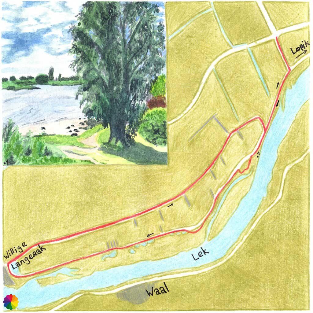
Willige Langerak trail, Lopik – 12 km
- Link to trail:
- Where: Lopik/Willige Langerak, Utrecht
- Starting point: M.A. Reinaldaweg in Lopik
- Intersection numbers to follow from starting point (trail network Utrecht): 13 – 12 – 21 – 22 – via Tiendweg back to 21 – 12 – 13
- Intersection 11 is at TOP Salmsteke, via intersection 18 pick up the trail at intersection 12.
- From TOP Schoonhoven, via intersection 81 pick up the trail at intersection 22.
- Characteristics: fields, polders, dikes, rivers
- Special interest: I wrote an extensive report about the Willige Langerak trail.
- Public transport:
- Start at TOP Salmsteke or at starting point: bus 295 (Rotterdam Capelsebrug – Utrecht) or bus 195 (IJsselstein – Schoonhoven), bus stop Gemeentehuis in Lopik
- Start at TOP Schoonhoven: bus 295 (Rotterdam Capelsebrug – Utrecht), bus 497 (Gouda – Schoonhoven), bus 195 (IJsselstein – Schoonhoven) or bus 505 (Woerden – IJsselstein), bus stop Schoonhoven Oost
- Parking:
- at town hall in Lopik
- parking lot at ferry in Schoonhoven
- Restaurants:
- Eethuys/HappyFood or Amigos in Lopik
- Various restaurants are located in the city centre of Schoonhoven
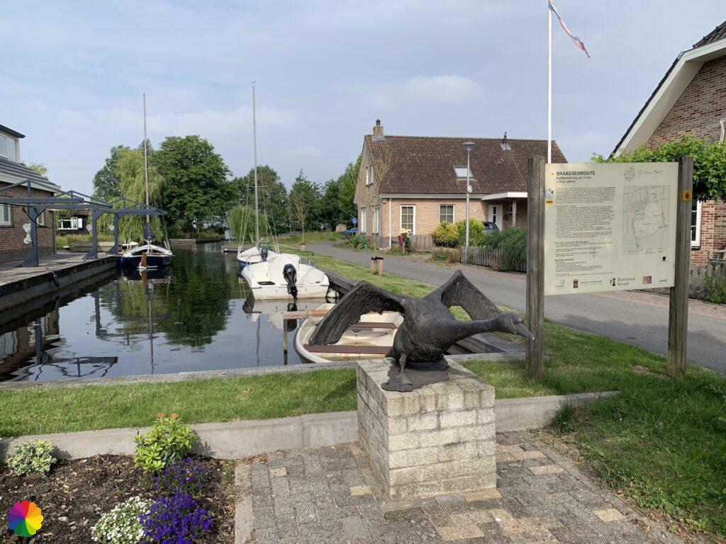
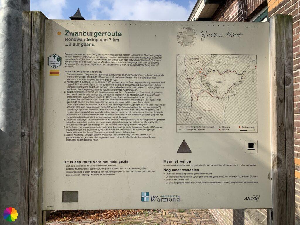
Zwanburgertrail, Warmond – 7 km
- Link to trail: zwanburgerroute.nl
- Where: Warmond, Zuid-Holland
- Starting point: Gemeentehaven in Warmond
- Intersection numbers to follow from starting point: difficult to map out with the trail network.
- Characteristics: fields, polders, lakes, ferry
- Special interest:
- The ferry De Heere Schouten only departures from March/April until the end of September (so not in the winter months), waiting times may be up to 45 minutes. Check the website in advance for departure days and times.
- I made an extensive report about this trail on this website.
- Public transport:
- bus 150 (Warmond – Sassenheim), bus stop Sweilandstraat
- bus 50 (Leiden – Haarlem), bus stop President Kennedylaan in Oegstgeest, approx. 20 minutes walk to starting point
- Parking: at Gemeentehaven in Warmond
- Restaurants: Brasserie Coazy on Koudenhoorn recreational island in Warmond
What to do next?
What am I going to do next, since I have finished the ANWB trail booklet? In any case, there will be four more blog posts about the trails that I have hiked this year (2021): Braassem trail, Ursula trail, Bethlehem trail and Zwanburger trail. Please be patient! I write my blog posts in chronological order and it takes me 2 to 3 weeks to write a blog post. I am about half a year behind at this point.
But I am not yet finished with the Green Heart, it is big enough that I have not yet seen everything. I did some research on the internet for the possibilities. The regional trail, the Green Heart streekpad, is of course an option. This trail is well-marked, but goes through many places I have already been. There is also the booklet Mooiste netwerkwandelingen in het Groene Hart (Most beautiful network trails in the Green Heart) by the publisher Elmar. But this booklet contains two of the same trails as the ANWB booklet. Then I realised that I had mentioned the Tourist Transfer Points (TOPs) before with their large green blades of grass as landmark. Many of these TOPs are located in the Green Heart. Wouldn’t it be great to hike a trail from a TOP from time to time and blog about it? So that is my plan for the coming years. Keep an eye on this website for updates.
Soon I will move to Noord-Brabant province and will live further away from the Green Heart. But I will still be there regularly, because my family lives there. The Green Heart will always have a place in my heart. Maybe a bit cheesy, but it is true!
It has become a long blog post, but I hope that other hikers can use this information to plan their next hike within the Green Heart. Next time, another ‘normal’ post about the Migration birds trail (Trekvogelpad) will follow.
Back to Blog.