The time has come: the last hike on the Southern Waterline trail! At least, nothing is what it seems this time. This stretch goes from Reek to Grave (in the Netherlands), and I actually expect the hike to be quite long and boring. It is certainly long (21 km is long for me), but it is by no means boring. There is something for everyone: expansive views over the polder and the Maas river, but you also pass through the woods and heathlands of the Rustven nature reserve and the Reekse Heide and Bossen. And you can soak up some culture in the charming fortified town of Grave. It’s not even the last time I’ll be returning to the Southern Waterline. To see Grave better, I went back again for the Velp Monastery hike.

Surprisingly enjoyable start
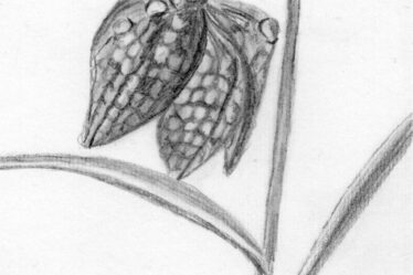
I start in Reek and walk first to the east and then south towards the Reekse windmill. Just behind the windmill, I enter a lovely forest where heather is in bloom. A sign indicates that I am in the Rustven nature reserve.


What a lovely nature reserve, with narrow sandy paths and patches of heather here and there. I lose my way a few times, but with the help of the trail guide and Google Maps, I manage to find my way back. A little later, I arrive at a sand drift of the Reekse Heide.

Further on in the Reekse Bossen, I come across an information panel from the Southern Waterline about the Mineursberg.
The Mineursberg and an old landwehr are remnants of the Southern Waterline. The Mineursberg was an area where the so-called mineurs from the time of Napoleon carried out exercises with mines. The landwehr or landerd was a historic line of defense that consisted of an earthen wall to defend the army camps.
Source (in Dutch): Zuiderwaterlinie
Here I lose my way again. I have the impression that the trail in the guidebook does not quite match the markings, or that a few posts are missing here and there. Nevertheless, I find my way back onto the trail. I walk along the contours of the former defensive line. I zigzag nicely through the forest.


Then the trail mainly follows paved roads and paths. I pass by the town of Escharen and then take a long detour to Velp.


Am I in Velp or Grave?
Once in Velp, I leave the town again via the Mariëndaal estate, with its number of ponds and lovely views. I then pass fields where colorful gladioli are in bloom.


Then I reach the Oude Maasdijk, a familiar place from the previous section from Reek to Megen. Back then, I went into the Keent nature reserve, but now I turn right towards Grave. After a while, I leave the dike and think I’m arriving in Grave at a church. But the place name sign says that this is Velp again. Fooled!


Via a gravel path along the Hertogswetering canal, I finally arrive in Grave. I am no longer following the trail exactly. It makes a complete loop around Grave, but I have already hiked 20 km and want to finish the trail. I walk without a detour to the end of the trail in the center of Grave. Unfortunately, it is very busy and the church at the end point is under construction. This means I can’t take any nice photos of Grave, so I decide to come back another time to really finish the hike and explore Grave at my own pace.


Velp Monastery hike
And so it happened: at the end of 2024, I returned to Grave to truly complete the Southern Waterline trail. My eye had fallen on the Velp Monastery hike on the Visit Brabant website. This trail also visits the fortified town of Grave. You can find more enjoyable Monastery hikes on the Visit Brabant website.
Other trail guide about this region
So I start the monastery trail in Grave. The town looks very different from how it does in summer. It’s a dull, gray day, but the Christmas lights make it cozy nonetheless. I start at the marina and walk along the restored fortified wall to Grave’s only remaining town gate. Here I have a beautiful view over the Maas river.


Then I walk straight through the center and pass the church and the Market Square again, where the Southern Waterline trail officially ends.


Here, I pick up the Southern Waterline trail in the opposite direction. I do want to walk the entire trail! This leads me to the Grave City Museum and the fortified walls.


The fortified town of Grave is built in a favorable location on the Maas river and the mouth of the Raam river on the border of provinces Gelderland and Brabant. As a result, the town has been besieged many times, but it has always recovered. The town is full of authentic buildings and sights, such as the Hampoort and the Arsenaal.
Source (in Dutch): Zuiderwaterlinie
I zigzag along the contours of the fortified wall and the canal surrounding Grave. I also come across the gravel path where I entered Grave last time.


I pick up the monastery trail again and walk through Velp. I think I am walking past the monastery, but it turns out to be the Mariënwaard rehabilitation clinic. The rehabilitation clinic is located on the beautiful Mariëndaal estate, which I also passed through last time.


I pass Bronckhorst Castle Monastery, but this is still not the monastery they mean. Then I go past the little church from the previous hike, but now from the other side. Further on in the distance is finally the real Emmaus Monastery.


I walk back to the starting point of my hike in Grave via the dike along the Maas river.


Final thoughts
At first glance, the last part of the Southern Waterline trail between Reek and Grave seemed like a somewhat boring hike, but it turned out to be a lot more fun than expected. The first part through the Rustven nature reserve, the Reekse Heide, and Bossen was truly a hidden gem.
It was also a good idea to return to Grave later and get to know the town at my own pace. A nice way to end this trail.
Tip: The Realm of Nijmegen regional trail passes through a part of the same area.
More info:
Trail: Section 13 Southern Waterline trailWhere: from Reek to Grave, Noord-Brabant, the Netherlands.
No. of km: +/- 21.5 km
Hiking date: 19 August 2024
Materials used in illustrations: Coloured pencils for the map and watercolour paints for the illustrations
Rating: ⭐⭐⭐⭐
- OV starting point: bus stop Kerk, Reek – bus 96 between Oss and Grave
- OV ending point: bus stop Busstation, Grave – bus 99 between Uden and Nijmegen
More hiking through fortified towns of the Southern Waterline
The fortified towns make the Southern Waterline trail a unique and interesting trail. Below are a few previous blogs about fortified towns along the Southern Waterline.
ColourFlux Studio makes use of so-called affiliate links. If you buy a product through the link in an advertisement, ColourFlux Studio receives a small amount. There are no additional costs for the buyer.
Back to Blog.